|
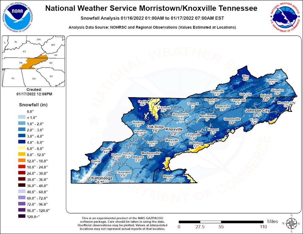
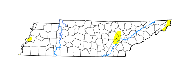
After an extended weekend (for some), we make a return to sunshine and gradually warming temperatures. Most locations saw a decent snow this past weekend, with valley locations generally between 0.5 and 3 inches. The better snowfall was seen across the high terrain of the Plateau as well as the Smokies. A transition to snowfall as cold air advected in even allowed for some light accumulations in the southern valley for the Chattanooga area as well. Moving forward, the heavy rains we have seen the past couple of weeks has allowed for the improvement of minor drought conditions seen across the state. There still remains some very limited abnormally dry spots in East Tennessee, but nothing our next rain maker can't handle. As one system exits, our next one looks to arrive later tomorrow. A cold front out of the Midwest will develop and pull east. As it does so, showers will develop out ahead before overrunning colder air could provide a chance at a changeover to mixed precipitation overnight and into Thursday morning. The bulk of this event will be in the form of rain, with little to no snow accumulations expected for the central valley. The best opportunity for any accumulations will be the higher peaks of the Smokies tomorrow night. This will be a fairly quick mover, dumping upwards of an inch of rainfall tomorrow and early Thursday, with sunshine gradually returning for the end of the work week. Temperatures will be the warmest tomorrow, topping out near 50. The remainder of the week will see highs in the 30s, with most Friday lucky to break the freezing mark (32). Have a good one, and don't forget to follow us on Twitter/Facebook for the latest! Pre-recorded for 5pm show
0 Comments
Leave a Reply. |
Your trusted source for everything weather in East Tennessee.
Social Media
|


