|
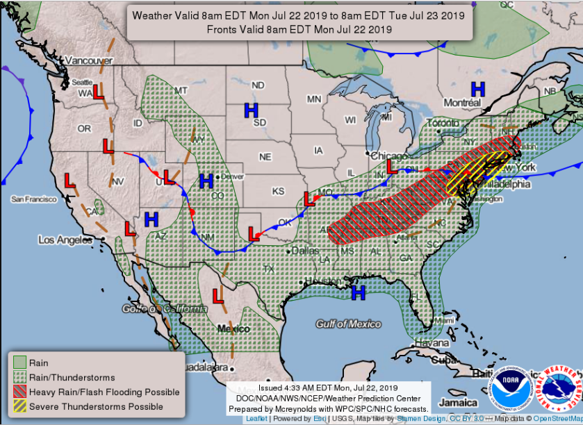
I hope everyone had a good weekend. We will have an active start to the week, but it will be well worth it. As seen below, an unusual July cold front is working its way through the Ohio and eventual, Tennessee valley's. Ahead of this cold front will be lots of storm activity for most of Kentucky and Tennessee. This storm activity will likely be strong to even severe at times this afternoon and overnight, so continue to check back in with us on the latest. It is important to note much of east TN is under a FLASH FLOOD WATCH until 2am Tuesday. This means the preconditions for flash flooding are in place and areas under this watch are favorable for flash flooding in flood-prone areas. As I said, please have ways to check back in with local weather officials for the latest watches and warnings. Storms will likely begin popping up early this afternoon with the brunt of the system arriving by this evening. This evening and into the overnight hours, expect gusty winds, lightning, small hail, and heavy downpours at times. As we work into our Tuesday, showers will begin to dwindle by the morning hours, eventually fading by the afternoon. Once showers move out, expect beautiful clear skies and cooler temperatures. If there are any outdoor plans you have been delaying due to heat or rain, this is the perfect week to do them. Tuesday afternoon, Wednesday, and Thursday will be fall-like with high's in the low to mid 80's, low humidity, and sunny skies. Soak it all in though, as the heat and humidity will soon return later this weekend and into early next week. As an example to show what you can expect temperature wise this week, check out this modeled temperature run below. As you can see, we will remain in the low to mid 80's for the next several days. I hope everyone has a good week filled with lots of outdoor adventures (which we would love to view and share here -- simply email or tag us on social media).
1 Comment
|
Your trusted source for everything weather in East Tennessee.
Social Media
|


