|
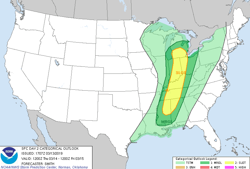
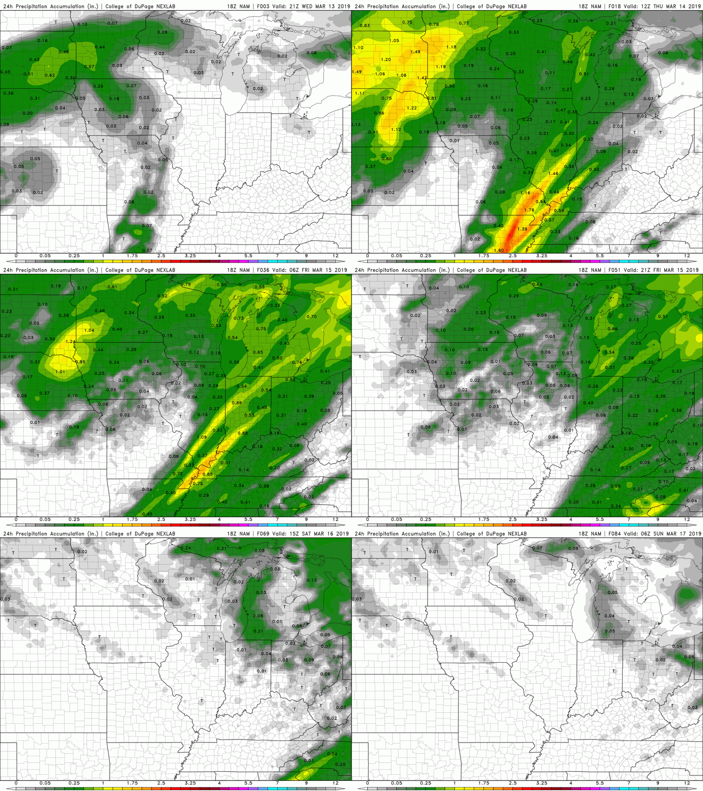
Happy Hump Day! It has been a pretty day today with partly cloudy skies throughout. Expect clouds to begin increasing overnight and during the day Thursday; ahead of a front moving into our region. Ahead of this front, there is potential for some thunderstorms, heavier winds, and heavier rains. As of now, the ignition "ingredients" for this system are mainly in western Tennessee. This graphic (below) was released by the National Weather Service (NWS) Storm Prediction Center (SPC). Seen in this graphic is a relatively thin, but long line of a slight risk. For those in this area, they can expect thunderstorms, stronger winds, heavy rain, the possibility of hail, and the slight chance of isolated tornados. For us east "Tennesseans" we can expect some thunderstorms, heavier winds, and heavy rain. This system will be quick moving, arriving sometime around 11pm and moving completely out by 3 pm Friday. Not to get confused, I am referring to a single line of heavier rain/storms than scattered rain for the rest of the time. For tomorrow (Thursday), clouds will be increasing throughout the day. Scattered showers are possible throughout the day but these will be light and few and far between. The wind is also something to look out for, as gusts can be up to 30 mph tomorrow afternoon. I would not be surprised if the NWS released a wind advisory ahead of tomorrow afternoons winds into Friday morning. As I said, the main weather maker will arrive Thursday evening. Friday we will feel the remanence of the system with a chance of some showers (but these will end early), allowing for clouds to begin moving out Friday afternoon and overnight. This will allow for a clear weekend, with Saturday and Sunday being mostly sunny with high's in the mid 50's. At this point (roughly 30 hours out), there is plenty of time for things to chance with this system. There is a lot of discrepancy in the models dealing with timing and exact placement, so change is possible. Currently, the moisture values are pretty weak, but I expect these to increase as we move through the day tomorrow. Thursday will be pretty warm and partly cloudy allowing for the potential of convection, (the transfer of heat) providing the ingredients and energy for a weather event. In the end, rain totals will not be too high, but with already saturated surfaces, minor flooding/flash flooding is possible, especially if the storms sticks together long enough to impact our area. Below shows the 24-hour precipitation amounts. In total, there is a chance for the "slight" outlook to be pulled a bit farther east, but the bulk of the severe threat is located from western Tennessee all the way into southern/mid Ohio. As always, I will be the first to update you on any changes with this system! If you have Twitter, follow us, as this will be the quickest way to update you. If you do not, you can follow along here by scrolling through our tweets on the right side of the home page.
Sources: NWS, NOAA, COD Weather
0 Comments
Leave a Reply. |
Your trusted source for everything weather in East Tennessee.
Social Media
|


