|
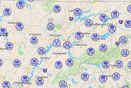
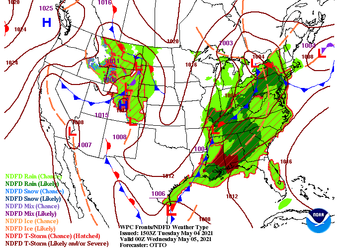
Hopefully you are staying dry and safe this afternoon, it has a been a busy and active morning. The NWS in Morristown has issued several severe thunderstorm warnings across the Southeast and also has issued a flash flood warning for Hamilton, Sequatchie, and Marion counties until 2:15 pm this afternoon. Looking below, these "weather hobbiest" rain gauge totals show upwards of 2+" for Chattanooga and surrounding towns. Overall, the valley has picked up between 0.5 and 1.25" this morning. We will release a better graphic with more official totals tomorrow, but it at least gives a general idea of the rainfall we have picked up so far. The latest surface map depicts a low making it into Western Tennessee this evening and a low draped across the Southeast. Severe weather will then shift to states like Alabama, Mississippi, and Georgia the later half of today. As for us, another round of showers and storms is possible tonight, before needed sunshine returns tomorrow afternoon and ahead. Looking at model guidance, another round of showers and storms will likely impact us this evening/night. Luckily, with the strong convection we saw through the morning, a lot of that energy is gone, so strong storms are less likely. Guidance is also suggesting a northern shift in activity, which will likely leave the northern Plateau and into Kentucky with the heavier activity. Nonetheless, stay tuned for additional alerts as we work towards sunset. As mentioned, a cold front will clear things out Wednesday afternoon with cooler temperatures to follow Thursday and Friday. You can check out the full 5-day forecast under the "Weekly Forecast" tab above. Please share any reports you may have. We have seen ponding across parts of Knoxville and flooding in areas of Chattanooga. Those reports help us get an idea of what's going on and where, and we can pass that information to the NWS and other viewers! Stay safe and tune in for any updates or alerts that we may have the second half of today. Pre-recorded for 5pm show
0 Comments
Leave a Reply. |
Your trusted source for everything weather in East Tennessee.
Social Media
|


