|
Are you feeling the heat? We are already in the mid to upper 70's and it is only noon. Comparing temps to this time yesterday, some parts of the region are 8 to 12 degrees warmer. This trend will continue into Wednesday with high's in the central valley expected to be near 90. 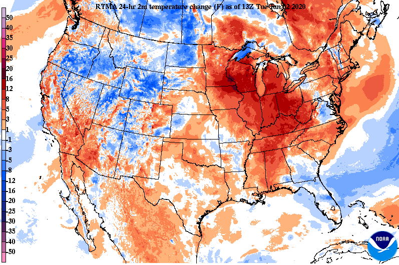 In large part, the heat and humidity can be contributed to the high pressure system to the east. The natural clockwise flow allows warm and muggy air out of the Gulf and right into the southeast. Remember to stay hydrated today and tomorrow, feel like temperatures will likely be in the low to mid 90's.  Diving into model guidance, we'll continue staying dry today and tomorrow. As a low draws near Thursday, shower and storm activity will ramp up. By Friday evening, showers and cloud cover will thin out providing a party cloudy weekend with afternoon pop up showers/thunderstorms possible. Severe activity chances will be limited Thursday but heavier showers, gusty winds, and small hail are possible.  Thank you again for your patience last week; we are now back on track! Stay hydrated, stay cool, and have a good one.
0 Comments
Good afternoon! A look over the Space Needle shows light foot traffic and sunny skies early this afternoon. High's today will top out near average in the lower 80's under mostly sunny skies.  Some changes are coming in the days ahead as a warming trend is expected. Given the high pressure system on the east coast, return flow will pull in hot and muggy Gulf air. Expect this to stick around the second half of the week and into the weekend. As for the sky conditions, we'll steer clear through mid-week before shower chances arrive the second half of Thursday and early into Friday.  A look into high's this week shows lower 90's possible for parts of the valley Wednesday, Thursday, and Friday. Along with well above average temperatures, very muggy conditions will accompany. Feel like temperatures the second half of the work week and into the weekend will be in the mid 90's for most with triple digits possible towards the southern counties. 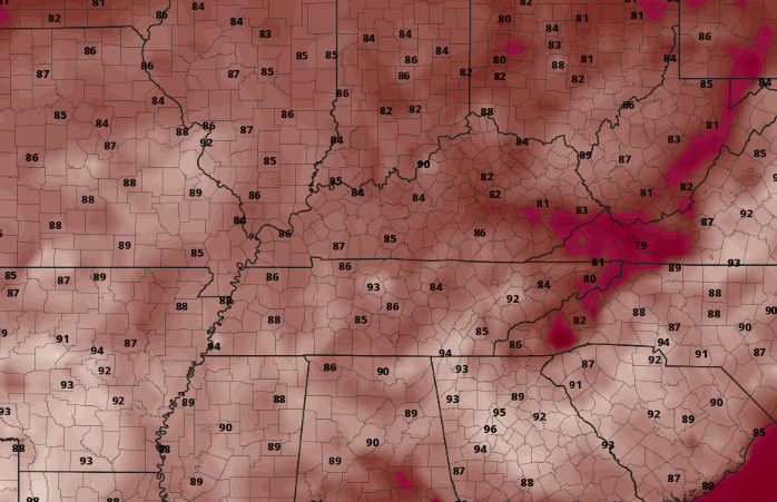 Be sure to stay cool and hydrated this week as heat related illnesses can strike fast in these conditions. Thank you for your patience and following along on social media this past week. Things should return to normal tomorrow! |