|
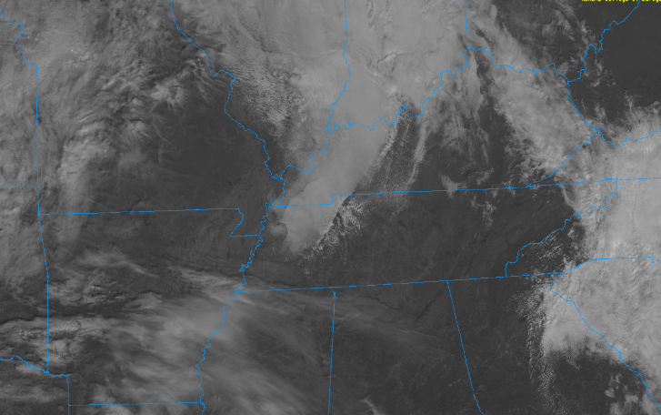
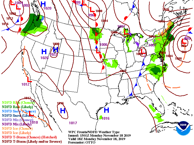
Happy Monday to all! Average temperatures this time of the year is 60 degrees and we will be nearing that this afternoon with high's in the mid to upper 50's. Cloud cover has moved out as well but it will soon return this evening and overnight, as you can see from the west. This cloud cover is all associated with a system to the north and west that will move through overnight and into Tuesday. Light shower activity can't be ruled out for northern areas of Tennessee and into Kentucky. As for the valley, we will stay mostly dry tomorrow afternoon with broken cloud cover throughout much of the day. Working into Wednesday, sunny skies and warmer temperatures will return. Jumping into model guidance, the NAM is suggesting shower activity will stay more northern tomorrow afternoon but some of the high-res models suggest a brief shower in the northern valley as well. Fortunately, working into Wednesday, a high pressure system will work in bringing back sunny skies and high's around 60 degrees. Toward the end of the gif below, shower activity increases to close out the work week. If you live in eastern Kentucky or northern Tennessee it wouldn't hurt to bring an umbrella incase you run into a shower toward the end of the work day. This system will be quick moving, just grazing east TN before sunny skies return mid week.
0 Comments
Leave a Reply. |
Your trusted source for everything weather in East Tennessee.
Social Media
|


