|
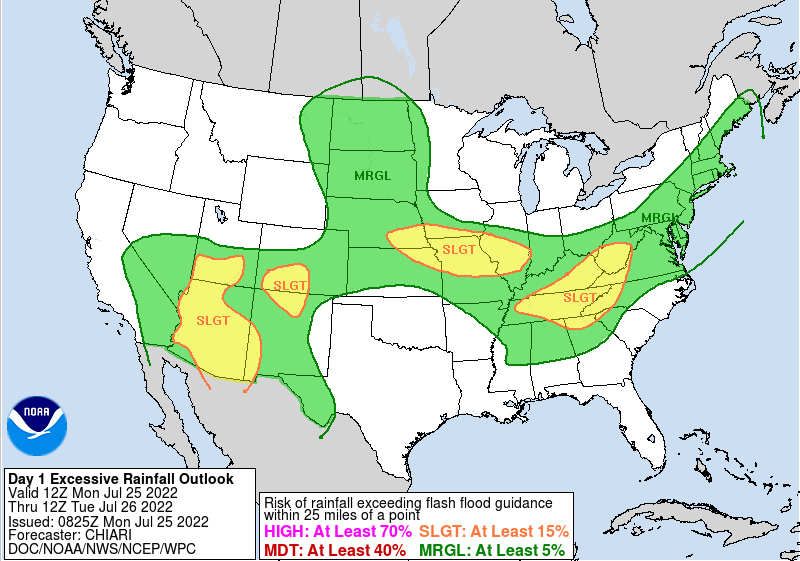
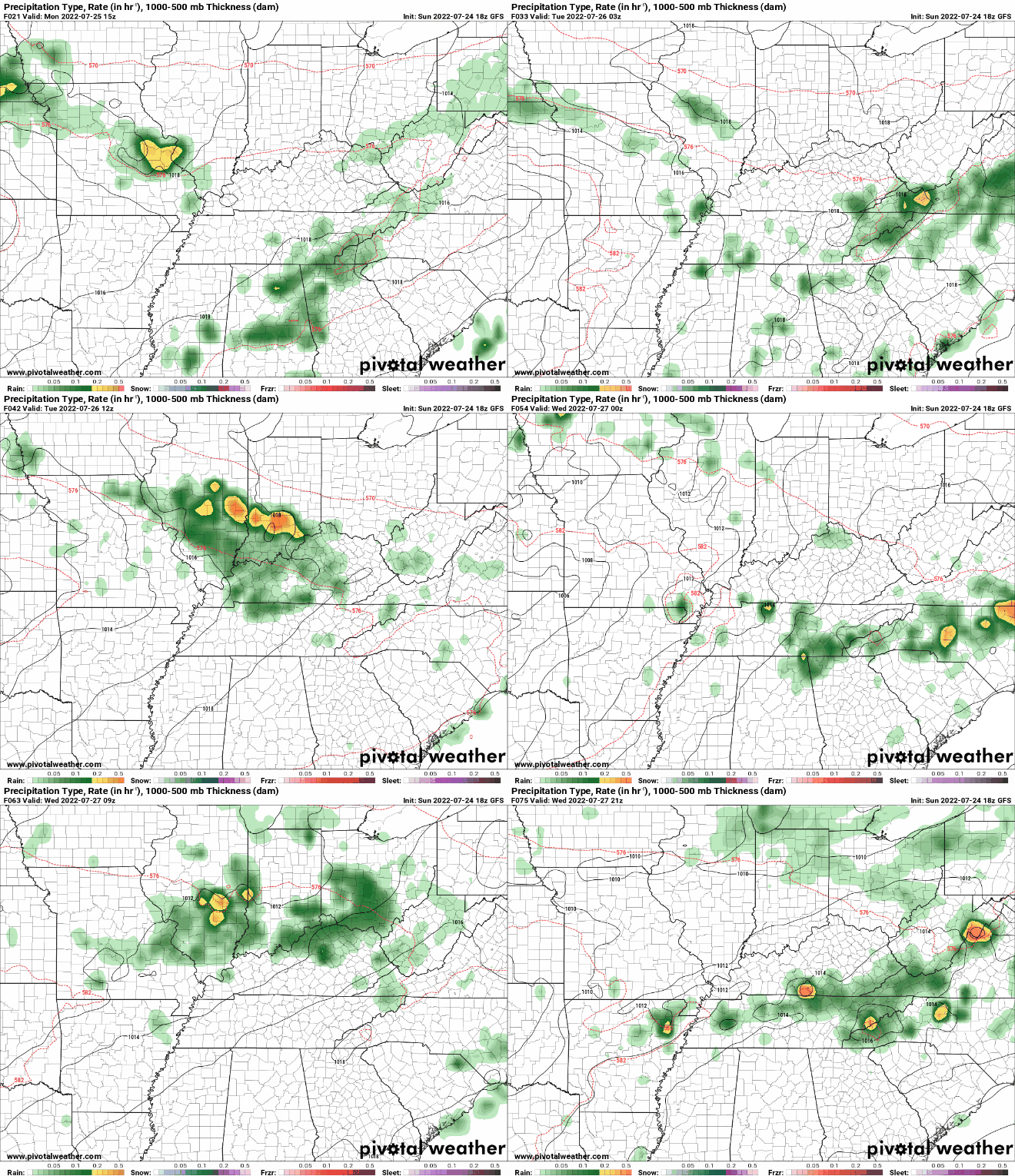
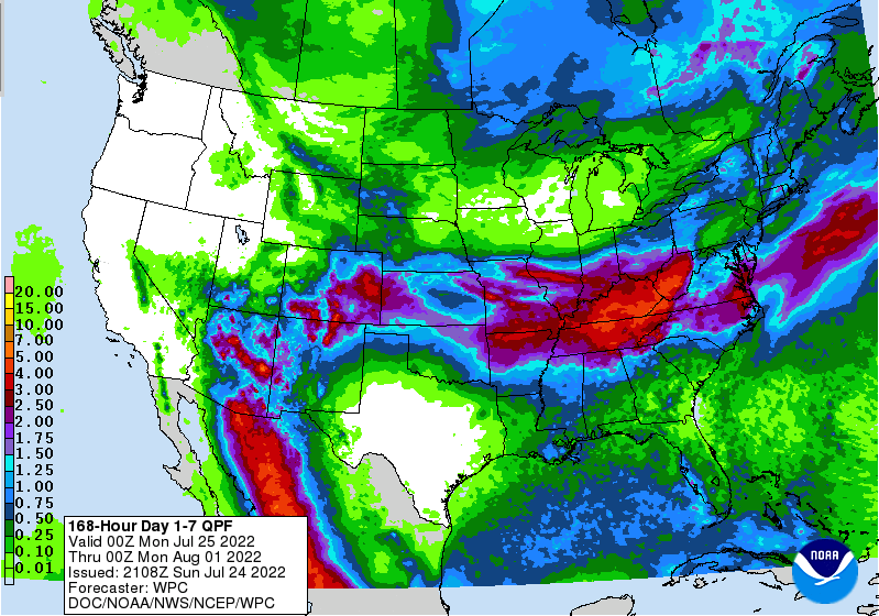
We will start off saying: Keep your umbrellas very close by this week! An active stretch of showers and storms finds us starting today and continuing through at least Saturday. Because of the pattern, flash flooding will be a major concern this week. A slight risk was introduced for today, as showers/storms become widespread this afternoon. Heavy downpours and repeat activity will lead to instances of flooding across the area. This threat will continue to increase in the days moving forward, so have a way to receive any watches or warnings if they were to be issued. As far as how this plays out, a frontal boundary will hang just to our north, allowing for showers and storms to develop off of. This hangs around through tomorrow, before lifting north as a warm front Wednesday. A secondary boundary will then find the area Thursday, bringing renewed chances through the end of the week and into the weekend. The severe threat overall is low, but not entirely ruled out. Strong storms will be possible during the afternoon hours each day, with gusty winds the primary threat. Rainfall amounts overall will vary. Some will see much higher amounts than others, but on average, 4-5 inches can be expected over the next 7 days. With pretty saturated soil conditions already, it won't be hard for flooding to occur. As mentioned, the threat of this rises each day for areas that see continued or persistent activity. A wet pattern can be expected this week, with several rounds of shower and storms anticipated. Let us know if you are seeing flooding and/or rising waters, so that we can share that with other viewers as well as the National Weather Service. Have a good one, stay tuned for further updates, and do your best to stay dry this week. On the plus side, temperatures will be a bit cooler than the low and mid 90s! Pre-recorded for 5 pm weather broadcast
0 Comments
Leave a Reply. |
Your trusted source for everything weather in East Tennessee.
Social Media
|


