|
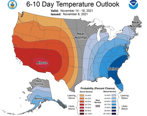
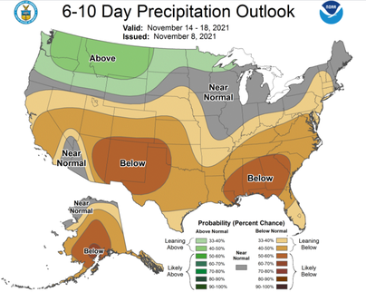
With above average temperatures the first half of the work week, how will this pan toward the middle of the month? Well, a swing back toward below average can be expected. Confidence continues to rise on this solution and we'll get our first taste of that this weekend. Oppositely, after a very wet year so far, so look to pivot towards a drier forecast mid-month. This could be concerning towards drought & fire related conditions, so we'll keep a close eye on this over the next couple of weeks. Warm and dry conditions are expected through tomorrow, before a cold front sweeps across the Eastern CONUS, bringing moderate rainfall and much cooler air. This front is expected to bring rainfall the latter half of Thursday, with a few lingering showers, particularly along the east, into Friday. Much cooler air will then follow for the weekend. Enjoy the temperatures and conditions now. With the passing front, highs in the 40s and low 50s can again be expected Saturday and Sunday. Pre-recorded for 5pm show
0 Comments
Leave a Reply. |
Your trusted source for everything weather in East Tennessee.
Social Media
|


