|
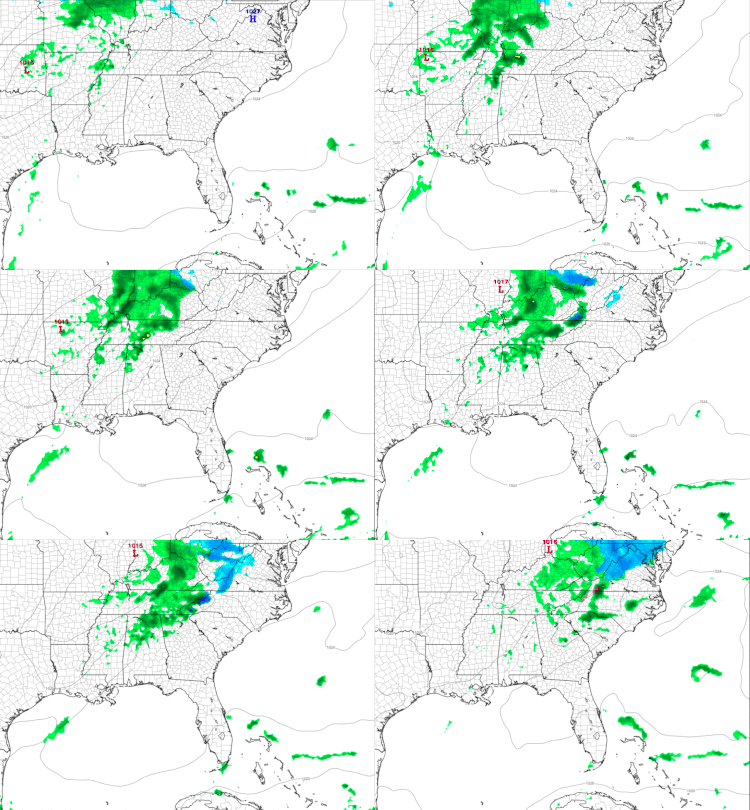
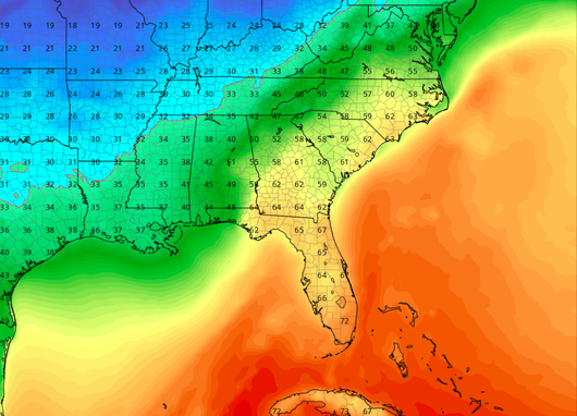
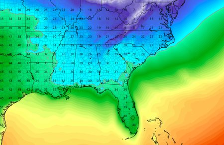
Good Morning everyone! Big Changes in weather are in store over the next several days. To start, temperatures will be in the mid 30's as you are leaving the door and heading to work/school. Before you leave, I recommend bringing an umbrella or rain jacket as today will be wet at times. Expect showers to begin around lunch time (noon timeframe) and be spread out throughout the day and into the evening hours. As you can see below, a line of showers impact our area and are expected to mostly move out by 9 pm. Anytime after nine, showers will be widespread and relatively quick moving. As for your high Thursday, expect it to top out in the low 40's. Into Thursday evening, not much of a change as temperatures will be in the upper 30's overnight. Overall, rain totals are expected to be between a quarter and half an inch. Friday looks to be much drier as the temperatures warm up to be in the mid 50's. Cloudy skies will persist most of the day for east TN. Friday evening low's will dip into the low to mid 40's. Big Changes Into Our WeekendSaturday's system will bring lots of change into east Tennessee and the whole southern region. A low pressure system is expected to bring a strong line of rain (Possibly embedded with thunderstorms) Saturday afternoon. The timing of this system first hitting is around lunch (12-1 o' clock). Periods of rain will continue into the overnights hours before transitioning to snow showers. Rain totals can reach up to two inches! Winds are another issues associated with this system as there can be gusts between 40-50 mph at times. The reason for this is due to the very cold air trailing this system. With this in mind, be on the look out for wind advisories and other alerts put out by the NWS for your Saturday into Sunday. I will keep you up to date on here, as well as through our Twitter (@SecretCityWX). Transitioning into Sunday, it will be a cold one. Temperatures will be dropping (yes dropping) throughout the day due to the strong cold front associated with the system. Do not rule out the possibility of some snow showers Sunday. Snow amounts this weekend look dim as most areas will receive little to no accumulating (Accumulation: a tenth of an inch or more snow) snow. Due to the moisture from the rain and warm surfaces, any snow that falls is likely to melt. From the graphic below, you can see the sharp line of cold air funneling into our area Saturday night into Sunday. This is why temperatures will be getting progressively colder from Saturday night and throughout the day Sunday. Prepare Monday for the coldest temperatures of the year thus far. Temperatures on MLK (Monday) in the early morning hours will be in the teens. Adding on the wind, temperatures could feel in the mid-single digits for our area. Please be careful if you plan to be out Monday (especially Monday morning) as frostbite and hypothermia can occur quickly in these types of conditions. Monday's high across the area is expected to reach around freezing with sunny skies. If you can get through Monday, Tuesday and the days following look to be much warmer (mid to upper 40's) as a high pressure system will sit over the eastern United States. Stay up to date for the latest changes in weather through our Twitter (@SecretCityWX) and on here! Also check out our "Weekly Forecast" tab to see your highs/lows and precipitation potential in the days to come. Remember to stay dry, safe, and warm, as lots of things are happening in the days ahead.
0 Comments
Leave a Reply. |
Your trusted source for everything weather in East Tennessee.
Social Media
|


