|
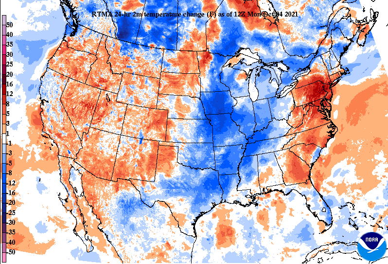
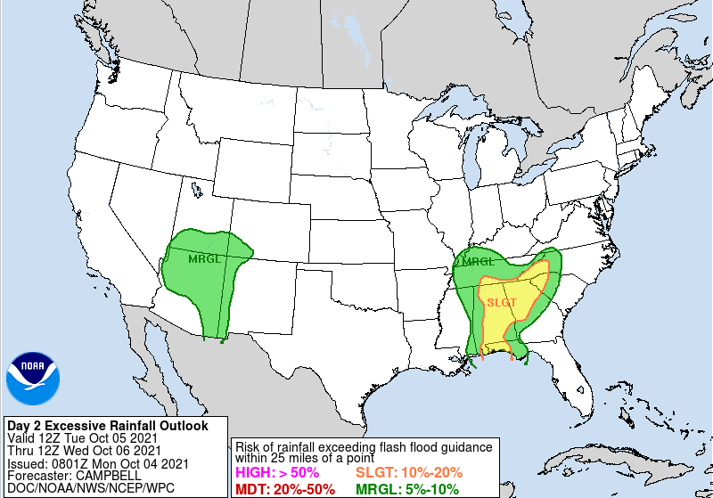
A passing front has lowered temperatures throughout the region, with highs expected to top out in the mid 70s today. Looking at the past 24-hours, you can see where the front has been with temps anywhere between 5 and 15 degrees cooler. This is typically the average for this time of the year, so expect 70s to hang around much of the week. An upper level disturbance will settle across the region, bringing unsettled weather through much of this week. As a result, showers can be expected every day, with hydro issues of a concern. The Weather Prediction Center (WPC for short) has placed us under a Marginal Risk for flash flooding today, Tuesday, and Wednesday. A slight risk even is across the far southeast. With this in mind, use caution if in flood prone or low-lying areas. There is no concern for strong storms or severe weather, just consistent moderate showers at times through the work week. As mentioned above, the WPC has placed the area under a marginal risk for flash flooding. This outlook is for Tuesday, where you can see a slight risk along the southeast and bordering Georgia/Alabama. This expands slightly north for the day 3 (Wednesday) outlook, but it will depend on how much rainfall we see through the day tomorrow. Be sure to tune back in for updates in regards to the flooding threat and more. Be sure to follow us on Twitter/Facebook if you do not already. We provide updates day and night on the latest radar trends, reports, forecasts, and more. Thank you as always for your support, and take advantage of a drier day today before moderate rainfall arrives much of the remaining work week. Pre-recorded for 5pm show
0 Comments
Leave a Reply. |
Your trusted source for everything weather in East Tennessee.
Social Media
|


