|
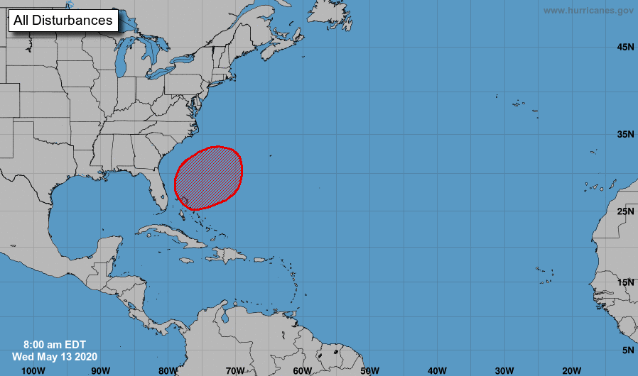
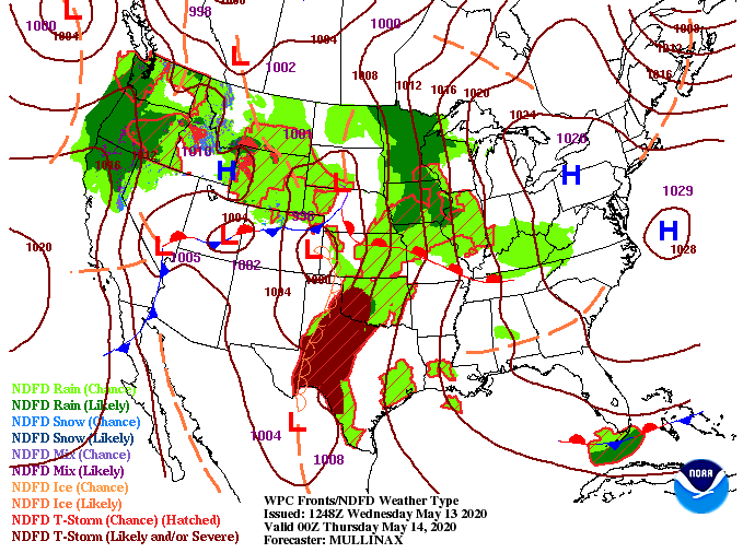
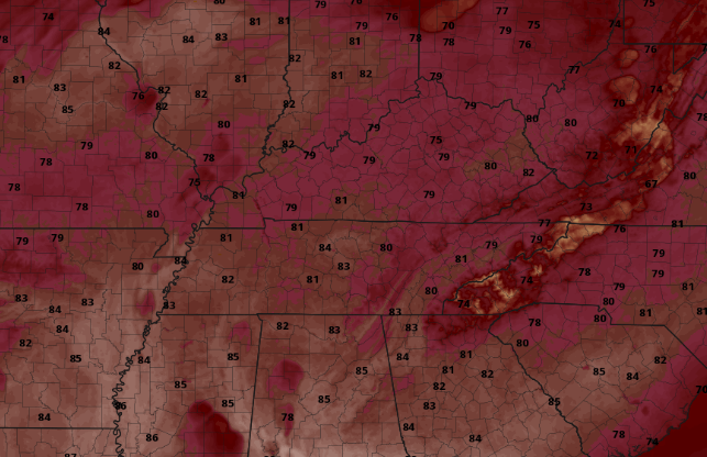
If you have followed along the past week, we mentioned the likelihood of an above average hurricane season. Looking below, we are already seeing an active Atlantic. Coming out of the National Hurricane Center, there's a high likelihood this area of low pressure (north of the Bahamas) will develop into a subtropical depression or storm in the next few days. Not to worry though the path will continue north and east with no impacts expected for the US. Jumping back to home, shower activity has been limited to the Plateau and southern Valley so far today. As we push into the afternoon hours, I expect this to continue before skies begin clearing overnight. A warm front is also working through the area today, providing much warmer air from the south tomorrow and the days ahead. To highlight the month of May so far, we have had 4 record low temperatures. Two of these were tied for the record low and two were new record low temperatures altogether. An opposite effect will take place the later half of May with above average temperatures working in. High's near 90 degrees will be possible this weekend, especially for those to the south. Sunshine will dominate the next few days before shower activity creeps back in in limited quantities this weekend. Have a good one and brace for warm temperatures the next several days.
4 Comments
<a href="https://pg-slot.game/%e0%b8%a3%e0%b8%a7%e0%b8%a1%e0%b8%9a%e0%b8%97%e0%b8%84%e0%b8%a7%e0%b8%b2%e0%b8%a1/slot-game-6666-2//">slot game 6666</a> เกมส์สล๊อตออนไลน์ slot online สล็อต เล่นง่ายได้เงินจริง ระบบ ฝาก-ถอน AUTO 30 วินาที เพียงแค่นั้น สล็อต pg แจกเครดิตฟรี slotgame6666.com มาแรงที่สุดในชั่วโมงนี้
Reply
8/17/2023 04:41:51
โปรโมชั่น <a href="https://pgslot-th.com/">pg slot</a> มากมาย เล่นง่ายจ่ายจริง แตกจริง ต้อง PG-สล็อต เท่านั้น! เล่นสล็อต พีจีสล็อต เว็บไซต์ตรงผู้ให้บริการเกมสล็อตออนไลน์ชั้นหนึ่ง ทกลอง เล่น ฟรี พร้อมโบนัส
Reply
Leave a Reply. |
Your trusted source for everything weather in East Tennessee.
Social Media
|


