|
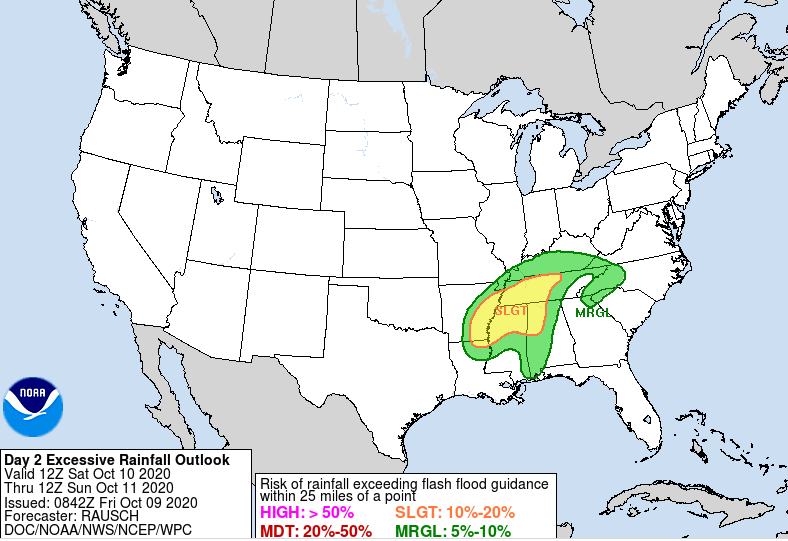
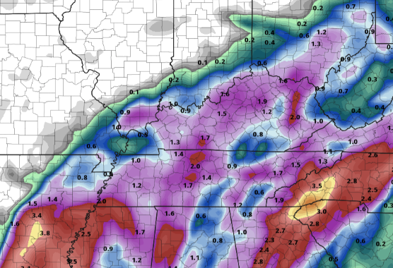
Good morning and happy Friday! Cloud cover will continue to work in through the day as Delta moves closer. For now, most should expect to stay dry the first half of the day with isolated to scattered showers working in by this evening and overnight. Looking at the day 2 excessive rainfall outlook, the WPC has placed parts of East Tennessee under a Marginal risk for flash flooding (5%-10%). Given how dry things have been across the area that will help in reducing flash flooding risk, but it is something we will be watching out for as we work into Saturday. Pockets of heavier rainfall are possible late tonight and through Saturday. A few thunderstorms aren't out of the question either, but severe potential is very low. Remnants of Delta should be begin to work out by Monday morning providing a bit of sunshine back across the area in the afternoon. A system to the west will help force Delta out by early next week while also giving us isolated shower chances and cooler air on the back side. Sunny skies and high's in the low to mid 70's should return by Wednesday of next week. Overall totals will vary. An initial line of showers will work through ahead of the parent low from Delta, then the brunt of activity the second half of Saturday and early Sunday. As of this morning, totals between the 1-3 inch mark are on tap. As Delta works north today, slight changes in the path will likely impact overall totals. Continue to check in through social media for the latest. That will wrap it up for today, I hope you've enjoyed our dry streak as Delta will provide a good rain through the region. As I mentioned, tropical systems are hard to pinpoint down, so check in through our social media for updates. The biggest risk this weekend will be flash flooding, but I think due to the dry stent we have been on the risks are low.
0 Comments
Leave a Reply. |
Your trusted source for everything weather in East Tennessee.
Social Media
|


