|
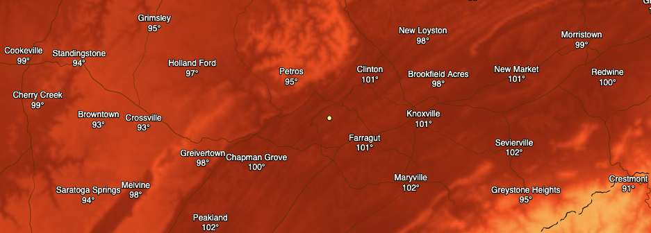
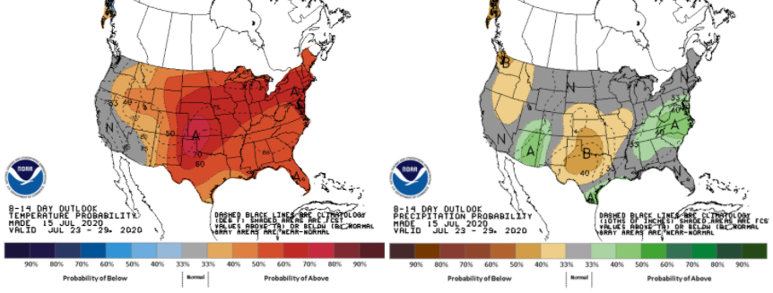
Wow! 3 o' clock heat indices will be in the lower 100's across the central valley. Make sure your heat safety is your number one priority if you are outdoors during the day today. Higher dew points are what are contributing to these very hot temperatures expected this afternoon. As a front to the west draws near, moisture will begin transporting into the area this afternoon. If it wasn't clear enough above, it will create a very hot and sticky environment today and the days ahead. This will also allow for the development of afternoon showers and thunderstorms. As we have seen the past several weeks, isolated to scattered showers will develop in the PM hours (mainly off of the higher elevations) and work into parts of the valley. A few strong storms are possible Friday and into the weekend so do be weary of these as well as the heat. The long-term view shows little change in the weeks ahead. Very hot and above average temperatures plan to stick around through the end of July. Typically, the end of July and into August is our transition period to drier days. August and September is our "dry period", where we see the least amount of precipitation during the year. Looking below, the CPC suggests average to above average to end out of the month of July. This is good in helping limit drought levels as we work toward the drier time of the year. We'll keep an eye on any changes but anticipate the heat and humidity to continue with a few showers mixing in the next couple of weeks. That will do it for your Thursday but stay cool and hydrated. It does not take long for heat related illness to impact you when it is in the lower 100's. Stay safe and have a good one!
0 Comments
Leave a Reply. |
Your trusted source for everything weather in East Tennessee.
Social Media
|


