|
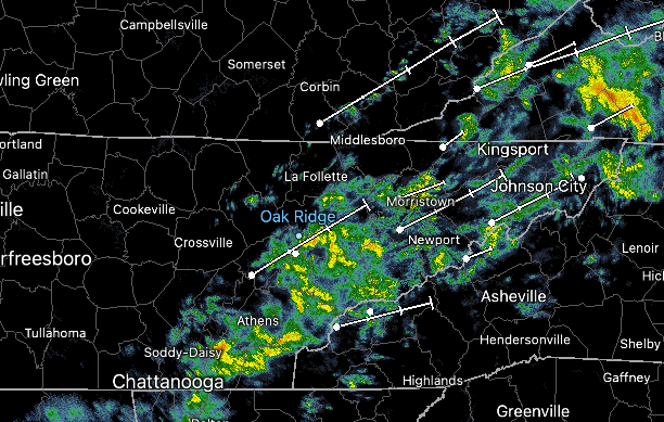
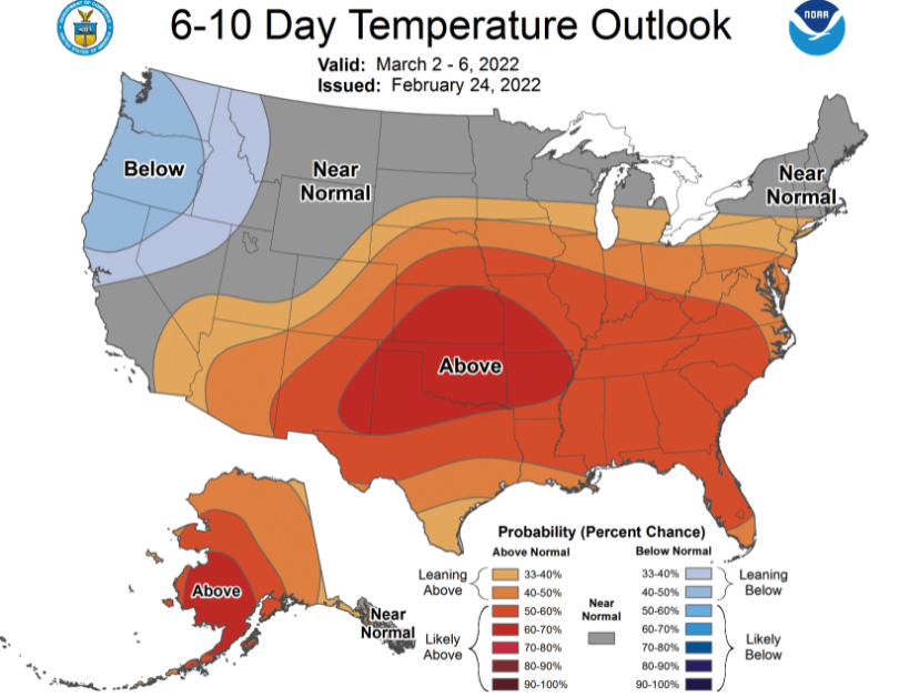
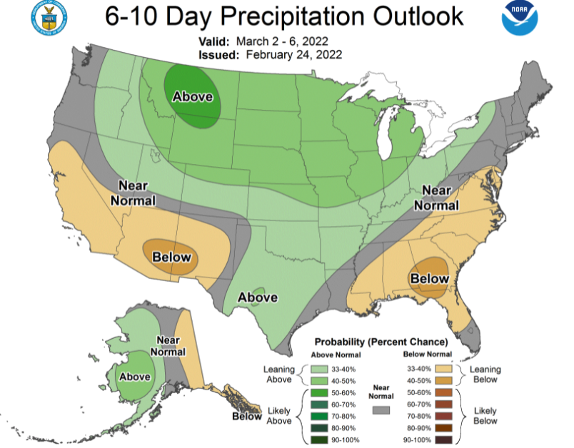
The last of the showers are working across this morning and should exit over the next couple of hours. A cold front runs along Middle Tennessee and will allow for the advection of cooler air across the state through today. As a result, anticipate "peak temperatures" for the day to come early, with afternoon temps in the low to mid 50s. After variable temperatures this week, a swing toward warmer air is on the way. This week will see above average temperatures, with the trend looking to continue for the first week of March. This could bring a wrap to Winter, with very limited options (as for snowfall potential) expected over the next month and a half. In addition to temperatures, rainfall has been significant this week. From Monday night through this morning, our station picked up exactly 6.5 inches of rainfall. Several locations, namely the Northeast, were under flash flood warnings yesterday morning/afternoon. Several rivers are also running very high and I anticipate that to continue today as things slowly begin to recede. As for the precipitation outlook for the first week of March, a fairly average forecast is on tap. The week ahead will be mostly dry before a transition back to near average. We will see a final opportunity for scattered showers to a few flurries (for the valley) Saturday night into Sunday, as a quick moving system clips us to the south. Sunnier skies then follow Sunday afternoon and we trend warmer through mid week. Have a great weekend and enjoy above average temperatures on Sunday.
0 Comments
Leave a Reply. |
Your trusted source for everything weather in East Tennessee.
Social Media
|


