|
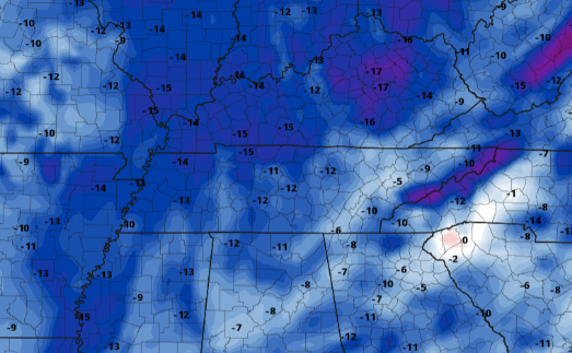
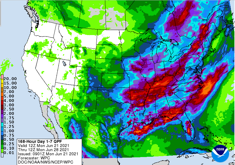
After a fairly active day that brought upwards of 1.5 to 2 inches of rainfall and a few bouts of severe storms, things have calmed down. The last of showers is working east this morning. A cold front also sits along the Appalachians, which will continue to funnel in much cooler air. For this afternoon, highs will range from the mid to upper 70s. When comparing this with the average high for this time of the year, temperatures are 5-10 degrees cooler. For the Smokies, this is 15-20 degrees below average. With that said, this won't last long so take advantage while you can. Looking ahead, a pretty wet pattern is likely to set up. In addition to the moderate to heavy rainfall picked up yesterday, multiple waves will work across the Tennessee and Ohio Valleys Friday through early next week. Another flash flooding threat could become apparent, so tune in for updates in the days ahead. The first round will be an upper level shortwave that will bring isolated to scattered rain/storms Friday and early into the weekend. Following, a low and front will move very slowly, dumping upwards of a couple of inches late weekend and early next week. As you can see above, 3 to 4 inches of rain is expected over the next 6 days. For the time being, expect sunshine and mild temperatures today and tomorrow, before warming right back up Thursday and Friday. That will do it for today. Things should turn out beautiful by this afternoon. That will continue into Wednesday as well before temperatures warm back up and the threat of rainfall again enters the forecast. Check out our full video forecast below. Pre-recorded for 5pm show
0 Comments
Leave a Reply. |
Your trusted source for everything weather in East Tennessee.
Social Media
|


