|
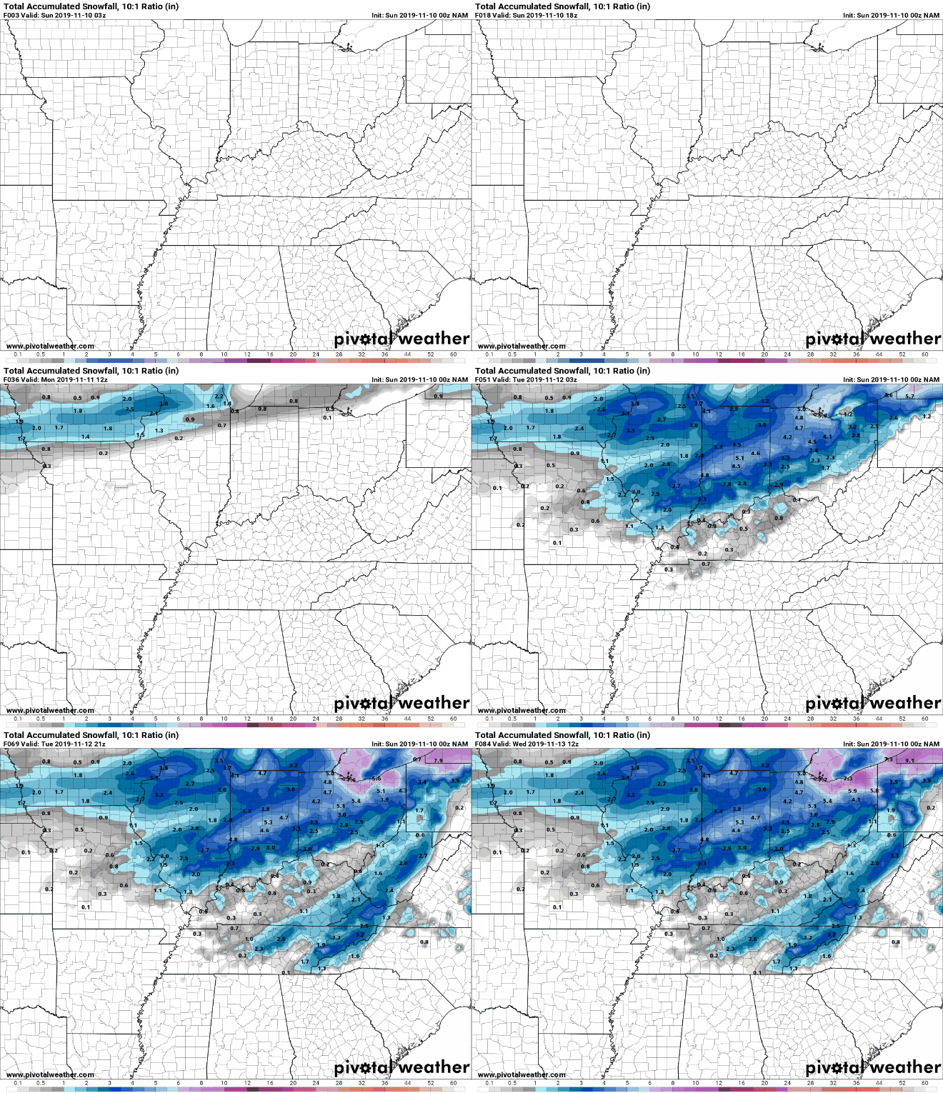
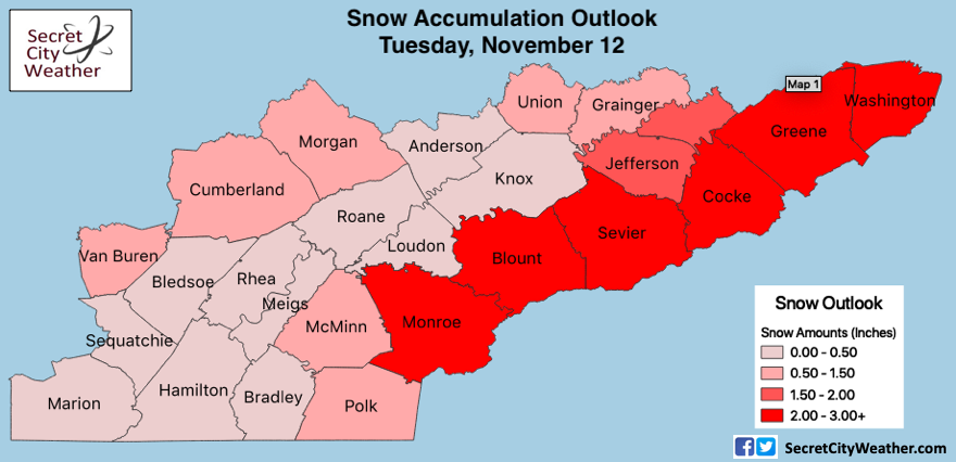
Good afternoon everyone! I typically do not post on the weekends but given the upcoming system is rather interesting and could impact daily operations early to mid week, I thought I would provide my latest forecast and thoughts. Regarding this next system, we will have clouds build and move in throughout much of Veterans Day. Rain shower will arrive by the evening hours and carry on through the night. By early Tuesday morning an Arctic blast of air will arrive creating a transition phase from rain to frozen precipitation. The timing of this cold air arriving is still uncertain given the time period is too far out for some of the high-res short-term models. With that said, there will be a transition period across the board. As you can see below (just one model) rain will transition to snow early Tuesday morning, eventually petering out by the early afternoon (west to east). Snow amounts will vary due to the topography but I do think all will see snow fall. As for the valley, I will keep totals on the lower end given the timing of the cold air is not in phase from model to model. The best chance to see snow accumulation will be in the Smokies and areas east of the valley. The latest models are narrowing in on the Plateau as the spot for snow showers to begin falling. Totals in this area (Plateau) will be up to an inch of snowfall. For the valley, expect (as of now) a trace to half an inch possible (higher totals for higher elevations). For northern TN, similar to the Plateau with up to an inch possible. Lastly, if you are in the Smokies or foothills (east of the valley) you will likely see 1 to 3 inches of snow into Tuesday. As you can see below, the "U" or "Horseshoe" effect is occurring (as it usually does with winter events). Warmer air is trapped in the valley while the higher elevations are much cooler. Topography plays a huge role in winter weather (and all weather) here in east TN making it challenging to pinpoint exact snowfall amounts per county. Here is a rough outlook of the snowfall you can expect into the day Tuesday. Something to keep in mind from the above model guidance for accumulation is ground temperature. During the day Monday we will have high's around 60 degrees. Though the ground cools much quicker than other surfaces/ liquids, it will still take time for it to cool down quick enough for snow to stick. Basically, this means if model data is saying two inches for the Plateau it likely means only one inch will stick after the ground is to proper temperature. In addition to ground temperature, the air temperature will be around the freezing threshold here in the valley, so freezing rain could be the largest concern early Tuesday morning. By Tuesday afternoon, we will clear out leaving high's only in the mid 30's and breezy conditions out of the north. I hope this helps paint a better picture into Tuesday and if you have any questions don't hesitate to shoot us an email at SecretCityWX@aol.com. Enjoy the rest of your Sunday and have a great Veterans Day! We will continue to update you on the latest here and social media.
0 Comments
Leave a Reply. |
Your trusted source for everything weather in East Tennessee.
Social Media
|


