|
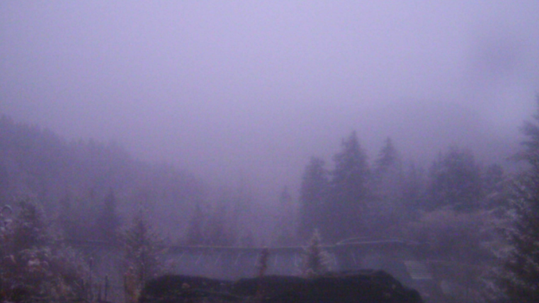
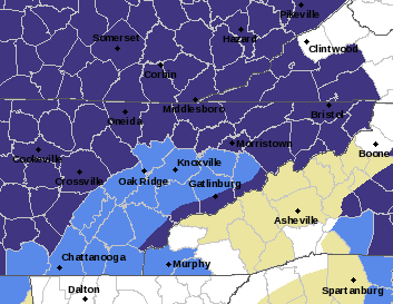
Good morning! As promised, there is some light snowfall falling in the highest peaks of the Smokies. This shot comes courtesy of the Newfound Gap Cam. A light dusting can be seen on some of the trees and grassy surfaces. This will continue on and off today as a weak disturbance drifts east (from our south). Here across the valley & plateau, temperatures will warm this afternoon to be again in the upper 40s and low 50s. Currently a few alerts are out. Across the valley (light blue) a frost advisory in effect. Similarly, purple indicates a freeze warning. Both are set to expire over the next hour or two. With the added cloud cover last night and into this morning, most didn't get quite as cold as the NWS may have expected. Nonetheless, with clearing skies tonight, Friday morning will likely be the coldest start we've had to the new cold season. Lows will be in the 20 to low 30s, with a few of the valley locations in the mid 30s. As a result, a frost advisory is in effect for valley locations with another freeze warning across the higher & cooler terrain. After a brief sprinkle or two through early this afternoon, we change to a dry pattern. High pressure will edge in from the north and west, gradually increasing temperatures and keeping mostly sunny skies in the forecast. Highs by next week could be as warm as 70! That will wrap it up for today....I suggest you wrap yourself up in the morning, as it will be pretty chilly! (pun intended) Sunny skies and warming temperatures will then follow. Pre-recorded for 5pm show
0 Comments
Leave a Reply. |
Your trusted source for everything weather in East Tennessee.
Social Media
|


