|
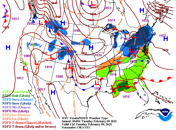
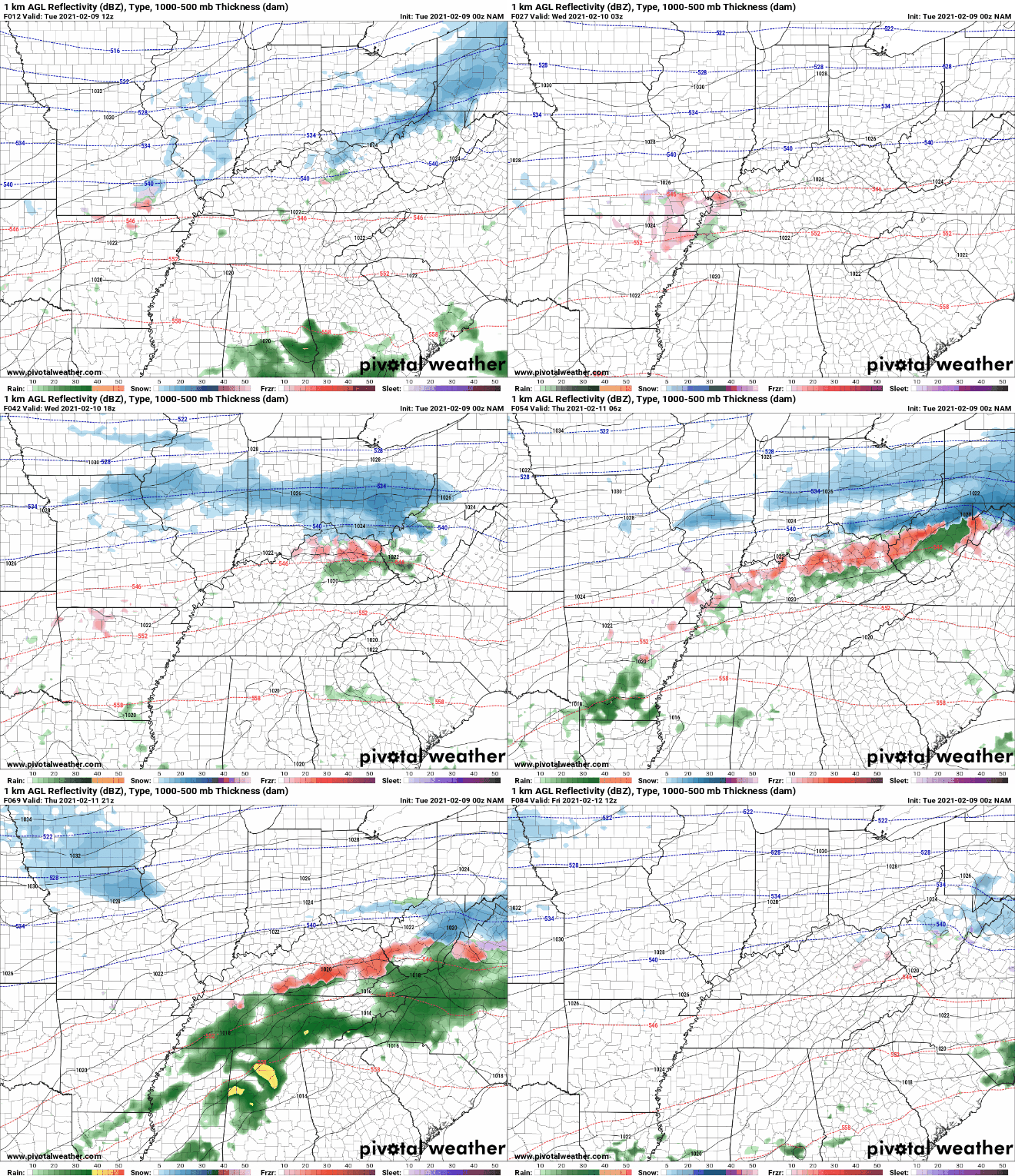
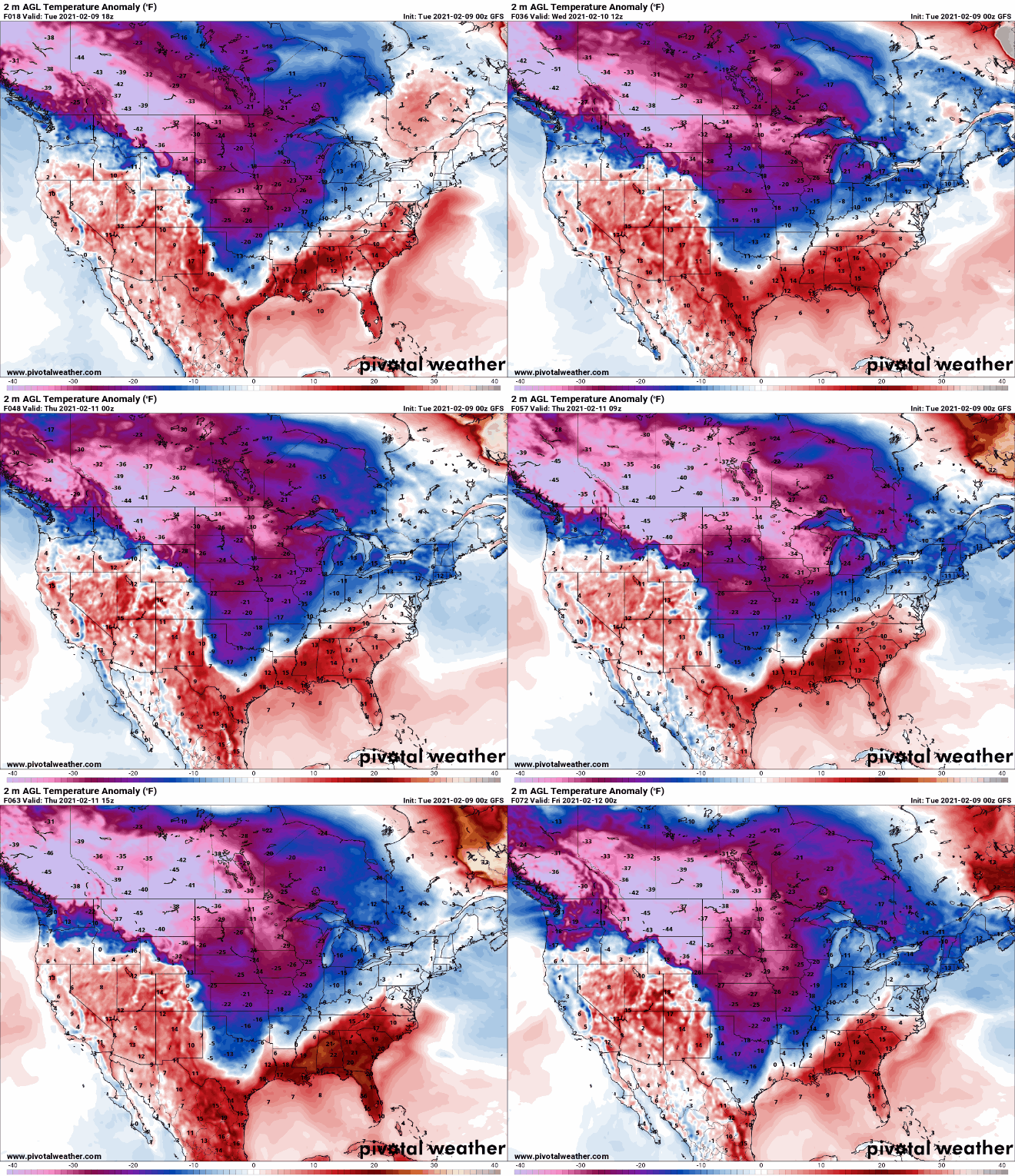
Our pattern of unsettled weather begins inching in today. Southern flow will increase temperatures to the mid 50's this afternoon with cloud cover overhead. By this time tomorrow, a system from our west will begin pushing in dumping rainfall by Wednesday night and Thursday. A messy playout is ahead for those to our north in Kentucky. Forewarning now, if you have plans today through Thursday to head through central and northern Kentucky, check the local forecast. Two rounds will bring severe freezing rain potential and the chance for snow. Fortunately for us, the majority of our area will deal with all rain. Getting right into it, showers build in later Wednesday and continue through parts of Thursday. As of now totals range in the 3/4 of an inch to 1.5". Following the rain will be a nice cool down Friday and through the weekend. Looking ahead, COLD temperatures sit just to our west. Don't let the negative digits deceive you as these are depicting the change from normal (negative indicating colder than average). As you can see, East Tennessee will be upwards of 15 degrees above average today and Wednesday before colder than average temps find us this weekend. As we push to complete this years edition, we would like to open up the opportunity for sponsorships. Sizes vary from full down to quarter with premium slots available. If you and/or your company are interested, visit SecretCityWeather.com/Sponsors or click the link below for direct access to our page. We are excited to get this out in the coming weeks! As always, we appreciate your support! That will wrap it up for today but stay tuned for updates as rain and cooler air are on the way to finish out the week. Pre-recorded for 5pm show
0 Comments
Leave a Reply. |
Your trusted source for everything weather in East Tennessee.
Social Media
|


