|
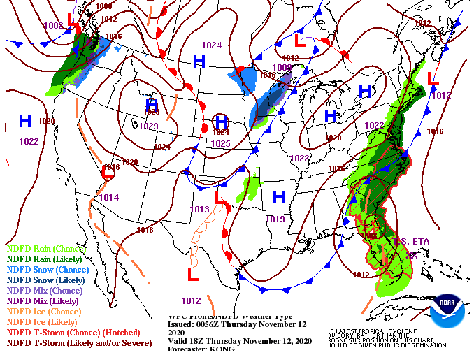
Showers have worked out this morning leaving the majority of us under overcast skies. The good news is high pressure is wedging its way in, which will provide clearing throughout the day. Some sunshine is expected to return this afternoon with high's in the upper 60's. Model guidance is picking up on some of the showers to our east before dry air and sunshine fill in this afternoon. The dry stent continues in through Friday and Saturday before another cold front plows through. This second one, arriving late Sunday, will bring much cooler air into East Tennessee. If you are sick of the record setting high's we have seen this week, you are in luck. We anticipate to start the new work week with high's struggling to find the upper 50's for most. For a change, this will be below average for this time of the year. Knoxville averages high's in the lower 60's for early to mid November. Along with the cooler air to follow, we could see a few sprinkles Sunday afternoon, otherwise the majority of us will stay partly cloudy. That will do it for today...enjoy improving sky conditions this afternoon as well as some slightly cooler temperatures. Sunny skies will return in its entirety tomorrow and Saturday before a true Fall-feel returns early next week.
0 Comments
Leave a Reply. |
Your trusted source for everything weather in East Tennessee.
Social Media
|


