|
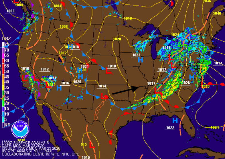
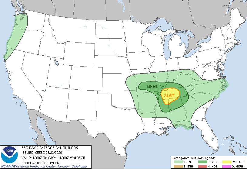
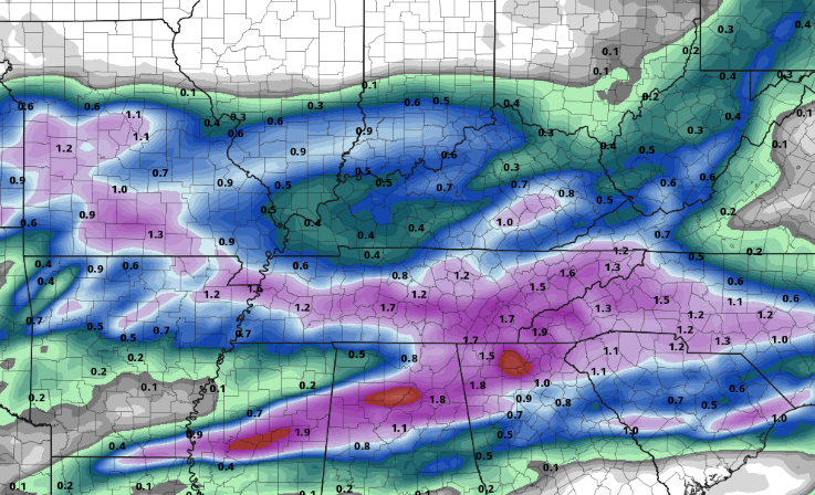
We had a nice round of "sleeping weather" overnight and into early this morning but showers are fading out this afternoon. As this system works east, mostly cloudy skies will stick around this afternoon and overnight. High's will remain cool today with a warming trend set for this week. As a low pressure system develops in north Texas today, it will begin to work eastward. This will allow the opportunity to see stronger showers and storms tomorrow afternoon. As seen below, a slight risk (2/5) is labeled for Middle and Western TN tomorrow. Depending on the amount of instability (vertical motion) we see will vary the chances for storm activity. Given the latest models, scattered showers will start the day and continue into the early afternoon. If cloud cover is broken at times (providing some sunshine in spots), we could see a better chance for stronger storms. The main threat will be damaging winds but isolated areas of spin-up and hail are possible. We'll continue to monitor the latest and keep you up to date. Scattered showers will start the day off before heavier showers and storms move in by the later half of the day. These will move east overnight tomorrow, allowing for clearing to take place Wednesday afternoon. This means SUNSHINE is finally back in the forecast for late Wednesday and through the day Thursday. As heavier showers and storms move through the day tomorrow, we'll see a fair amount of rain. Flash flooding potential isn't the greatest threat but it is possible for those in low lying areas and locations prone to rising waters. Expect an additional 1.5"-2" tomorrow to the 1.25" we picked up through today. Though severe potential remains on the lower confidence level, many severe parameters are in place. We'll monitor the instability potential as we work into Tuesday. This will give us a real idea on severe possibilities for tomorrow afternoon. Until then, stay dry and stay up to date for the latest!
0 Comments
Leave a Reply. |
Your trusted source for everything weather in East Tennessee.
Social Media
|


