|
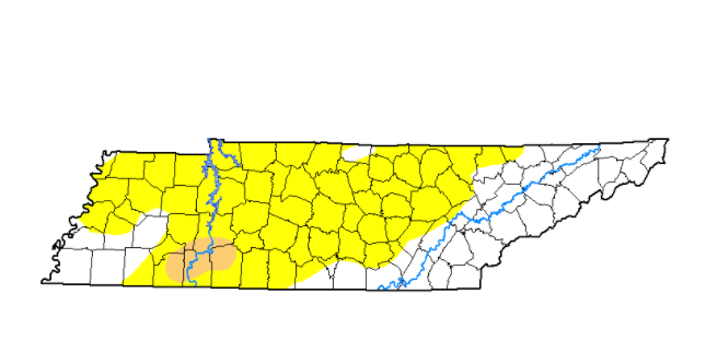
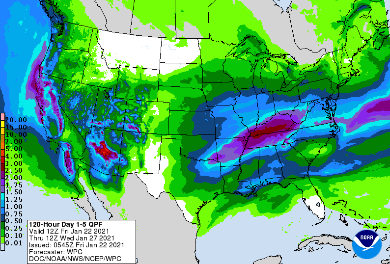
Cloud cover is thinning across East Tennessee this afternoon with temperatures warming up into the mid 40's (high's in the low 50's). A recap of the states' current drought shows an ever expanding abnormal dry line. This now encompasses nearly 3/4 of the state as of yesterday. The good news is this weekend could help these conditions significantly improve. As for today, sunshine will work back in and continue for most of the weekend. Saturday will be a bit cooler (in the mid 40's) but sunny skies should make it feel comfortable. By the end of the weekend, cloud cover increases across the region as our next system builds in. Showers will arrive towards the evening and overnight hours and throughout much of Monday. Earlier data suggested the bulk of rainfall across central and eastern TN but this now has shifted further north. Looking at the expected rainfall Sunday night through Tuesday morning, the heaviest swath of rain is across central Kentucky. This doesn't mean we are out of the woods. Localized flash flooding will be possible along the Plateau and specially, the northern Plateau and counties bordering Kentucky. East Tennessee as a whole can anticipate upwards of 1-2 inches (decreasing as you move west to east). Data continues to narrow in on rain to the north but we'll continue to monitor for changes. As of now, the biggest threat for any flash flooding will be the Plateau and northwestern counties bordering Kentucky. Have a great weekend and don't forget to check out our video forecast below.
0 Comments
Leave a Reply. |
Your trusted source for everything weather in East Tennessee.
Social Media
|


