|
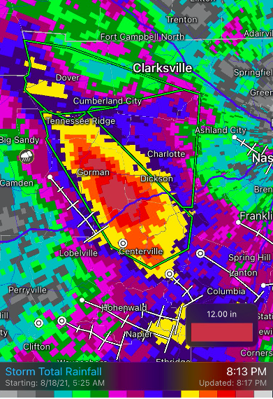
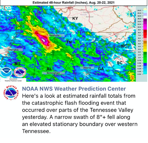
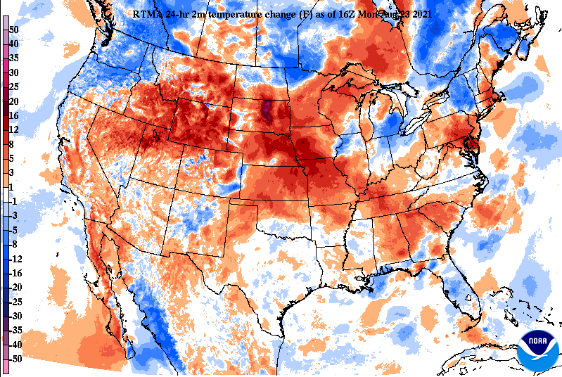
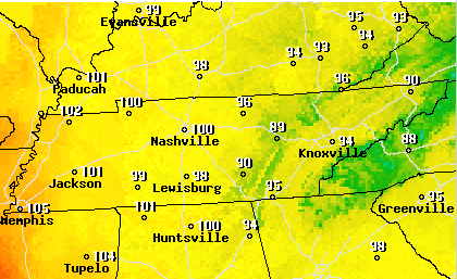
Though things were pretty tame for East Tennessee this past weekend, the same can't be said for those near Nashville. A slow moving back building storm brought heavy rainfall Friday night and into Saturday morning. Within an 18 hour period, another strong meso-convective system dumped additional rainfall in nearly the same exact spot. The first round of rainfall dumped upwards of 8-10+ inches and led to a flash flood emergency that ran several hours. The second round, Saturday afternoon, added an additional 8-12". This, unfortunately, led to several deaths, likely multimillions in damages, and extreme flooding just south of Clarksville. This area was fairly sparse with gauge data, but a TVA site in McEwen recorded 17.02" in a 24-hour period. This easily set the most rainfall for the state of Tennessee within a 24 hour period. The "white" indicated on estimated rainfall totals (right image) indicates between 16-18" of rainfall. The left image shows the storm total rainfall for the second system Saturday afternoon (up to 12 inches!). For those out and about this afternoon and in the days ahead, things are very warm. Looking at the temperature changes from this time yesterday, we aren't the only ones "feeling the heat". Portions of South Dakota are 30+ degrees warmer today than this time yesterday. Moving forward, the heat doesn't look to let up. Highs today through Wednesday will range from the low to mid 90s. Combining this with increasing humidity, feel-like temperatures will be in the lower 100s. Several heat advisories have already been issued for areas just to our west, so we'll keep an eye out for this trend if additional NWS offices follow suit more local. After an active pattern the past several weeks, things will steer a bit more dry. Thursday looks to be our best shot for rainfall, with only isolated afternoon showers/storms in the days prior and thereafter. The main concern will be the heat as highs today are anywhere from 6-10 degrees above average. Pre-recorded for 5pm show
0 Comments
Leave a Reply. |
Your trusted source for everything weather in East Tennessee.
Social Media
|


