|
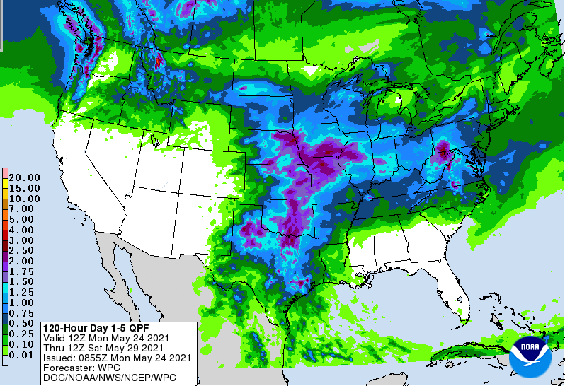
We start the new work week very mild this morning. Temperatures across the board range from the upper 50s to low 60s with mostly sunny skies. Looking over the Smokies we see the last of the fog lifting out as a beautiful morning is in store to enjoy a walk before it gets too hot. Afternoon highs today will top out in the upper 80s and lower 90s. With high pressure locking in the dry air and warm temperatures the past several days, that begins breaking down early this week. As the high shifts southward, a few isolated showers will find the lee-ward side of the Smokies this afternoon and the days ahead. For the remainder of us, anticipate staying dry with temperatures ranging into the lower 90s through Wednesday. By Thursday, better rain chances arrive as a system to the north and west nears in. Isolated showers/storms are possible Thursday afternoon before becoming more widespread on Friday. If you recall this graphic from last week, East Tennessee had no expected rainfall over the next 7 days. This week is a bit of a different story. Looking at the 1-5 rainfall forecast, a rainfall total of an inch is anticipated by the weekend. This isn't an impressive amount, and is still below average, but we'll take it as drought conditions could begin creeping in. The good news is the CPC suggests above average rainfall for the end of may and beginning of June. With well above average temperatures expected, make sure to throw on the sunscreen, take breaks, and stay well hydrated. Our hottest day of the week will be tomorrow with most locations in the low to mid 90s. Pre-recorded for 5pm show
0 Comments
Leave a Reply. |
Your trusted source for everything weather in East Tennessee.
Social Media
|


