|
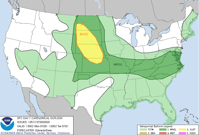
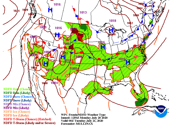
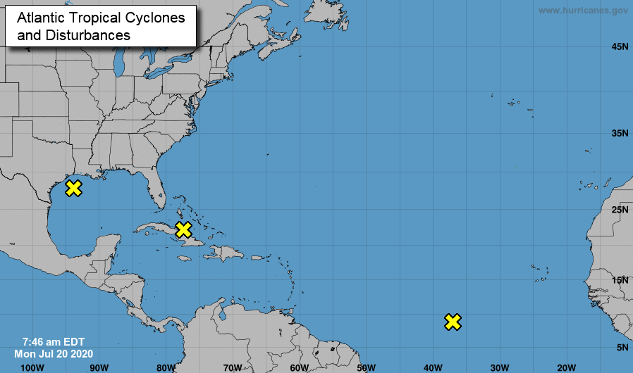
As a front to the north and west shifts in, moisture values will increase across the region. The SPC has labeled east TN under a marginal risk for severe storms this afternoon. Though severe levels are low, some cells could be strong to severe at times. As we saw yesterday, the bulk of activity stayed in the higher elevations. I expect this to be the case again today but some storms could roll through the valley this afternoon. A set of fronts will slide eastward the next couple of days providing opportunities for afternoon showers and storms. The first one comes today and remains in tact for tomorrow. As we work toward Wednesday and the second half of the work week, guidance is hinting at better precipitation chances. As we saw Sunday, afternoon pop up showers and storms (mainly in the higher elevations) will likely develop. By Wednesday, a second front to the north will allow moisture to funnel in from the Gulf. This will allow for better and more widespread activity the second half of the work week. Depending on how deep the front dips down will depend on how likely showers will be. Regardless, expect a chance for afternoon showers and storms each day. Lastly, an update on the Atlantic shows some hot spots for activity. In recent weeks, activity has been limited due to the Saharan dust plume. Now that it has passed, a more normal July is present. Guidance and the overall general pattern is hinting at more activity in the weeks ahead, so we'll continue to eye the Atlantic for any Tropical Storms, Depressions, or Hurricanes in the future. Continue keeping your heat safety in mind. Heat indices this afternoon are expected to return to the lower 100's. In addition to the heat, check back in for updates as showers/ storms are likely to develop for some parts of the region later today.
0 Comments
Leave a Reply. |
Your trusted source for everything weather in East Tennessee.
Social Media
|


