|
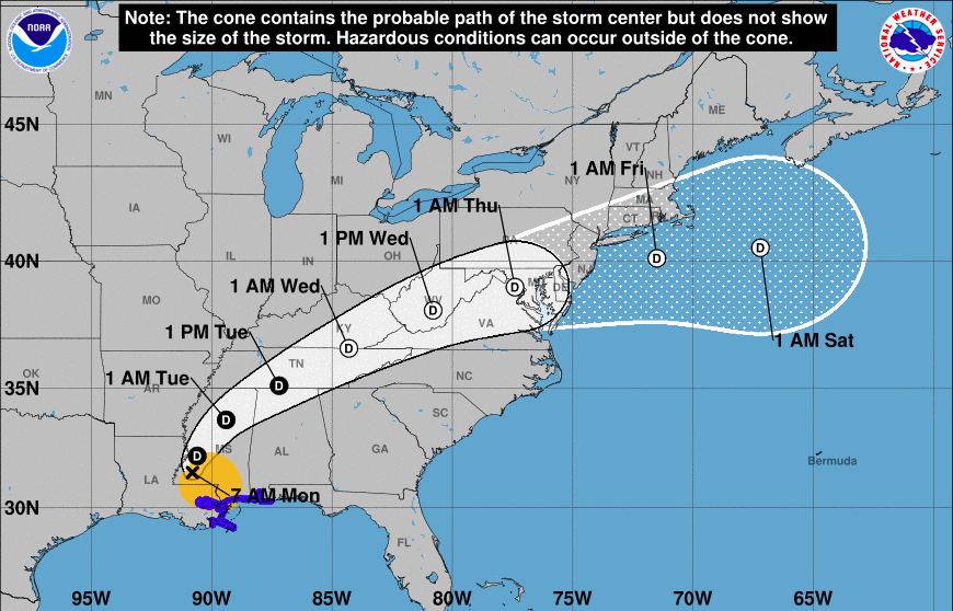
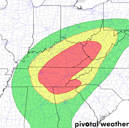
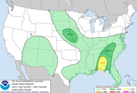
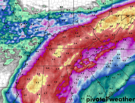
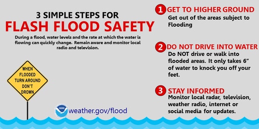
Lots to discuss, so jumping right in....Current Tropical Storm Ida is working through the Deep South and will shift northeast with time. The current track, as seen by the NHC below, depicts the storm crossing parts of Middle and Eastern Tennessee tomorrow and early Wednesday. This will bring heavy rainfall to the region. Because of this, a FLASH FLOOD WATCH has been issued from 8am Tuesday to 2pm Wednesday. The biggest concerns will be flooding/flash flooding, as the WPC has placed the area under a MODERATE (20-50%) chance of flash flooding tomorrow. Additionally, a marginal risk (1/5) of severe weather is also in place for winds and isolated tornadoes. Take the proper precautions now, especially for those in low-lying and flood prone areas. Also know where your "safe place" is if severe storms do strike. Looking at the expected rainfall, guidance varies. The general consensus is between 2-5 inches along Middle TN and the Plateau, 2-4 for the Valley, and 1-3 along the foothills and Smokies. Locally higher amounts will certainly be possible, especially accounting for terrain induced rainfall rates. As a reminder, here are some flash flood safety tips to follow. Always remember, "Turn around, don't drown" Have a way to receive alerts tomorrow through Wednesday. With heavy rainfall expected, we certainly could expect flash flood warnings at some point during the event. Be sure to follow us on Twitter/Facebook for the latest. Pre-recorded for 5pm show
0 Comments
Leave a Reply. |
Your trusted source for everything weather in East Tennessee.
Social Media
|

