|
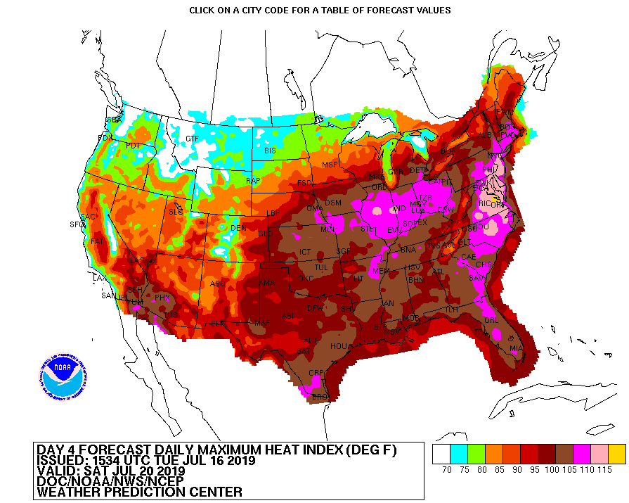
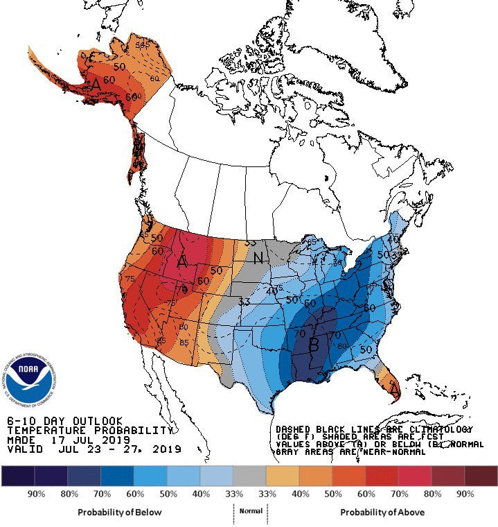
I hope many of you are staying cool and dry this afternoon as heat indices are beginning to near the triple digit mark. Scattered storms are currently across much of east TN now, but these will begin thinning out as we get closer to sunset. Looking ahead, brace for that mid July/early August heat. High's are not too much above average, but relative humidity will make temperatures feel in the lower 100's this weekend. As seen below, this heat outbreak isn't localized to just east TN, with 2/3 of the nation feeling the heat this weekend too. On the bright side, cooler temperatures are on their way. First, lets talk about rain potential to end the week and into the weekend. With remnant activity still sticking around from Barry, day time heating and precipitable water values still pretty high, afternoon showers are likely to pop up across the area. This will be the case Friday and Saturday. Sunday and Monday a new round of showers will arrive bringing locally heavy rainfall, storms, and strong winds. Following this moderate system Monday, we will see much cooler temperatures follow. If you take a look at the run below, you can see the line of cooler temperatures migrate from the northwest to the southeast as the GIF continues through. This will allow us a break from the heat with high's next week expected to be in the low to mid 80's. The strong ridge that has been sitting over the area will begin breaking down and moving out. NOAA is in full agreement as their latest graphic shows below average temperatures for much of the eastern United States next week. Enjoy your Friday and have a good weekend. Stay dry toward the later part of the weekend and into next week and remember to stay hydrated as "feel-like" temperatures will likely be in the lower 100's.
0 Comments
Leave a Reply. |
Your trusted source for everything weather in East Tennessee.
Social Media
|


