|
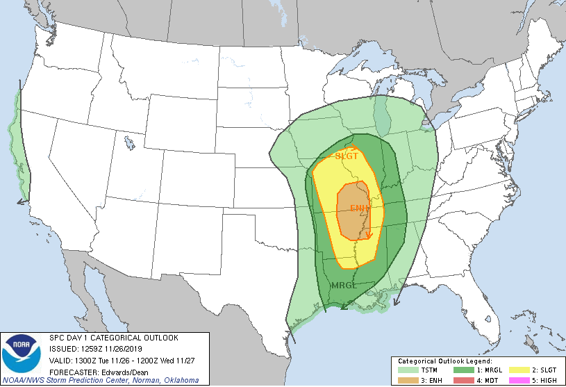
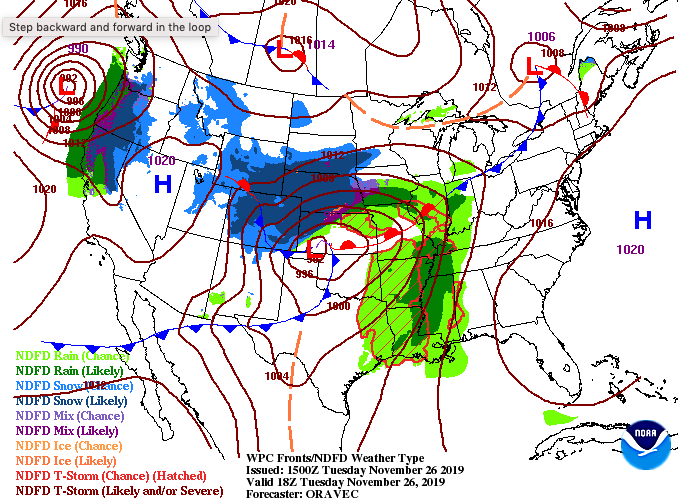
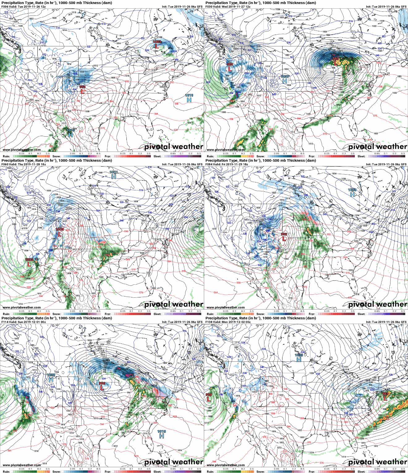
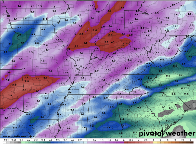
Happy Tuesday to all! We are one day closer to filling our faces with lots of food, but until then, we first must face a strong system currently to the west. The lasts SPC (Storm Prediction Center) outlook shows an enhanced region in parts of West TN, West KY, Arkansas, and Missouri. The good news for us is this system will be moving in a northeast direction (avoiding much of the heavier storms here at home). The surface map below shows the set up of this system with heavy snow storms to the north and severe storms to the south. East TN will feel a brief glimpse of these storms will gusty winds (30+ mph) overnight and into Wednesday, as well as heavier rains and some thunder. Fortunately for us, this system will move out just in time for Thanksgiving with sunnier skies and cooler temperatures in the forecast. System #1: Looking ahead at the set up of these two next systems, showers will arrive this evening (starting scattered) and becoming more moderate & heavy late overnight. Showers will begin moving out by the lunch time hour tomorrow as a cold front sweeps through. High's will arrive early in the day tomorrow (low/mid 60's) with temperatures eventually falling by tomorrow afternoon. The cold front will not only decrease temperatures but also help clear the skies. Thanksgiving: Thursday will be beautiful with sunny skies and a mix of light clouds through the day. Temperatures will feel very much like Fall as well, in the low 50's as high's. By Thursday night, clouds will be reintroduced, increasing overnight and through the day Friday. Weekend (System #2): By Saturday, showers will arrive (mainly in the afternoon hours) and carry through the first half of the day Sunday. The latest data suggests this next round won't be as strong, with more light to moderate shower activity. With the second system moving out late Sunday, temperatures will again fall, leaving high's back in the 40's early next week. The latest outlook below suggests rainfall between half an inch and an inch over the next 5 days. Keep in mind this is just one of several models. As for the system tonight and into tomorrow, total rainfall is expected to be around half an inch with localized amounts higher in heavier storms. That will conclude today's forecast so stay up to date on our social media for the latest in these next systems. Have a good one!
0 Comments
Leave a Reply. |
Your trusted source for everything weather in East Tennessee.
Social Media
|


