|
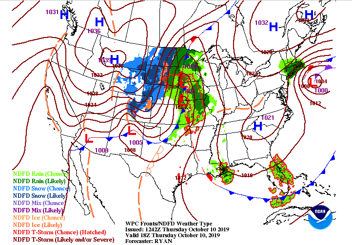
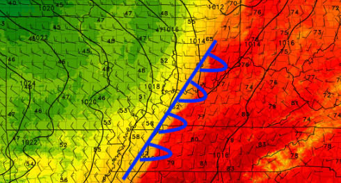
Happy Thursday; one more day before the weekend! Until then, changes are coming. We will stay above average today into tomorrow, before cloud cover builds tomorrow afternoon. A high pressure system will keep us dry and warm today and tomorrow before a cold front moves through the region. We will see some scattered light rainfall Friday night into Saturday morning before quickly clearing out for Sunday. Looking into tomorrow, check out this swing in temperatures from East TN to West TN. Note, this is at 4 tomorrow afternoon, typically thought of "as the warmest time of the day". We will be sitting in the low 80's while west TN in the upper 50's. Thats nearly a 30 degree temperature difference across the state due to the cold front! This will slide through Friday night, knocking high's to the mid 60's Saturday and low's in the 40's overnight. The high pressure system will keep things dry this afternoon, but as the cold front approaches, so does some rainfall. This won't be a wash out, just some scattered light showers (40% chance) Friday night into Saturday. By Saturday afternoon, clouds will begin decreasing as a high pressure system moves in allowing for a BEAUTIFUL Sunday and Monday (Mostly sunny and high's in the low to mid 70's). Remember to check out our video forecasts below. If you enjoy our content, we would love for you to share with friends, family and/or on social media. I hope everyone has a great Thursday!
0 Comments
Leave a Reply. |
Your trusted source for everything weather in East Tennessee.
Social Media
|


