|
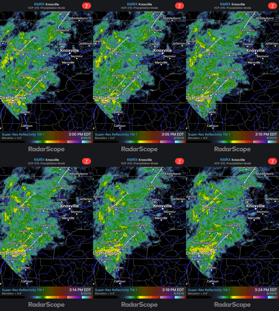
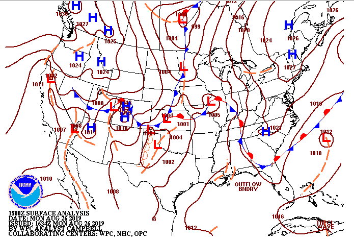
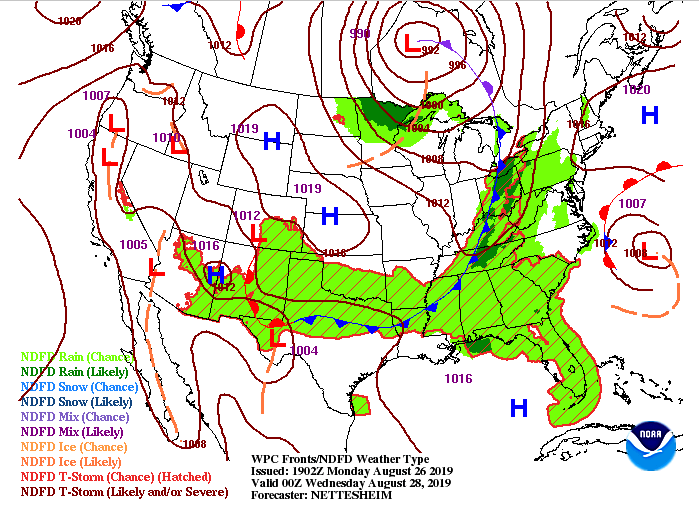
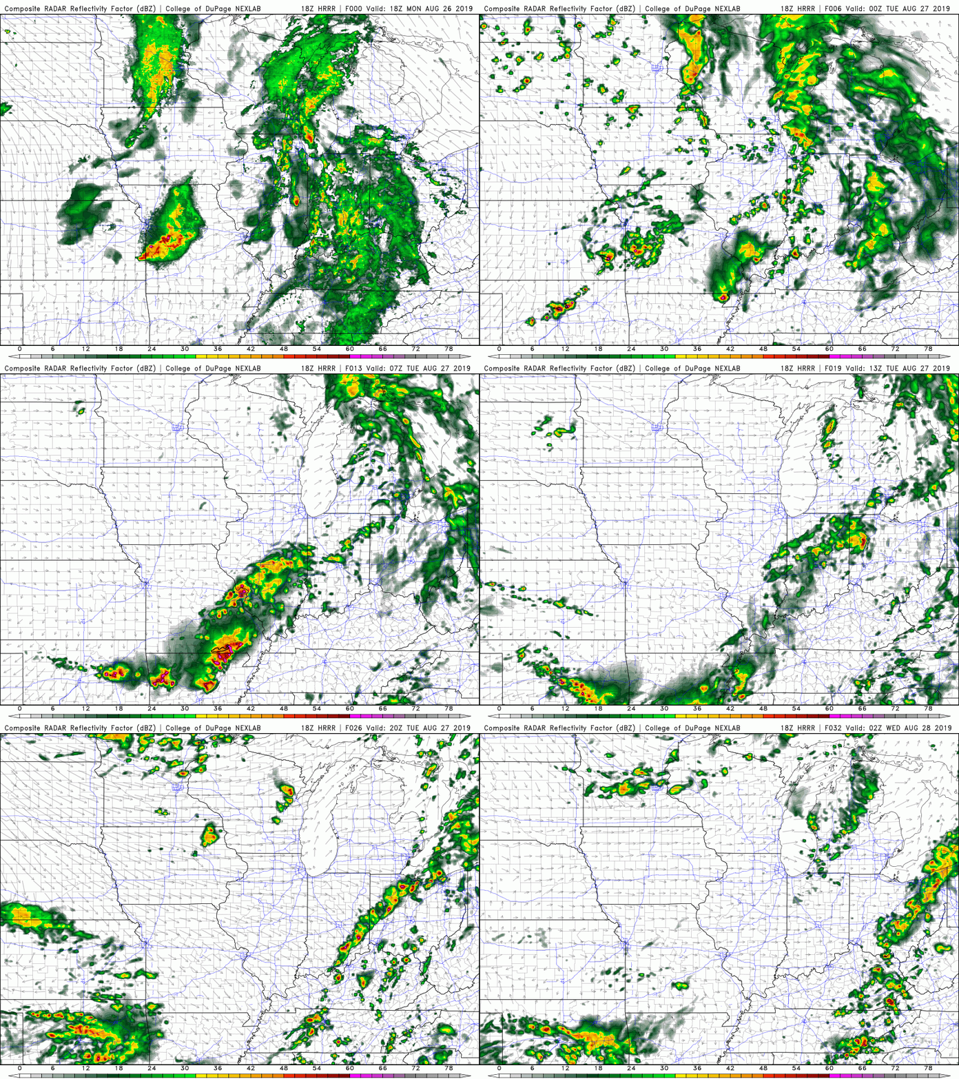
I hope everyone remembered their umbrellas out of the door this morning as its been a wet one so far. As we continue into this afternoon and evening, showers will continue on and off. A few rumbles of thunder can not be ruled out, either. Radar (below) shows the steady showers that are currently falling throughout much of the area. Analyzing the Tennessee valley, we see a very slow moving front. This is what brought many of the showers and storms late last week and into the weekend. It will continue to slowly move through the area before moving out tomorrow afternoon. Once this moves out, a separate cold front will push through bringing showers and thunderstorms late Tuesday and into Wednesday morning. This graphic shows the cold front moving through the Tennessee and Ohio Valleys Tuesday around 8 pm. Note behind this front is a strong high pressure system that will dry us off through the remainder of the week. Ahead of this cold front, expect a line of scattered showers and storms to push through. This will be much different than the light and steady showers we have felt today. If we look at our model guidance (below) we see that line of storms develop late Tuesday before becoming scattered. This is good news, as nocturnal cooling will help cap off or "kill" the stronger storm potential that is present during the daytime hours. With this system, we can't rule out some stronger storms (gusty winds, lightning, and small hail), so stay weather aware. The good news is Thursday looks to be beautiful with sunny skies, much lower humidity, and high's in the low to mid 80's. A high pressure system will move in (as mentioned) bringing us plentiful sunshine to closeout the week. We will stay sunny through the weekend with temperatures increasing, along with humidity (creeping back in), each day. By Sunday afternoon and into early next week, we could see the chance for afternoon pop up storms return. Until then, stay up to date on our social media handles (Twitter/Facebook: @SecretCityWX) for the latest!
1 Comment
8/31/2019 00:32:51
The rain will stop anytime soon, there is a time for rain and a time for that ray of heat from the sun. The sun will be the one that will rise from that dark night that we all see. I want to ensure that people will have a positive outlook in life just like what we are reading right now we need to have a positive perception in life. There are charts and diagrams that we can see here and it will be the reference that we need to look at so that we may have a good findings and a good quality of reporting. I will read this report and look for the details of it. I will read this report and look for the details of it.
Reply
Leave a Reply. |
Your trusted source for everything weather in East Tennessee.
Social Media
|


