|
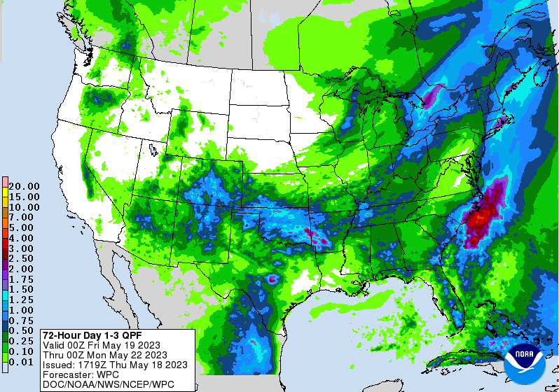
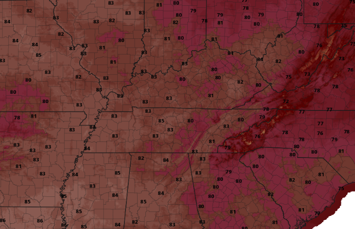
Good morning! Most areas are running in the upper 50s to low 60s right now (6:30 am) but will climb much warmer by this afternoon. It should be a pleasant one overall, with partly cloudy skies and highs running in the upper 70s and low 80s. Clouds are set to increase by this evening, with a cold front en route. This will lead to showers and isolated storms late tonight into Saturday, with rainfall amounts minimal. Generally a couple of tenths up to a quarter of an inch will be possible through this time tomorrow. After the passage of the cold front Saturday afternoon, drier conditions edge back in by Sunday. From Sunday through mid week, things look dry and warming. There is some uncertainty in guidance, suggesting a disturbance to bring limited afternoon showers/storms Tuesday or Wednesday, but for now will hold dry during this time. Looking below, temperatures will warm up quite nicely over the next several days. With the front, cloud cover, and showers tomorrow, highs will max out in the low to mid 70s. A quick turn around can be found thereafter, with highs warming into the low to mid 80s by Tuesday, and climbing higher by Thursday. After this bout of rain it looks to be warm and dry for sometime so take advantage if you can! Saturday may ruin a few outdoor plans, but showers should be out by midafternoon for most. Our dry and warming trend then finds us Sunday into next week. Pre-recorded for 5pm weather broadcast
0 Comments
Leave a Reply. |
Your trusted source for everything weather in East Tennessee.
Social Media
|


