|
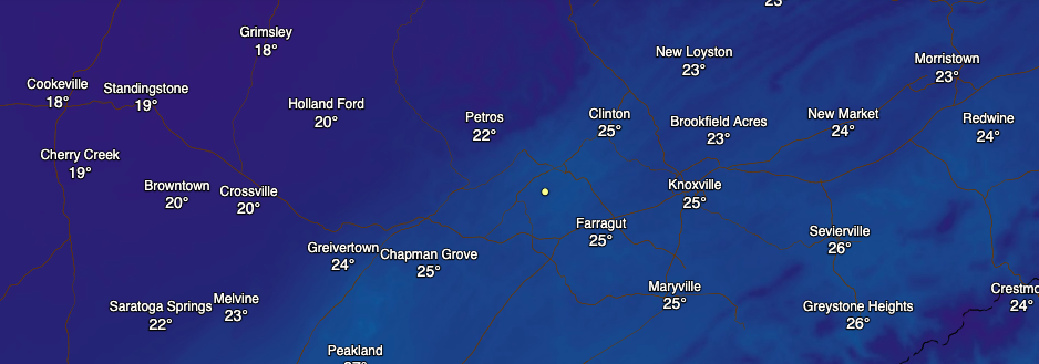
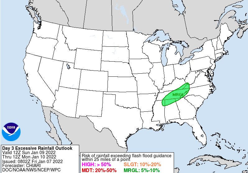
I hope you are staying warm this afternoon! Current temperatures are running from the upper teens to low 20s (Plateau) to mid 20s across the valley. These will warm a few more degrees before days end, but most won't break freezing (32). Luckily into tomorrow, high pressure will shift east, allowing for some return flow across the region (meaning warming temps). That is first not to downplay overnight lows tonight, as many find the low to mid teens once again. Working ahead, an approaching cold front and system will bring moderate to heavy rainfall Sunday. Precipitation amounts between 1 and 2 inches is possible, with the higher amounts westward (middle/western TN). This will be a quick moving system, dumping rainfall Sunday and out by Monday but cooler temperatures will follow. Because this system packs a lot of moisture and rain rates are expected to be moderate to heavy at times, the WPC has highlighted a Marginal Risk (5-10%) for flash flooding. Given the limited snowpack for a majority of the area, not anticipating too many hydro related issues. With that said, common flooding/flash flooding locations could see impacts Sunday afternoon. Dry but cool conditions return early next week, with highs Monday and Tuesday in the upper 30s to low 40s. Have a great weekend, stay warm, and use caution Sunday with the moderate to heavy rainfall expected. Pre-recorded for 5pm show
0 Comments
Leave a Reply. |
Your trusted source for everything weather in East Tennessee.
Social Media
|


