|
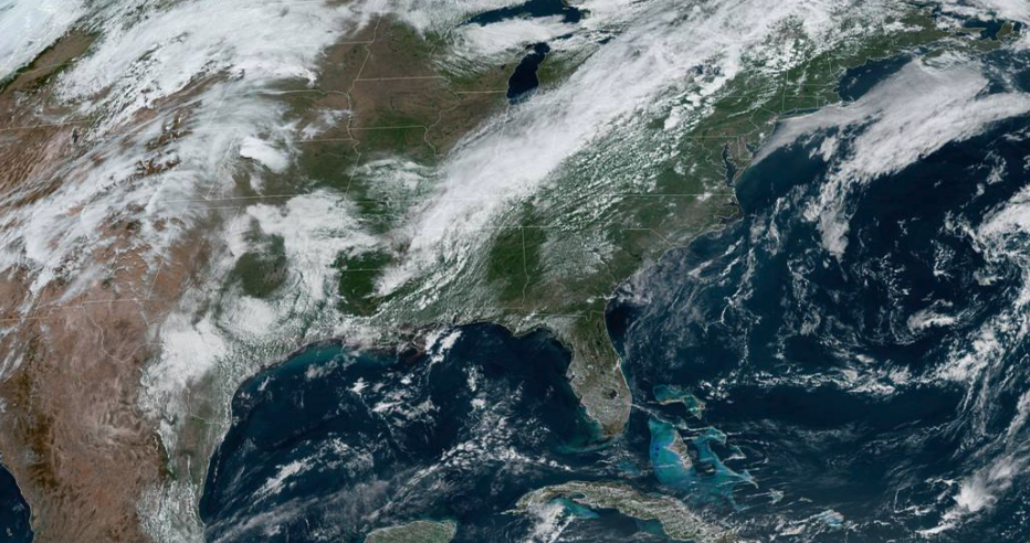
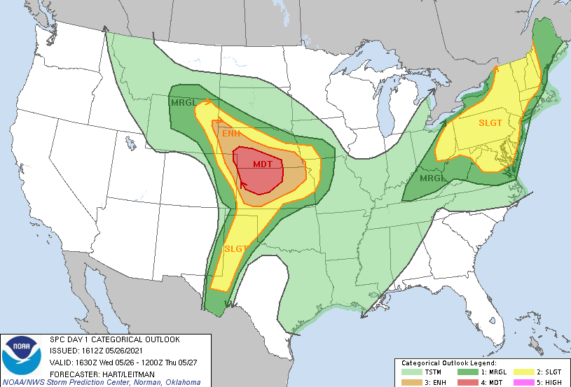
Cumulus clouds continue to develop ahead of the front this afternoon. As you can make out from satellite, this line of showers/storms is working eastward. Fortunately for us, it looks a bit more "scary" than actuality. With drier air across East Tennessee and dying instability eastward, most of us will stay on the dry side with only an isolated shower/storm or two possible. Highs today continue to be warm as well, topping out in the upper 80s. Comparing satellite to the SPC outlook today, the cold front will primarily impact Eastern Kentucky and north. Again, a few isolated showers and storms could be possible late this afternoon and evening, but activity should be fairly minimal. This map also points out the moderate risk across the Central Plains. This is associated with a strengthening low that will shift eastward in the coming days. Though severe weather looks Marginal (for now) on Friday, a few strong to severe storms will be possible with this system. Model guidance does a fair job at representing the isolated afternoon showers/storms today and tomorrow. By Friday that system (just discussed above) will work to our north bringing moderate to strong showers and storms at times during the day. The main threats will be strong winds, small hail, and localized heavy rainfall. Following this system, we begin to dry back out for Sunday and Memorial Day. Conditions remain on the warm side but a break is in site. With a front arriving tonight, temperatures will dial down a couple of degrees before our next system lowers temperatures into the 70s for the weekend. Pre-recorded for 5pm show
0 Comments
Leave a Reply. |
Your trusted source for everything weather in East Tennessee.
Social Media
|


