|
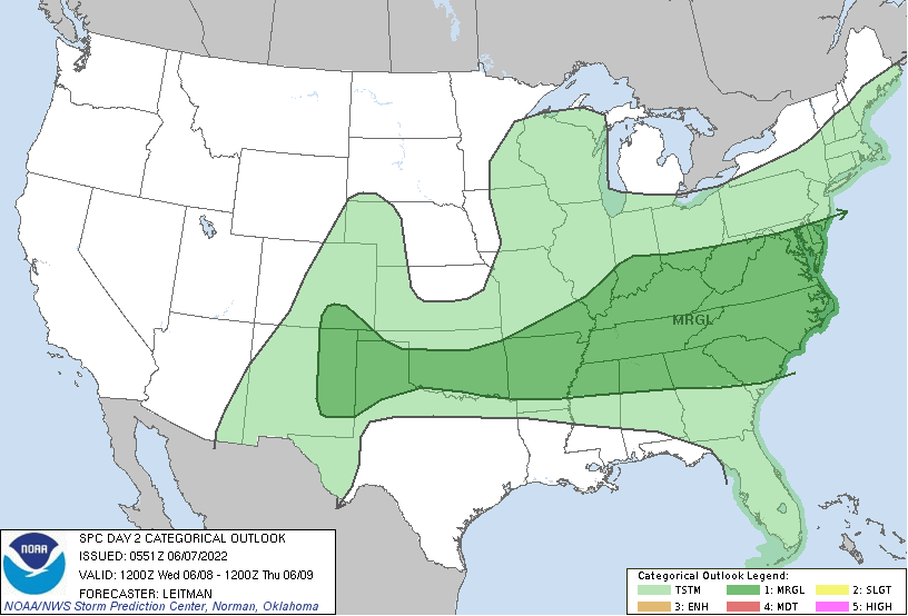
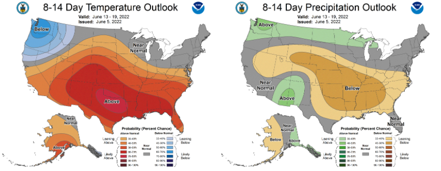
Though the severe risk (both today and tomorrow) is low, it is not entirely ruled out. Given the aid of daytime heating and the frontal boundary, a few strong to severe storms will be possible during the afternoon to early evening today and tomorrow. The primary threat will be damaging wind gusts but large hail is possible as well. Looking at model guidance, rounds of showers and storms are in store ahead. We saw a large swath of showers this morning that are slowly working their way out. This will set the chance for isolated to scattered showers later this afternoon and evening. Showers and storms then return at times throughout tomorrow, with the best opportunity the second half of the day. Activity will then dwindle out tomorrow night and early Thursday, where partly cloudy skies return for the afternoon. After a soaking several days expected this week, we flip sides. Not only will we warm back up, but drier conditions are also forecast. Looking at the CPC outlook below, warmer than normal conditions as well as a strong signature for drier than normal conditions are planned for next week. With the frontal boundary wavering across the area, showers and storms will develop at times this afternoon and evening. Showers and storms then return, with the best opportunity tomorrow afternoon and evening. Drier conditions, briefly, return Thursday and parts of Friday, before another round into the weekend. We will also cool off, with highs Friday and Saturday for most in the 70s. Pre-recorded for 5pm show
0 Comments
Leave a Reply. |
Your trusted source for everything weather in East Tennessee.
Social Media
|


