|
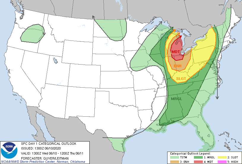
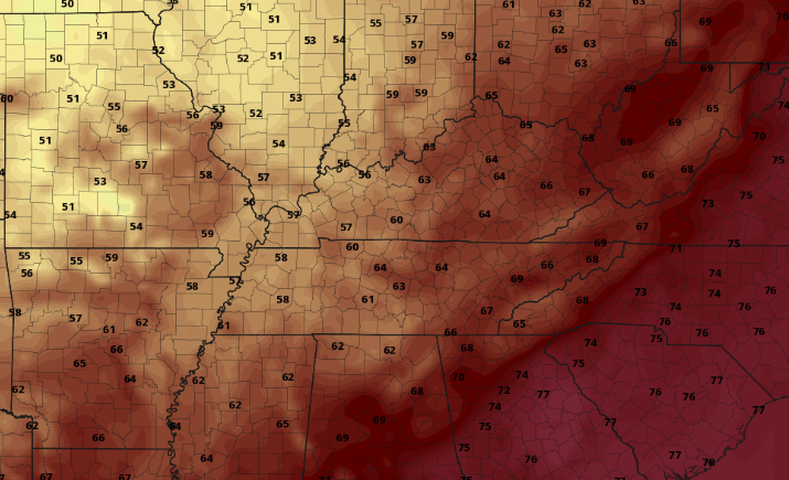
A marginal risk remains in place this afternoon as showers and storms are expected to develop this evening ahead of a front. The heavier showers and storms today will be scattered with a developed line (ahead of a cold front) likely staying into the northern valley and into Kentucky. With that said, the timing for activity will fall between 4pm and 9pm tonight. Gusty winds and small hail are the biggest impacts through the evening hours. Activity will begin picking up this afternoon as a cold front from the west draws near. As mentioned, the best chance for storm activity falls into the late afternoon to evening timeframe before clearing takes place overnight. In the days ahead, sunny skies, average temperatures, and low humidity will be present. Take a look at the future temperature map late tonight/ early into Thursday. You can definitely see where that cold front lies with a 10+ degree temperature swing from North Carolina to Tennessee. Cool air will stick around Thursday and Friday with high's in the low to mid 80's. Working into the weekend, a secondary front will keep things comfortable Saturday and Sunday. Check in this afternoon with us on the latest regarding the showers and storms. Though severe potential remains low, gusty winds and hail can still be an issue for some. As long as you can make it through today, beautiful conditions are in store for the days ahead.
0 Comments
Leave a Reply. |
Your trusted source for everything weather in East Tennessee.
Social Media
|


