|
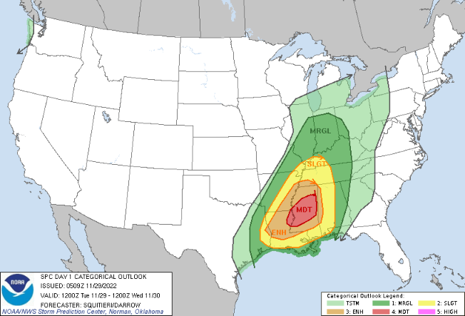
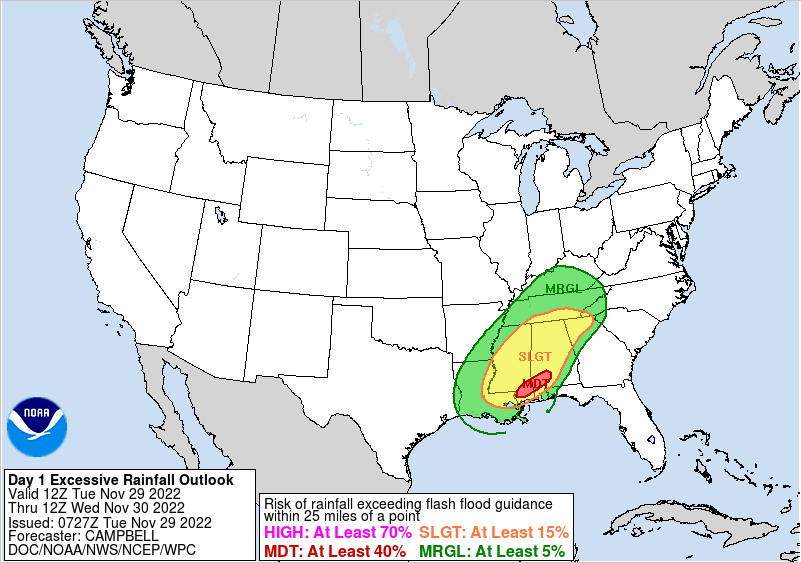
Those heading out this morning, be weary. Patchy dense fog has developed overnight and will gradually lift out over the next few hours. Take your time and account for some longer travel times to and from this morning. As far as tonight, the Storm Prediction Center has expanded the Marginal risk of severe storms further east. As discussed yesterday, this is because of a few stronger and longer tracking storms that could find their way off the plateau and southern Middle Tennessee. The risk remains low, but not ruled out. The main threat will be damaging wind gusts but a few isolated instances of hail will also be possible. Showers will find the area later this evening, before widespread showers and embedded thunderstorms build in overnight. The primary threat locations for strong to severe storms will be the southern East TN valley and the Plateau. Storms are expected to weaken with the onset of nightfall, but a few stronger ones moving in from Mississippi could bring heavy rains, frequent lightning, and strong wind gusts. Showers will linger for the first half of the day tomorrow, before clearing overnight and into Thursday. Much cooler air will then follow for Thursday, where highs will be lucky to break the 50 degree mark. Flash flooding is also a concern. Though we have been dry, isolated strong storms could bring heavy rainfall rates over one location and lead to flooding. Keep this in mind as well, though the risk is relatively low in total. Stay tuned for alerts and know what to do if a warning were to be established- especially in the overnight hours. Have a good one and give us a follow on Twitter & Facebook for the latest alerts. You can find us at @SecretCityWx Pre-recorded for 5pm weather broadcast
0 Comments
Leave a Reply. |
Your trusted source for everything weather in East Tennessee.
Social Media
|


