|
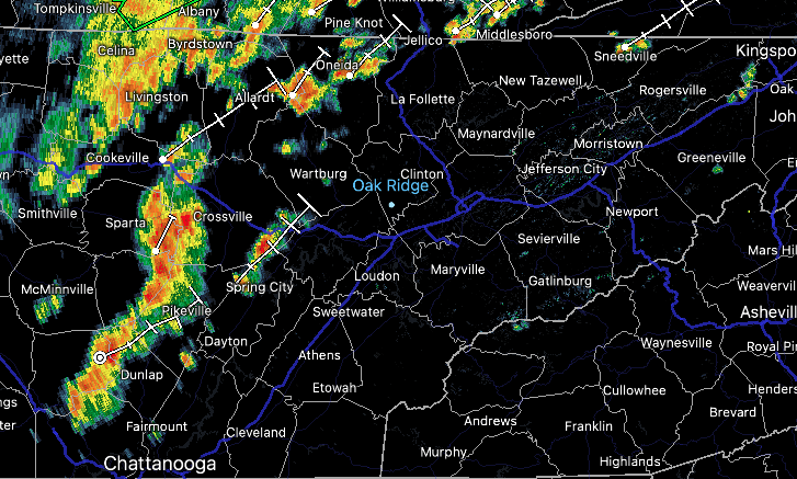
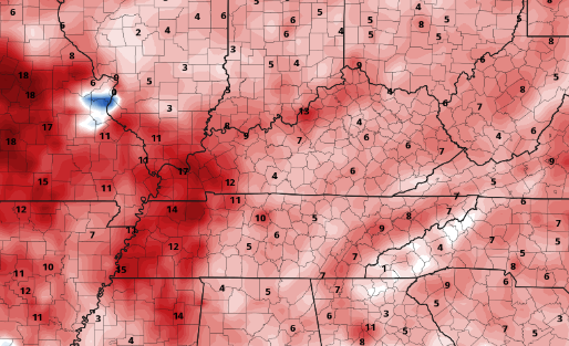
Showers and storms are beginning to work their way in early this afternoon. Keep in mind even though the severe threat is low, a few storms could be strong- dumping heavy rainfall as well as providing gusty winds. A low end chance for flash flooding is also in place. Activity will begin to lessen overnight tonight, as a frontal boundary washes out across the area. Because of this boundary, shower & storm potential will stick around through at least mid week. Towards late Thursday and into Friday, high pressure fills in bringing drier but warmer conditions. The good news is, rainfall won't be as heavy as what we have seen north of us. Some areas of Kentucky have picked up over 2.5" of rainfall since midnight this morning. Generally, around an inch of rainfall is expected area-wide through today/tonight. From thereafter, shower/storms will be isolated to scattered and mainly during peak heating (afternoon & early evening). By the end of the work week, high pressure and southerly flow will boost temperatures right back up above average. Highs will range in the low, and for some, mid 90s. Looking at temperature anomalies, we will top out anywhere between 5 and 10 degrees above average. This trend looks to continue throughout the weekend as well. Overall, some much needed rain will find us today, with scattered activity each afternoon through mid week. Drier but warmer conditions then return late Thursday, Friday, and into the weekend. Pre-recorded for 5pm show
0 Comments
Leave a Reply. |
Your trusted source for everything weather in East Tennessee.
Social Media
|


