|
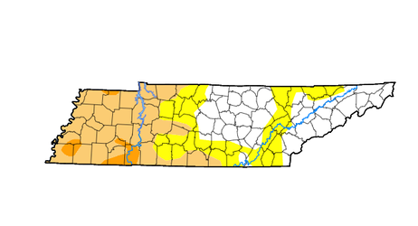
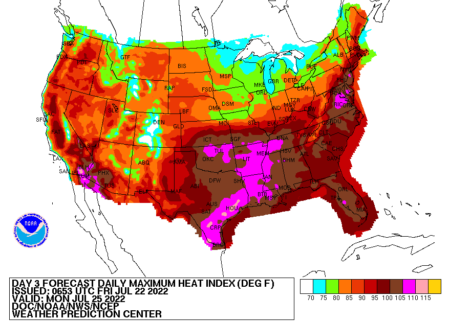
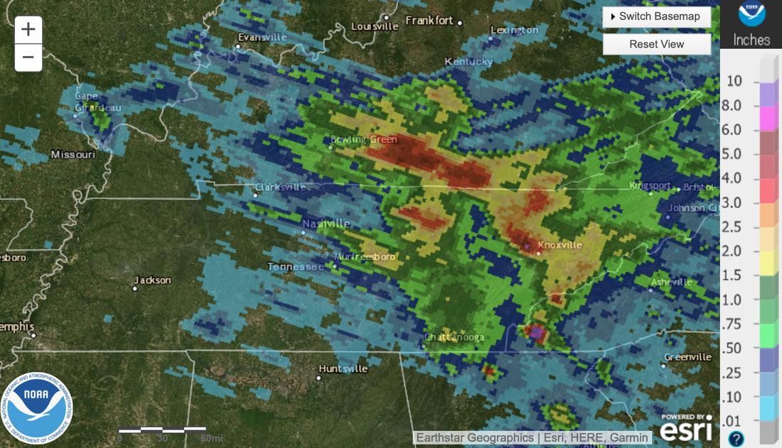
A pleasant start to the day, as current (8 am) temperatures range in the upper 60s to low 70s. Take advantage of the mild start because changes are coming. Also use caution if you are heading out this morning, as dense fog is showing up across the area. Before taking a dive into the forecast, a look at the latest drought map. There has been both some improvement, as well as some significant decline. Across East Tennessee, most areas are blank (or running normal), while West Tennessee is in some serious need of rain. Well below average rainfall through June and into the first half of July has led to a very depleted moisture levels. As such, severe drought has expanded through most of the area. Moving forward, very warm temperatures will find the region. These could be the warmest days we have seen so far this year. The positive part of this news is it's going to be a drier heat. Highs are expected to top out in the low 90s today, followed by low and mid 90s tomorrow and Sunday. Dew points will increase through the weekend, leading to heat indices in the low triple digits by Sunday afternoon. It could be much worse, so we'll count our blessings, but definitely keep your heat safety in mind the next few days. Looking at a recap of Wednesday night, a nearly stationary storm across portions of Oak Ridge, Clinton, Powell, and North Knox dumped significant rain. Flash flooding was a major concern in this area, as radar estimates of 6-8 inches were seen. Looking below, you can see the 24-hour rainfall amounts associated with the storm, then followed by the large storm complex (from Central KY) a few hours later. Thankfully we have dried back out and will continue that trend into the weekend. With that said, showers and storms return late Sunday night and into the day Monday. A frontal boundary looks to stall out across Kentucky, leaving us with the chance of showers & storms each day next week. These will be hit and miss, with the best opportunity during the afternoon hours. Another frontal boundary then looks to press in later in the work week. Overall, warm and dry this weekend, then pretty active next week with rounds of rainfall. Pre-recorded for 5pm weather-cast
0 Comments
Leave a Reply. |
Your trusted source for everything weather in East Tennessee.
Social Media
|


