|
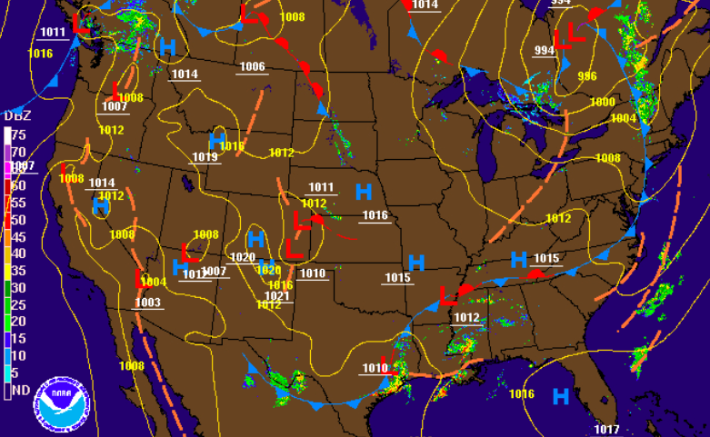
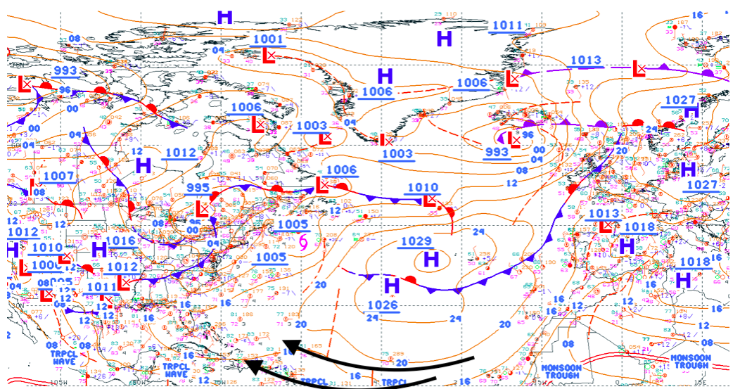
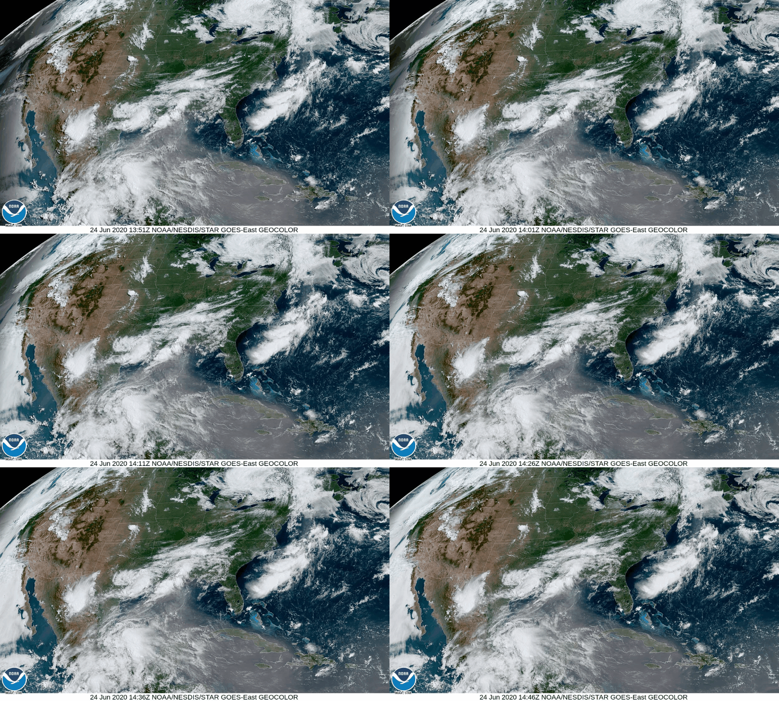
Happy Hump day to all! A mix of cloud cover and limited sunshine has been the main story so far this morning. As we push into the afternoon, a front will begin to work through. Ahead of this, we could see a few isolated showers by this evening. On the flip side, this will allow for clearing back side (AKA sunnier skies for Thursday). Thursday and Friday will be relatively the same. Lingering showers will move out by Thursday morning allowing for partly cloudy skies the remainder of the day. To close out the work week Friday, partly sunny with isolated pop up showers/ storms possible. These will stay mainly in the higher elevations, but a stray shower can't be ruled out here in the valley. Temperature-wise, expect to stay in the mid 80's today and tomorrow before warmer temps (mid to upper 80's) arrive Friday and Saturday. Sahara Dust PlumeShifting gears, something rather interesting is taking place in the Tropics. Strong storms in Africa are kicking up massive plumes of dust from the Sahara. These occur every summer but this is one of the larger ones seen in many years. Taking a look first at the surface map, the Bermuda high, along with the African Easterly Jet, are steering this plume right into the southern US. High pressure systems are associated with clockwise flow, so we'll likely see some of the pros and cons of this dust plume here at home by the weekend. To get a view of this plume, check out the "dirty cloud-like mass" south of Florida. This massive plume will begin working north bringing some positives and negatives with it. Sahara dust plume pros: 1) These severely reduce tropical development. Tropical depressions, storms, and hurricanes are, for the most part, out of the question while these are in the southern Atlantic. 2) They make for GORGEOUS sunrises and sunsets. With dust particles in the atmosphere, they refract light allowing for the many colors seen during sunrise/sunset. Be sure to pay attention to this as we work towards the weekend. Sahara dust plume Cons: 1) Awful air quality. Those with underlying health conditions could feel some of the impacts of this plume. The good news is the bulk of this mass will be to our south, so parts of Texas, Louisiana, and others will be affected the most. It will be exciting to see some pretty sunsets/ sunrises in the days to come, so take advantage if you get the chance! For now, enjoy sunnier skies Thursday with temperatures staying below average.
0 Comments
Leave a Reply. |
Your trusted source for everything weather in East Tennessee.
Social Media
|


