|
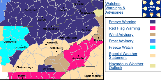
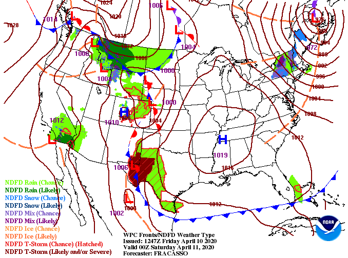
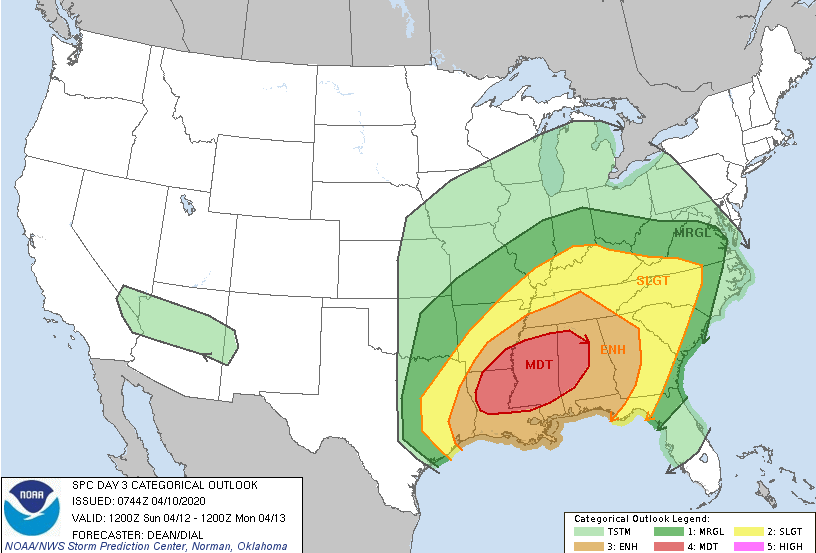
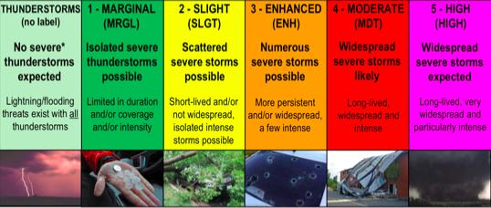
With cooler air working in today, Freeze Warnings have been placed for tonight. The main concern is for Anderson County and to the north. Though the NWS doesn't include the valley, overnight low's are likely to be near that freezing mark. Protect any sensitive plants you may have as frost and freezing temperatures are likely. Looking at the latest across the country, not to much is going on locally. A high pressure system will keep things dry and peaceful today and tomorrow before big changes into Easter. The SPC day 3 outlook (For Easter Day) has changed quite drastically since yesterdays release. Many factors for severe weather are in place and the likelihood for catastrophic damage late this weekend is something on many meteorologists minds. For a "play by play" rehearsal, a low pressure system will develop in Texas and work north and east. With a strong, warm, and moist subtropical jet as support and a cold pool to the west, lots of instability is in place for Sunday. The latest data continues to push this system further north, the reason we've now been included in the severe outlooks. Timing: Showers will begin working in Sunday morning with heavier showers and storms by the afternoon and evening. The biggest threat (as of now*) comes after 2pm Sunday. This line is capable of producing damaging winds, large hail, and isolated tornadoes. With this system being several days out, changes are likely occur so check in for updates. If you have friends/family in parts of Alabama, Mississippi, Arkansas, and Louisiana, make sure they know the threats for Sunday. The table below give a brief description of what each categorical risk means. Most of east TN (as of today) is under a slight risk but Chattanooga and southern middle TN are under an enhanced risk. Be weary of the changes that are likely to occur over the next couple of days. It is very unfortunate that this system will work in on a major holiday, but given the stay at home orders nation-wide, it could help in saving lives. Given this system is 3 days out, we'll continue to monitor the track, impacts, and timing for us East Tennesseeans. Enjoy the sunshine and warming temperatures as we work into Saturday and be weather aware on Easter.
0 Comments
Leave a Reply. |
Your trusted source for everything weather in East Tennessee.
Social Media
|


