|
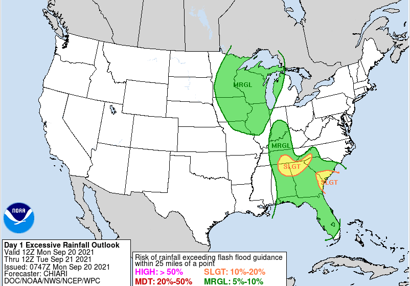
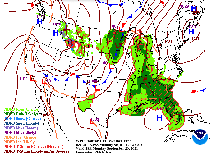
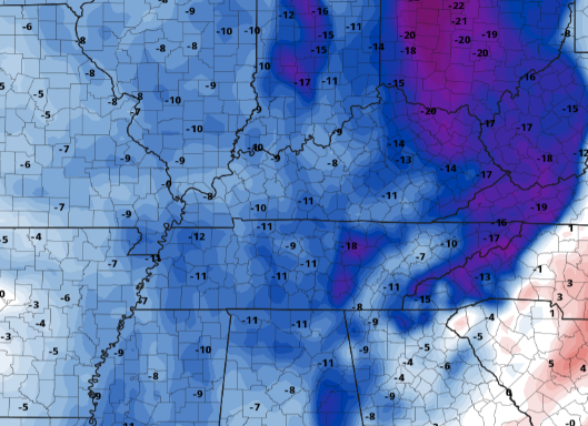
Unsettled weather continues for the start of the work week as a remnant low works north. If you recall Tropical Cyclone Nicholas making landfall in Texas, well this in combination with an upper level low, is what is left of that system. It will work north through today before a cold front slides in tomorrow and Wednesday. Looking at the excessive rainfall outlook, parts of the Southern Plateau are under a slight risk of flash flooding, while the remainder of the area is under a marginal. Days 2 and 3 also highlight a marginal risk (5-10%) of flash flooding for East Tennessee. With grounds continuing to saturate, rising water levels can't be ruled out. Looking ahead, the current surface map lays out a cold front across the Central and Northern Plains. This will work east with time, arriving Wednesday afternoon. Prior to its arrival, anticipate showers and storms, some of which could be heavier/stronger than others. Post-frontal air will feature much cooler and drier conditions as high pressure also builds in. Breaking down the rainfall now through Wednesday, we will have breaks at times as the two systems work through. Rainfall will be on and off today before a brief dry period arrives tonight. Then into Tuesday, a cold front will arrive the later half of the day bringing showers/storms through parts of Wednesday. We should see the last of the activity fade by Wednesday night (across the Smokies), leaving Thursday dry and COOL. Looking at temperature anomalies for the mid week, MUCH cooler air is en route. This image compares expected temperatures to those of which are the norm for this time of the year. As you can see, some areas will be up to 20 degrees cooler, with most locations between 8 and 12 degrees cooler than average. If you can handle a couple more days of rainfall and "icky" weather, a beautiful string of Fall days are ahead. Remember, the first day of Fall is September 22nd! Pre-recorded for 5pm show
0 Comments
Leave a Reply. |
Your trusted source for everything weather in East Tennessee.
Social Media
|


