|
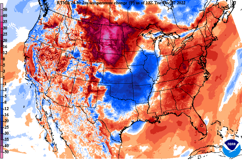
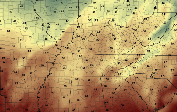
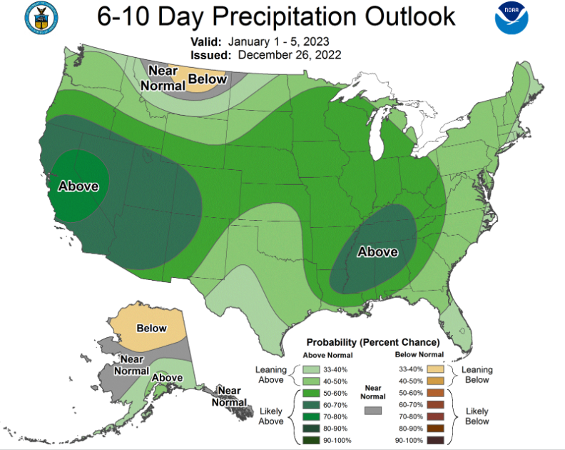
A weak upper disturbance brought some light snowfall for many yesterday, resulting in accumulations ranging from nothing up to 1.5". The Plateau and foothills took the brunt of the higher totals, but most valley locations did start the day with white on the ground. With below freezing temperatures, snow did stick to some roadways causing issues last night and again this morning. For those heading out or planning to, take your time and account for delayed travel times. After a 4-day sub-freezing streak, we finally have some warmer air working in across the region today. High pressure will gradually shift east through the SE this week, allowing for warmer air to advect (move in) in from the south. Highs today will generally top out in the lower 40s, with highs tomorrow climbing into the upper 40s and low 50s. Check out Friday afternoon, as highs likely find the mid 50s or warmer. With the high to our SE by weeks end, not only will warmer temps move in but also increasing moisture. A low pressure system and associated cold front will shift east out of the lee side of the Rockies, allowing for showers to overspread the area by Friday night and into the weekend. Temperatures are expected to stay near to above average though, generally in the 50s to near 60 for some through Saturday. Post front, cooler air (40s) returns on Sunday, but only temporarily, as things warm right back up next week. Looking further out, an active stretch of weather is expected into the new year. We mentioned system number one into this weekend, but a blocking high just off the coast of Florida will favor increased activity across the Tennessee Valley. Several waves of low pressure and associated boundaries could bring heavy rainfall and the chance for flooding. Things are far out and there are many details that need to come together, but this is an early announcement of the potential. Nonetheless, showers and above average rainfall looks likely heading into the first week of the near year. That will do it for today. With temperatures climbing to the low 40s this afternoon, snow and ice should melt off and evaporate, limiting some of the reported messy conditions from this morning. Slick spots still remain possible into Wednesday morning as temperatures fall back below freezing overnight, but they will be very isolated in nature. Have a good one, enjoy the sunshine this afternoon, and look forward to much needed warmth through the week. Pre-recorded for 5pm weather broadcast
0 Comments
Leave a Reply. |
Your trusted source for everything weather in East Tennessee.
Social Media
|


