|
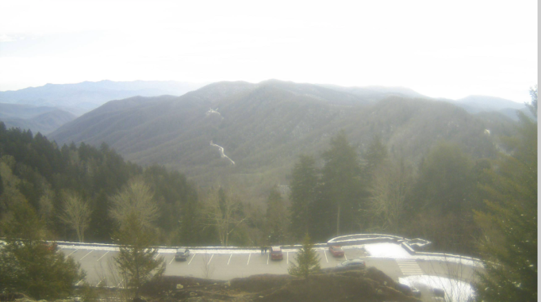
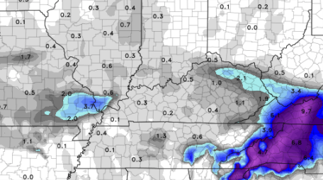
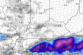
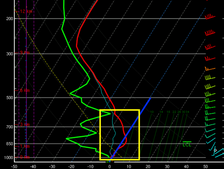
Good afternoon, I hope you're enjoying your Thursday so far. Things have been cloudy for much of the day as our next weather maker is quickly on the way. Looking over Newfound Gap, we see a few patches of sunshine, otherwise dry and cloudy conditions. High's today will top out around average in the mid 40's. Diving into model guidance, data is still very uncertain with this next system. Looking at the Euro below, we will start as rain (confident in this). As we work overnight and cooler air works in, a transition is likely. Depending on how cool things get, and where, will dictate snow potential. As of now, my confidence sits on a rain/wintry mix for the valley with snow likely for the Plateau and foothills. A winter storm warning will likely go into effect later this afternoon for the Smokies. There is discussion of a winter weather advisory for parts of the valley but we will stay tuned for more from the NWS. It is impressive to see so much uncertainty in data this close to an event, but this show's how unreliable trusting models can be. An example of this can be found below with nearly 10 inches suggested for one model and a few tenths possible in another. Because of the large uncertainty it makes it quite challenging to pinpoint exact details. Breaking this down more meteorologically, this sounding profile is from the central valley during the time of snowfall (right image above). The blue line signifies temperatures at freezing. Everything to the left of the line is below freezing (AKA snow), while everything to the right is above freezing. If we look at this profile, temperatures do swing above freezing as we get toward the surface (though not long). Something also to note is the lack of much moisture throughout the profile. This gives me reason to believe that the warm air nosing and lack of tremendous moisture will provide more of a bust (left image above) than anything else. With that said, here is what I am anticipating overnight and into Friday as of early this afternoon: Central Valley: rain to eventual mix with snow possible on grassy and elevated objects - few tenths of an inch & messy (winter weather advisory possible for some counties) East Knoxville to the foothills: Better snow chances with totals up to 2" (winter weather advisory possible) Smokies: Significant snow totals with a winter storm warning likely Plateau: Higher peaks likely to see 1-3"+ with lower areas up to 2" (mainly the southern half of the Cumberland Plateau) With this very dynamic and challenging system working in tonight, be sure to check in overnight for details on what to expect. I am going for a more conservative forecast given the uncertainty within data (especially this close in time). Also, have a way to receive alerts from the NWS for advisories, watches and warnings. Pre-recorded for 5pm show
0 Comments
Leave a Reply. |
Your trusted source for everything weather in East Tennessee.
Social Media
|


