|
Pre-recorded for 5pm weather broadcast
0 Comments
Good morning! Hit and miss cloud cover and sunshine this morning, followed by cloudy skies into this evening. Our next disturbance is en route, bringing showers by tonight. This will be quick hitting, fortunately, with the rain or wintry mix out by mid morning tomorrow. Dry weather and warm temperatures then follow Thursday through the weekend. View your full weather forecast below: Video forecast created as of 9:30 am 1/30/24
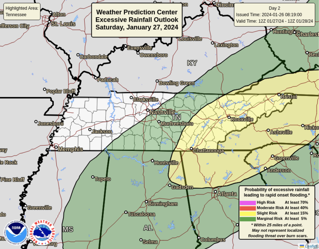
Quick Moving Disturbance Brings Shower Chances Tuesday Night; Drier Overall Today Thru The Weekend1/29/2024 Another round of moderate to heavy rainfall is expected late tonight through Saturday night, before tapering off into Sunday. Cooler temperatures will trail this system, returning to the 40s for afternoon highs by early next week. With snow melt, followed by our most recent moderate to heavy rainfall, flooding is a concern this weekend- particularly within river basins. We'll keep you posted, but I would not be surprised to see a flood watch go into effect to account for the flooding concerns. The worry comes within any thunderstorms we see, as heavier rainfall rates and more persistent activity can quickly cause issues. This stronger activity could result in flooding or flash flooding. Prepare now for the possibility of flooding, especially for those in low-lying or flood prone locations. Cooler temperatures return late weekend into early next week, with generally a drier pattern the next 5 to 7 days. The one exception is for a low end chance of showers Tuesday into Wednesday. Pre-recorded for 5pm weather broadcast
Video created the morning of 1/25/24
Pre-recorded for 5pm weather broadcast
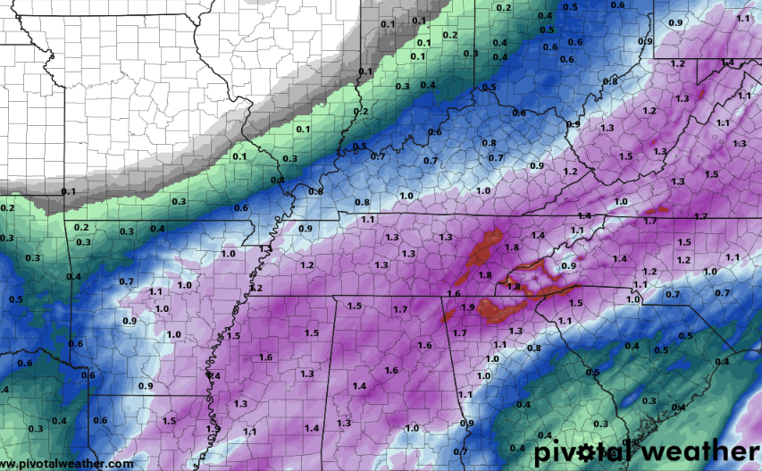
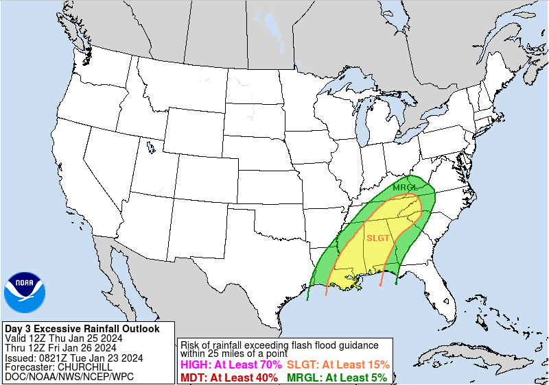
We are eyeing the threat of flooding the later half of the week, as a series of disturbances pass through the area. As of right now, the heaviest rainfall will push through Wednesday night through Thursday night, with another round of heavy rainfall possible Saturday. Not surprisingly, the Weather Prediction Center has thrown us under a slight risk of flash flooding for this activity. The 7-day rainfall outlook ballparks potential totals in the 2.5-4" range. With recent frozen grounds and snowpack still melting, this could pose problems for flooding. If you are in flood prone locations, start planning now for potential problems. Where thunderstorms set up (if they do), will be the biggest area of concern. Within these storms, much heavier rainfall rates and persistent activity should be expected. Check out our video forecast below for more details. Pre-recorded for 5pm weather broadcast
After a very cold bout the past 7 days, a big change up is in store. Not only is a big warm up expected, but a soggy one as well. A series of disturbances will look to pass through the area this week, dumbing the potential for inches of rainfall, possibly a few thunderstorms, and leading to the chance for flooding/flash flooding. The heaviest period of precipitation will come Wednesday night through Thursday night. Showers will taper off a bit Friday, but more rainfall is planned by the weekend. Keep the umbrellas and rain jackets handy starting tomorrow and over the next 7 days! Pre-recorded for 5pm weather broadcast
Lingering flurries today, otherwise gradually clearing out tonight into Saturday. Very cold air will once again fills in, leaving single to sub-zero lows tonight and Saturday night, along with well below zero feel-like temperatures. A wind chill advisory is in effect tonight into Saturday morning. Changes are coming for those who are patient, with well above average temperatures and well above average precipitation forecast to close out the month. View your full forecast below: Video Forecast Created at 11:15 am 1/19/24
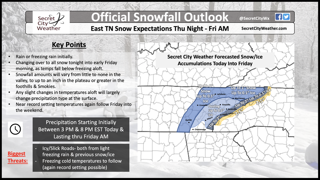
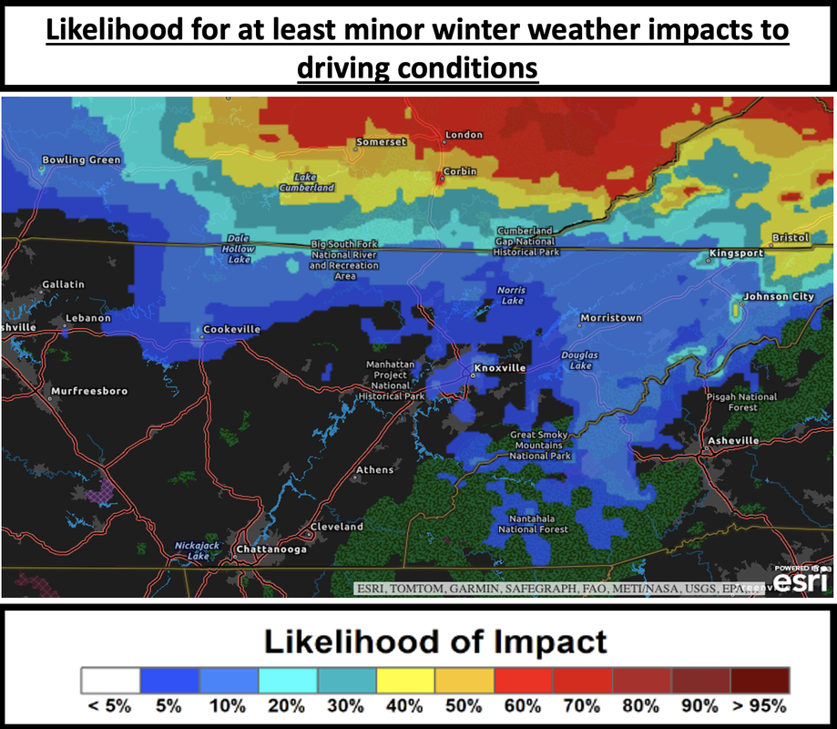
Plenty to go over, from icy, snow, frigid temperatures, and then a warming trend, so take a full listen below! We also provided some helpful graphics with our current thinking tonight into Friday, along with some driving impacts that are expected. Forecast Video Created @ 11:30 AM 1/18/24
|
Your trusted source for everything weather in East Tennessee.
Social Media
|

