|
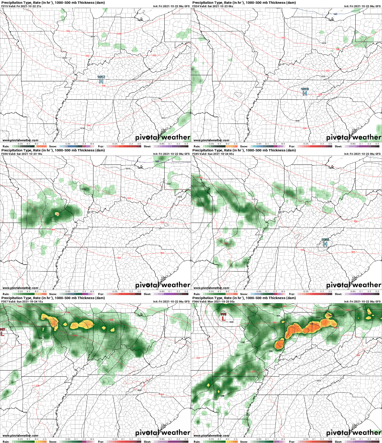
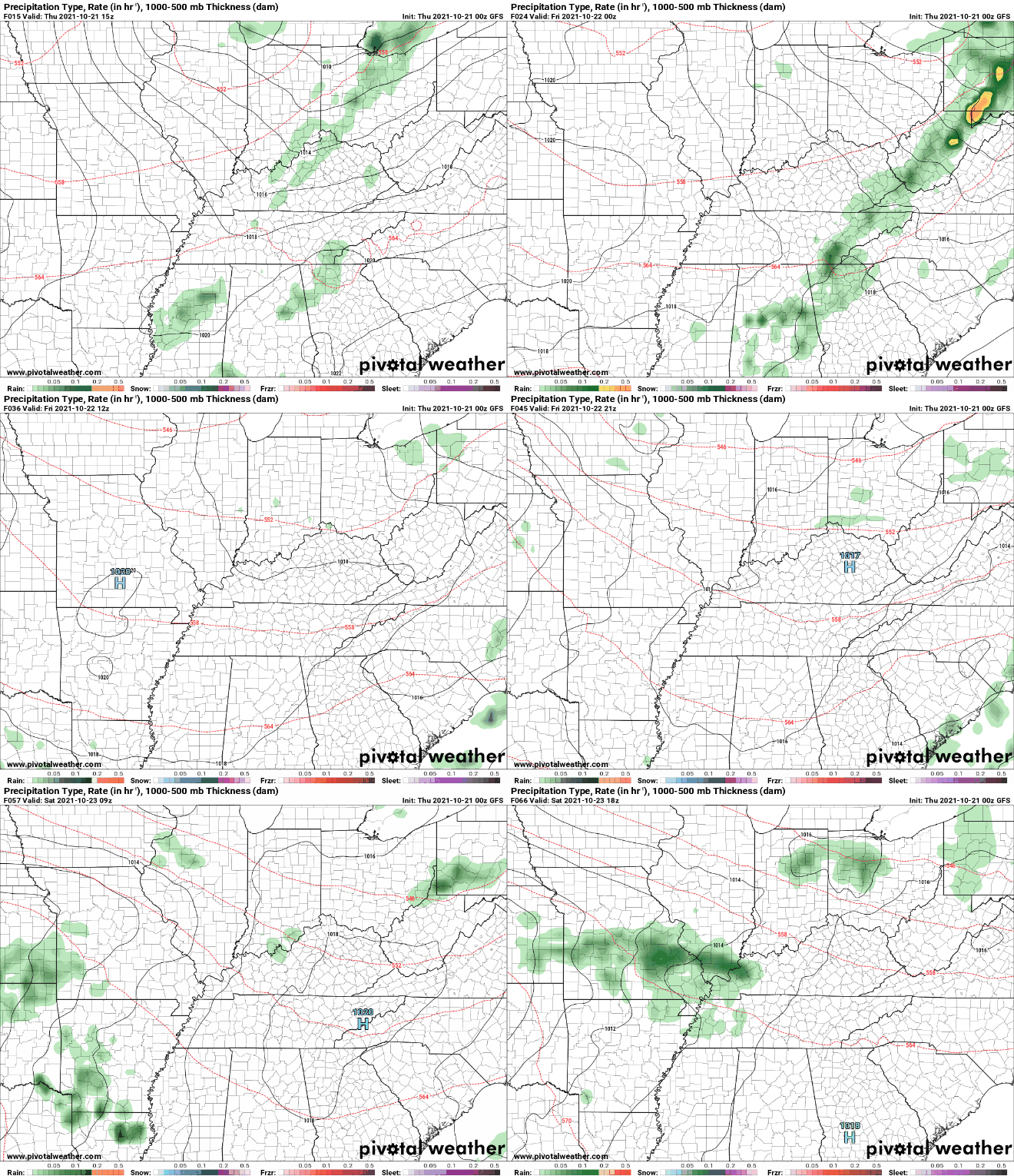
We will end the work week on a chilly note with highs today only topping out in the mid 50s. Shower activity will continue on and off as well, with a low working northeast today. With the added/continued rainfall, I expect the drought map (below) to stay, if not even, improve by this time next week. Showers will continue on and off today as the low pushes northeast. As we get into Saturday, a few lingering light showers could be present across East Tennessee, but will mainly stay contained to the Smokies through the afternoon/evening. Sunday will bring a better opportunity at sunshine with temperatures rebounding into the low/mid 60s as well. Things will stay seasonable & pleasant into Monday but some changes arrive Tuesday and midweek. A cold front looks to bring well below average temperatures towards the midweek. A cold front will blast through Wednesday, bringing not only some rainfall, but much cooler air as well. This could even be the first shot at some frozen precipitation for the high elevations of the Smokies. Early indications suggest highs could be as cold as the 40s to low 50s, but time will tell as better details come together. For now, anticipate a shot at cooler air next week, along with another chance for showers. That will wrap it up for today, if you don't follow us on Twitter/Facebook you can do so @SecretCityWx....We will begin drying out the latter half of Saturday with sunshine arriving Sunday. Have a great weekend! Pre-recorded for 5pm show
0 Comments
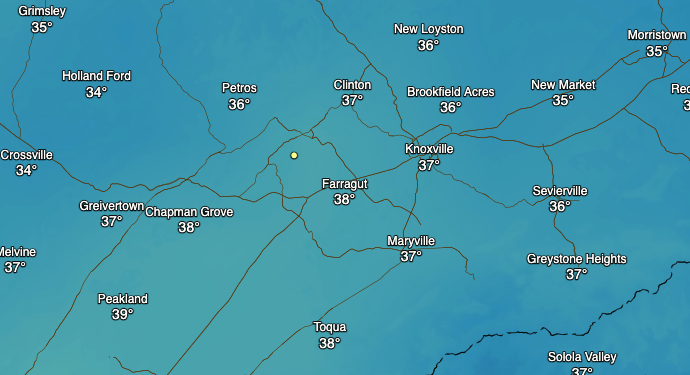
It is pretty chilly across parts of the Volunteer State this morning. Temperatures around 7am were in the mid to upper 30s. There have been some reports, particularly near KY and in the higher elevations of patchy frost, but most are seeing fog this morning. This will continue to lift out, leaving behind sunshine and temps in the low to mid 60s. A soggy pattern arrives tomorrow, with showers expected Thursday, Friday, and parts of Saturday. A slow moving system will cross above us, bringing upwards of an inch of rain through the first half of the weekend. This will work out Saturday night, with partly cloudy skies returning Sunday. Another front looks to arrive towards early/mid week, bringing limited rain chances and also cooler temperatures. The main thing the next few days will be the rain. We aren't expecting flash flooding/flooding, but locally, a few could see ponding and rising waters. Overall, keep the umbrellas handy as we will see hit and miss showers tomorrow and through the early weekend. Temperatures will also be a bit cooler, in the mid and upper 50s Friday and Saturday. Pre-recorded for 5pm show
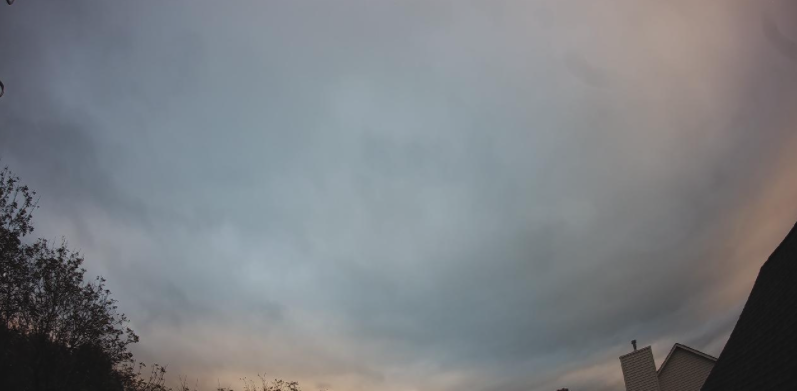
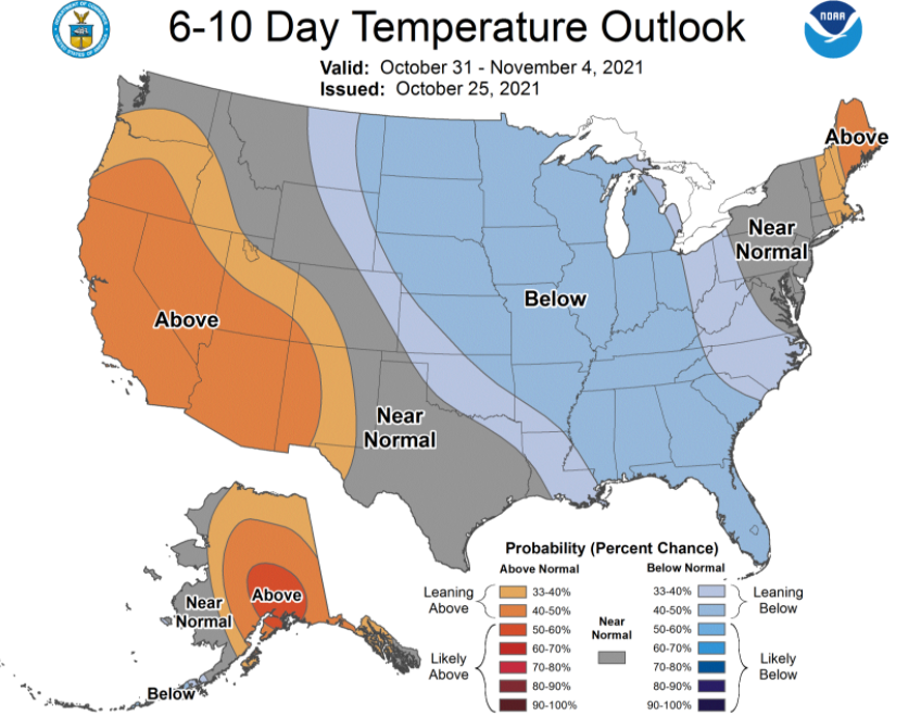
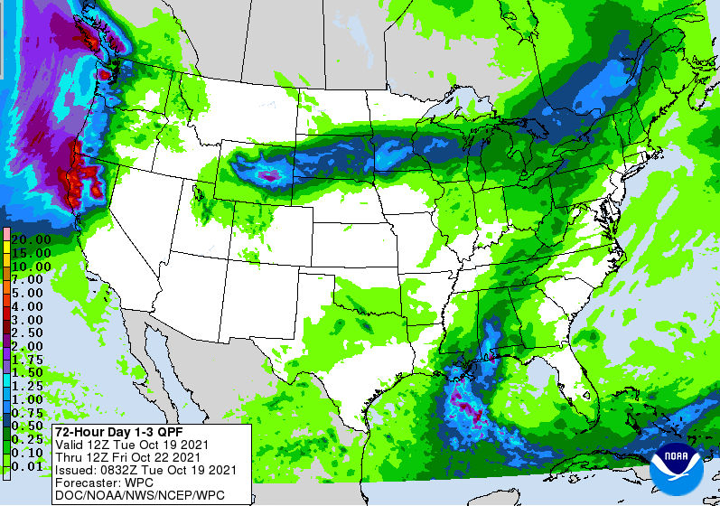
Though cloudy, the views aren't too bad given the rising sun. Some areas are reporting some light sprinkles/showers, but this will gradually die out through today as cloud cover decreases this afternoon. Temperatures will be a bit cooler as well, topping out in the mid 50s to near 60 degrees. We will briefly dry out before a soaker arrives Thursday. This system will be slow moving, dumping on and off rain Thursday, Friday, and parts of Saturday. General rainfall amounts will range between 1 and 2 inches. This will begin working out Saturday, with sunshine and cooler temps expected Sunday. Once we push past the weekend, another cold front will arrive for the region. This will make temperatures take a nose-dive with well below average temperatures expected to begin November. Highs next week could be as cool as the low 50s with overnight lows in the 30s. We will see how well this pans out as we get closer to time, but brace for some even cooler air to close out the month. Overall, the first half of the day today will be gloomy. As we get into the afternoon, high pressure will build in helping clear things out. Temperatures will warm as a result, topping out in the mid to upper 60s for Wednesday. Pre-recorded for 5pm show
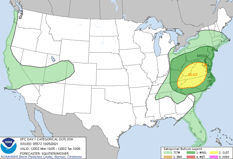
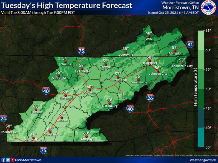
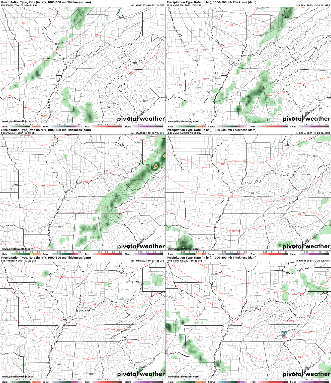
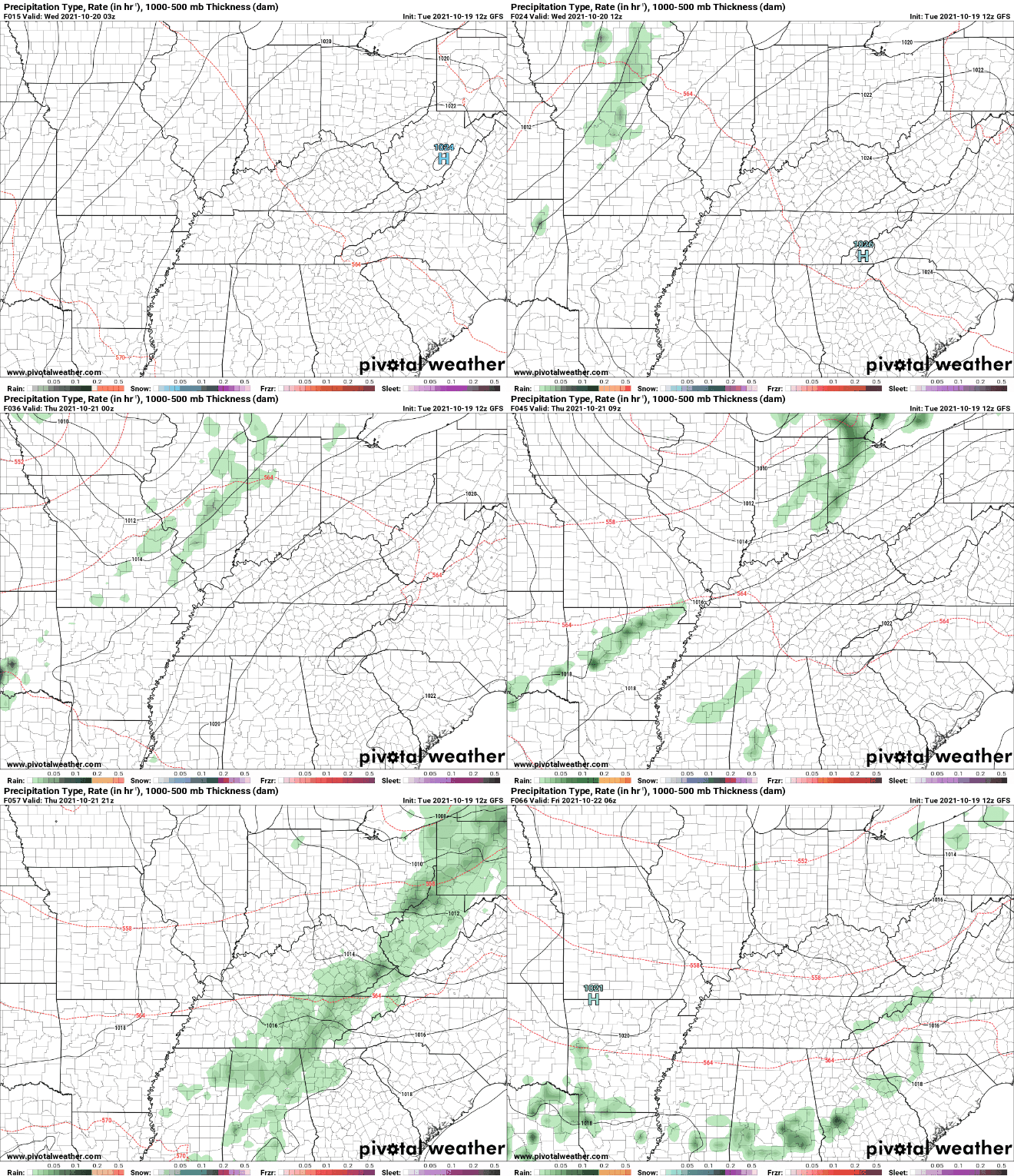
Good morning! I hope you have your umbrellas handy...a line of showers is currently working across Middle Tennessee and will arrive over the next hour or so. With it will be moderate showers along with a few embedded thunderstorms. Severe potential is low today, but strong to damaging wind gusts aren't to be ruled out. The SPC has issued a slight chance for far northeast Tennessee to include the opportunity for brief spin-ups as well (this afternoon/evening). Breaking it down, a line of showers/storms will work through this morning, with gradually clearing skies tonight and into Tuesday. Temperatures will fall tomorrow, before rebounding Wednesday to near average. Another system will then arrive, as a low makes its way out of the southwest and crosses just to our north. This will bring consistent rainfall Thursday, parts of Friday, and eventually moving out on Saturday. Rainfall totals look to be anywhere between 1 and 1.5 inches from now until Sunday. With cooler air working in this evening and Tuesday, highs will take a dip. Highs according to the NWS will range from the mid 50s (higher elevations) to near 60 for valley locations. These will continue to increase for Wednesday, with highs in the mid and upper 60s area-wide. Have a way to receive alerts if any warnings are to be issued. The severe threat appears to be very low and limited to the far northeast and into the Virginias. This will be best this afternoon as a second round of showers/storms develops across Middle KY and could catch the far NE. Pre-recorded for 5pm show
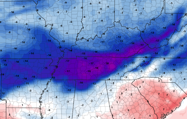
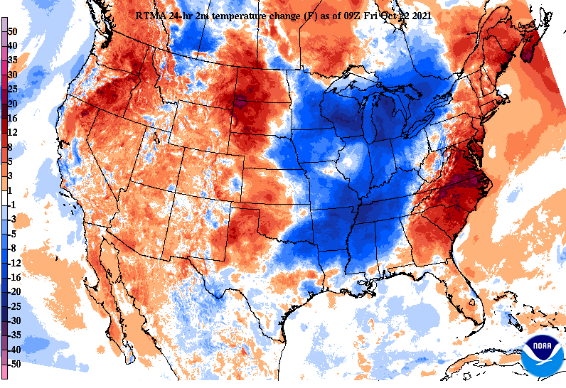
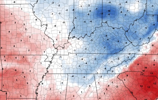
Good morning! If you haven't been out the door yet, don't forget to throw on a jacket. Temperatures are quite a bit cooler today with the passage of a cold front. Across the valley temperatures are in the low 50s with the higher elevations in the mid to upper 40s. Comparing this to temperatures this time yesterday, that is 10 to 15 degrees cooler. That will be reflected in our highs this afternoon as well, with most topping out in the low to mid 60s. This is slightly under the average for this time of the year. Working ahead, the weekend should start out pleasant. Highs will be right on par with the average with partly to mostly sunny skies. By Sunday, a lifting warm front will boost highs in the mid (and even some locations upper) 70s. An isolated stray shower may even be possible for those in the Plateau and areas bordering KY. As this works through, an area of low pressure and cold front will follow, bringing showers and a few storms on Monday. This will be followed by our next wave into parts of Wednesday and Thursday. Temperatures will dip a couple of degrees, but our second system will be much more pronounced, with highs returning to the low 60s and evening 50s. That will do it for today...it should turn out to be a beautiful Fall day with temps warming a touch into Saturday. Sunday will be pretty warm, with temps in the mid 70s for most. For reference, the record for Sunday is 84 degrees. Have a great weekend! Pre-recorded for 5pm show
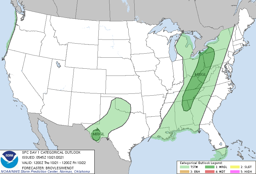
Showers have been minimal so far this morning, with nothing more than isolated activity thus far. As we work further into the morning and into the afternoon, a cold front will bring a line of showers and embedded storms. The threat remains low for any severe weather, but not out of the question. The SPC has placed the area under a Marginal risk of severe winds (60 mph+) as the line works through this afternoon/evening. Breaking it down further with model guidance, the line will work through after 5pm, bringing moderate to heavy (within thunderstorms) rainfall. Fortunately, this should be out by the overnight, allowing for clearing as we work into Friday. This means plenty of sunshine to end the work week as well as the start of the weekend. Upper level waves will then bring additional chances (isolated to scattered) for Monday and the new work week. With the front working through, colder temperatures will follow. This will be brief, as temperatures climb back to around 70 on Saturday and into the mid 70s Sunday and again Monday. Highs tomorrow will generally run in the mid and upper 60s with overnight lows into Saturday morning in the mid and upper 40s. Be sure to keep your phone/tv/radio nearby if any alerts/warnings are issued this afternoon/evening. The biggest threat will be wind damage, but the odds remain low. Nonetheless, use caution and remain alert. Pre-recorded for 5pm show
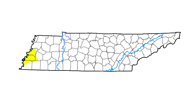
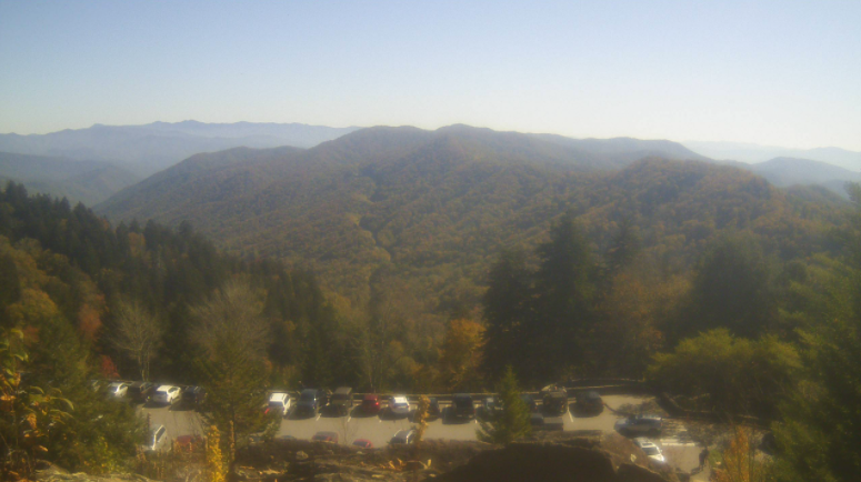
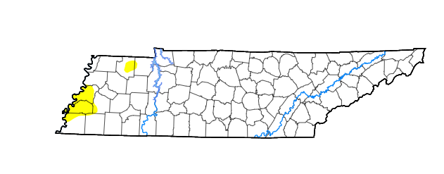
Overlooking Newfound Gap, another beautiful day is upon us. Those Fall colors are really starting to show as well, which are more apparent in the Smokies than in the valley locations. Highs today should top out on the warmer side, in the mid 70s. With all the recent rainfall we picked up, we have not highlighted the latest drought trends. Looking below is the current guidance for the state, with only a few localized abnormally dry spots across Western Tennessee. We will keep an eye on this moving forward, but expect little changes in the near future. With a cold front diving into the Mid Mississippi Valley, isolated showers will find us into Thursday morning. As the cold front works closer, moderate to heavy showers can't be ruled out in the mid to late afternoon tomorrow. A few embedded thunderstorms aren't out of the question either. The good news is this should fairly quick moving; out by the overnight hours. This will set up a cool but clearing day Friday with highs in the 60s. Guidance remains a bit fuzzy toward early next week, where additional isolated showers are possible. That will wrap it up for today...enjoy another gorgeous one with plenty of sunshine through the mid afternoon. Cloud cover will increase this evening and overnight as the front draws closer. Pre-recorded for 5pm show
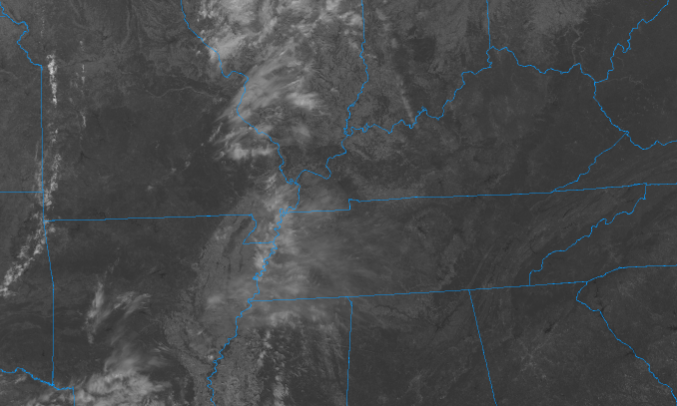
I hope you are enjoying these blue skies and seasonable temperatures! Some changes come Thursday, but until then, anticipate a few high clouds working in tonight and through Wednesday afternoon. Looking on satellite, you can see cirrus working in from the west. This will increase tonight, but shouldn't be enough cover to limit overnight lows, with temps bottoming out in the mid 40s for most. Working ahead, a low and cold front, currently in the Central Plains, will work east. As mentioned, cloud cover will increase tomorrow afternoon, with isolated showers possible Thursday morning. These will increase to be more scattered and widespread by the afternoon/early evening with thunderstorms possible (but limited) as well. Post-front, things clear back up but another round of isolated showers could find us late weekend/early next week. This system & front won't be as impressive as the previous one we had. Nonetheless, upwards of a quarter of an inch of rain will be possible for the day Thursday. A few locations could see locally higher amounts within thunderstorms. We will continue to warm up Wednesday, with highs in the mid 70s. A cold front and associated shower activity will arrive Thursday, followed by cooler temperatures Friday (mid and upper 60s). Pre-recorded for 5pm show
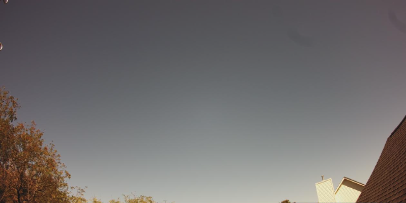
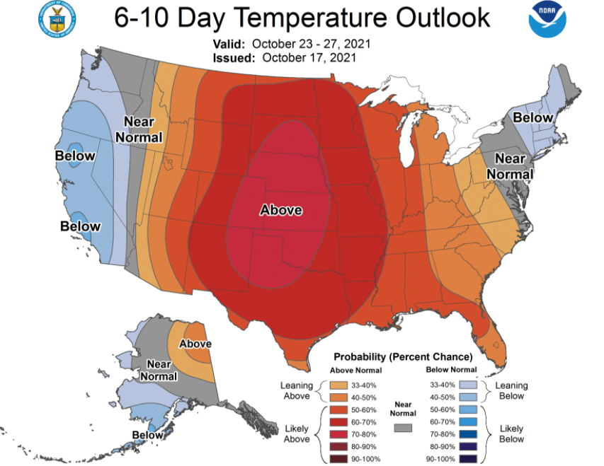
Good afternoon! Are you enjoying the change in air mass? Not only does it truly feel like Fall, but we also have sunny skies (not even a cloud in the sky). Highs will generally stay near average today with temps topping out around 70. Moving forward, serene conditions continue with high pressure dominating much of the eastern half of the US. Towards the end of the work week, Thursday to be exact, another cold front will slide across the area. With it brings another round of showers as well as cooler temperatures back side. This should be relatively quick moving, with sunny skies returning by Friday afternoon. Looking at the extended forecast, temperatures will warm up into early next week, with above average temperatures expected late October. As suggested by the CPC, most of the country will be dealing with the same conditions. Our average for this time of the year is the low 70s (for highs). That will wrap it up for today....other than the "perfect" Fall feel, there is little going on until Thursday. Showers again look minimal with totals up to 0.25". Have a good one and enjoy these conditions! Pre-recorded for 5pm show
|
Your trusted source for everything weather in East Tennessee.
Social Media
|

