|
For those heading out tonight to trick or treat, you should be in good shape. Cloud cover will hang around but any lingering drizzle/isolated showers should be out of the area. Drier and warmer conditions then find us ahead. Check out your full forecast below:
0 Comments
Good afternoon! Temperatures started off cool, but we have since warmed to the mid 50s (noon). We will continue warming into this afternoon, finding highs in the mid and upper 60s (on par with seasonal averages). As promised, here is the latest release of the drought across the state. As expected, no improvement seen, with in fact a decline across the southern valley. Given the rainfall we had two days ago and another round this weekend/early next week, we should see some much needed improvement late next week. 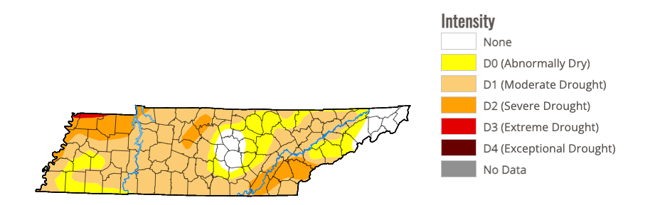 In terms of our next system, it's pretty straight forward. The low will track just to our west, allowing for increased cloud cover Saturday, showers into Saturday night and through Sunday, and then gradually clearing skies Monday. Rainfall amounts will vary, with the highest amounts across the Plateau and west. With that said, anywhere between 0.25 and 0.75" is expected. A helpful amount, but not nearly enough!  Overall, temperatures will be seasonable through Saturday, before showers arrive late weekend and early Monday. Have a good one and don't forget to follow us on social media @SecretCityWx If you haven't been outside yet, don't forget that coat! It's much cooler since the passage of the cold front, and the cloudy skies aren't helping. Comparing things to this time yesterday, we are anywhere from 10-20 degrees cooler. Fortunately, a warming trend will find us the next couple of days, before another system arrives late weekend.  Breaking down through early next week, high pressure remains in place through Saturday. This will lead to lots of sunshine Thursday through Saturday morning, with temperatures increasing into the low 70s during this time. As the system approaches, cloud cover will increase, leading to showers overnight Saturday and throughout Sunday. This is a welcomed sight, as we remain drier than normal in the most recent few weeks.  The system Sunday alone looks to dump between 0.5-1", adding to the 0.25-0.75" we picked up yesterday. This will aid in the aforementioned dry conditions, where moderate and severe drought has begun popping up across the state. Additionally, this will moisten soils, which reduces the risk of wildfires that we are seeing developing across East Tennessee as well. 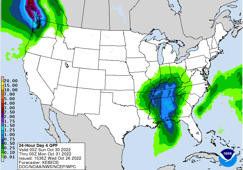 In total, temperatures stay cool today as cloud cover lingers. Satellite does show some breaking up starting to happen, but it will be a slow process through the remainder of the day. As such, anticipate cloudy skies through the first half of the night, ending in partly cloudy to begin Thursday. Sunshine then returns tomorrow afternoon, sticking around through the early weekend. Check out our video forecast below for more. Pre-recorded for 5pm weather broadcast
A line of showers and storms arrives tonight, as a cold front and low press in. A few storms could be marginally severe, mainly across the Plateau and western fringes of the valley. Gusty to damaging wind gusts are the main threat, but chances will be low. As this pulls further east, chances continue to fall off with the loss of energy. Most will see some rainfall, which is good news, but not enough to pull us from the drought conditions popping up. Cooler in for Wednesday, then warming Thursday and Friday. Another shot at some rainfall this weekend and early next week. Highs today in the mid to upper 70s, with cloud cover continuing to increase through the day. Pre-recorded for 5pm weather broadcast
Another nice day, and nice start, to the work week! Checking out the latest view from the Newfound Gap webcam, mostly sunny skies are present, with temperatures varying in the mid 60s to low 70s. Moving forward, cloud cover will gradually increase from the west this evening/overnight, leading to cloudy skies for most on Tuesday. 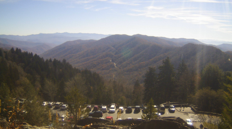 The increasing cloud cover will all be associated with a potent low pressure system and cold front, sliding eastward. There is a low end risk of severe weather with this system, but given the timing of the day, confidence is not high. With that said, SPC has a Marginal risk of damaging wind gusts in place, with the best potential for any strong storms across the Plateau Tuesday evening. Most of us stay dry through the day tomorrow, with showers and a few storms arrive through the evening (from west to east) and through the overnight hours. 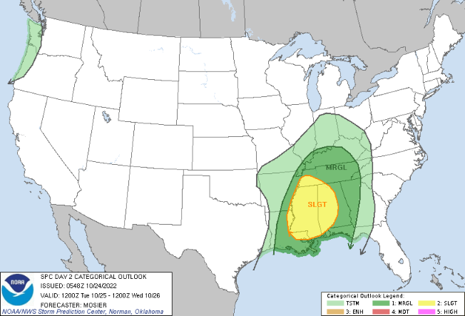 Most showers should be out by Wednesday morning, though a few lingering light showers are possible in the far east. As you can see below, the system really weakens as it moves eastward late Tuesday. This is because of many factors, but the loss of instability (or usable energy) can be most contributed. Cloud cover will decrease through Wednesday, setting up more sunny days Thursday and Friday. 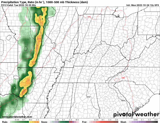 The main story has been the dry conditions in the recent weeks, but things look to take a turn. Much needed rainfall looks more common, with system number one late tomorrow, and additional rain potential later this weekend and into early next week. Pre-recorded for 5pm weather broadcast
Hope you are enjoying lots of sunshine this afternoon! It remains chilly with 1 pm temperatures in the upper 40s and low 50s. Most will edge out a few more degrees (mid 50s) before days end. The past several nights have been chilly, with another night of freezing temperatures expected. Looking at the nation-wide hazards map, most of the eastern half of the USA is under either a freeze watch, freeze warning, or frost advisory tonight. That gap across Tennessee is due to unknowns with the agriculture program. If you didn't know, the NWS puts these freeze warnings and frost advisories out as a tell to ag folks "temperatures could be cold enough to damage or kill your plants." Once a hard freeze occurs, plants are likely killed and coordination is conducted with officials of the state and local offices to judge weather to end the frost/freeze program for the season. It appears that most of Tennessee has agreed to end the program, but this may go one more night (tonight). Nonetheless the growing season has come to a close and lots of states across the USA will come to that decision by tomorrow.  As far as what can be expected moving forward: the answer is not much. High pressure will settle just to our south, working northeast with time. As it does so, temperatures will steadily warm, where we see highs returning to the 70s to near 80 through the weekend. Our next shot of rain arrives early to mid next week, where another cold front takes aim at the region. 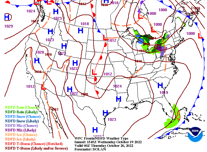 Other than the chilly starts each morning and the cooler than average highs in the afternoon, things should be pleasant with lots of sunshine. More comfortable temperatures will return towards Friday, with near average through the weekend. Pre-recorded for 5pm weather broadcast
Our coolest night of the period falls tonight, where lows dip into the mid and upper 20s. Elevated locations cold even find a few teen readings. As a result, a Freeze Warning is again in place through Wednesday morning, more than likely killing the last of the agriculture growing season/program for this year. Highs today will top out in the upper 40s for most, though a few low 50s are also possible. Moving forward, a warming trend finds us, where the 70s return this weekend. Check out more below: |