|
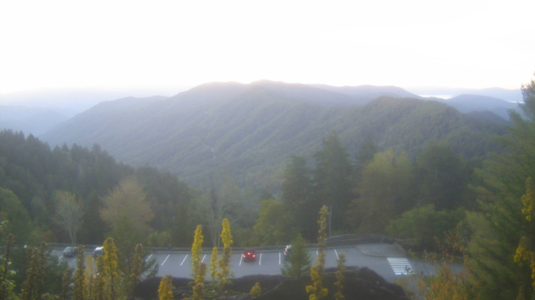
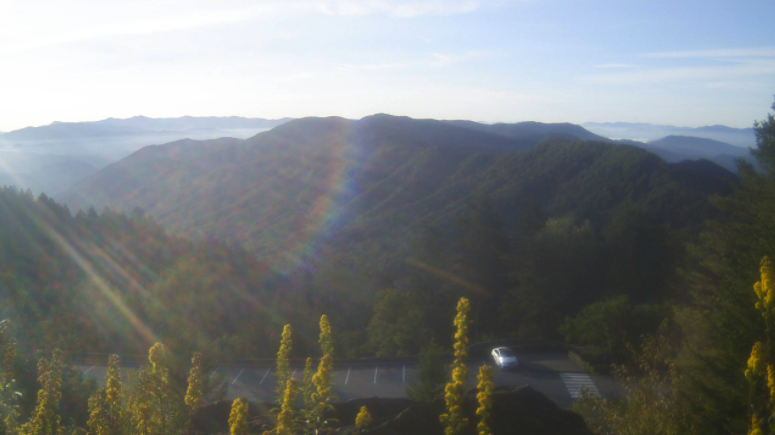
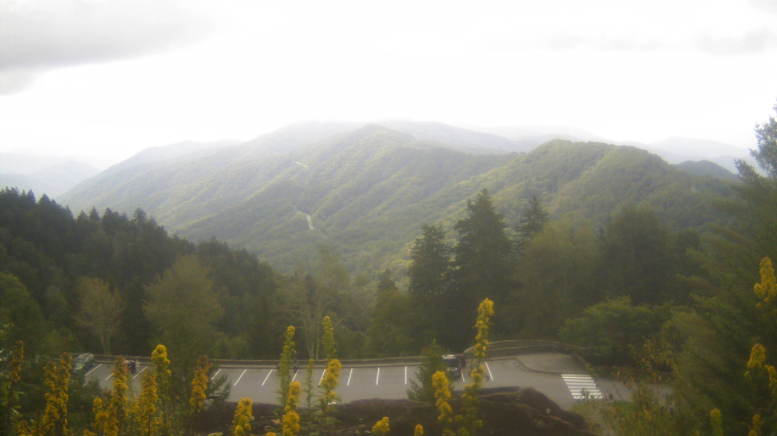
Good morning everyone! This view of the New found Gap area comes courtesy of the Great Smoky Mountains National Park. Another beautiful day is planned ahead with high's in the low to mid 70's and sunshine overhead. A cold front will work through this afternoon providing an additional drop in temperatures for Friday and the weekend. Fortunately for us, this one will be dry. We'll see it arrive sometime in the early to mid afternoon hours today. Following the passage of the front, anticipate much cooler and drier air. Low's tonight will fall to the mid 40's with the coolest temps of the new season likely Friday night into Saturday morning. As for rainfall chances in the next several days, things look pretty calm. With additional dry air arriving this afternoon, things will remain seasonable tomorrow and Saturday. A round of showers is possible for Sunday afternoon and overnight, but things dry back out for Monday and early next week. Overall, things should be beautiful for much of the weekend, so enjoy the sunshine and comfortable to cool temperatures. A look at dew points and more can be found in our daily video below. If you are in the agriculture sector looking for late season production, see how we can help! We can provide you with a better understanding in the weather patterns and when frost could impact crop production. Simply email us at [email protected] or visit the "Services" tab above and we will get back to you as soon as possible.
0 Comments
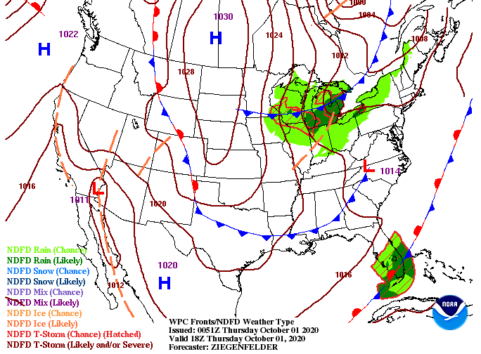
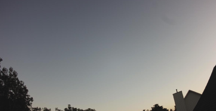
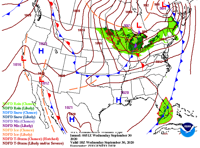
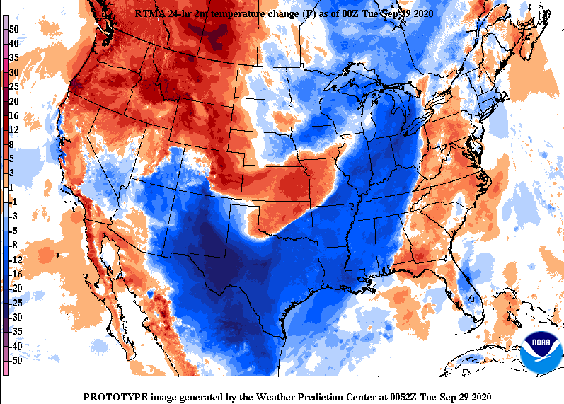
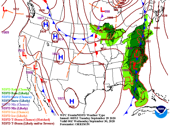
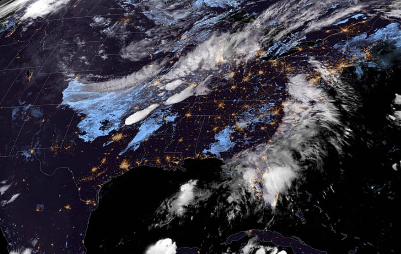
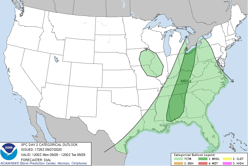
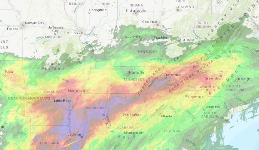
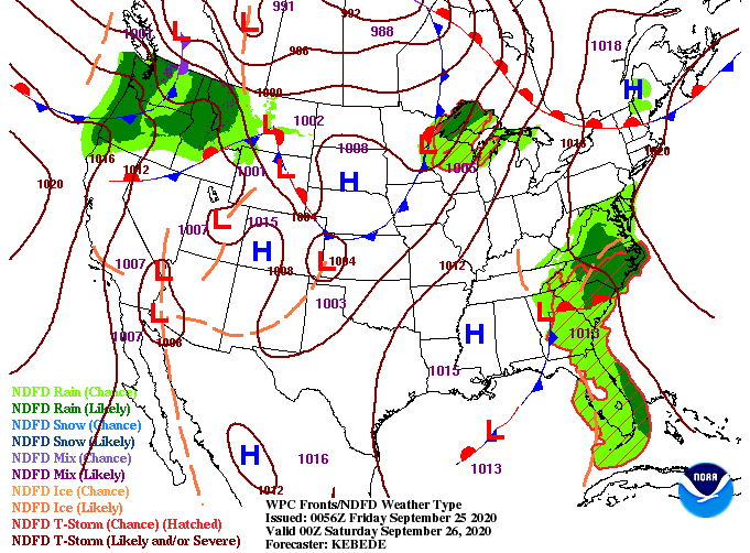
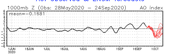
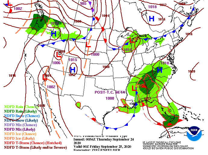
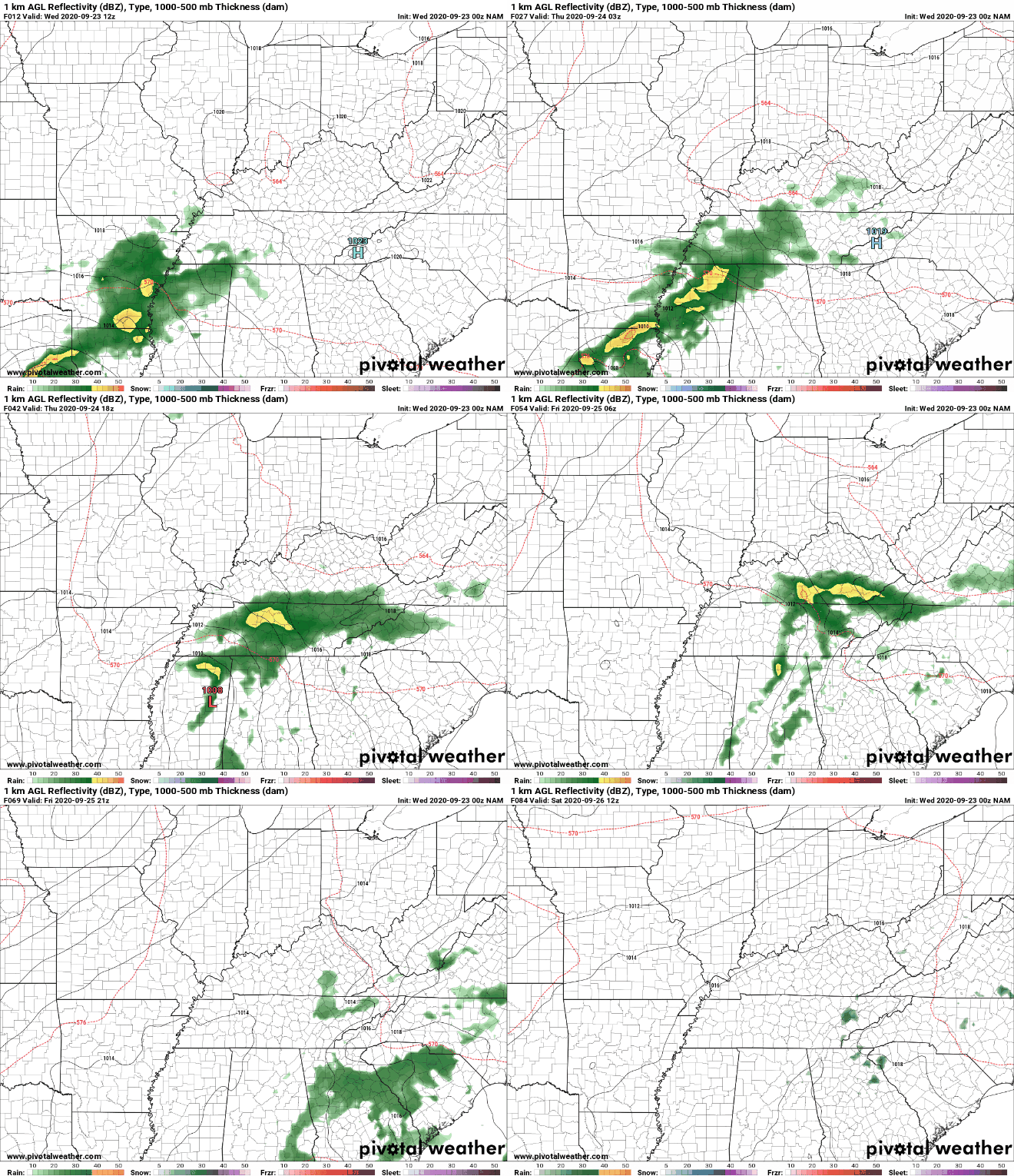
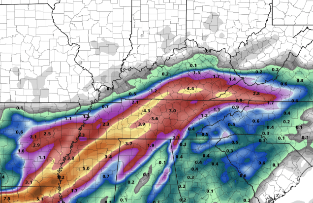
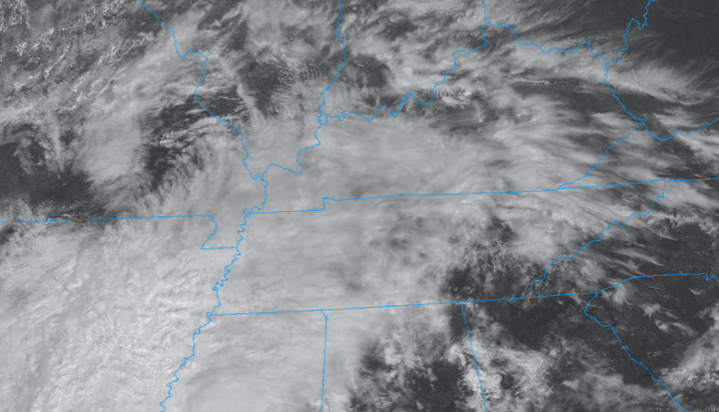
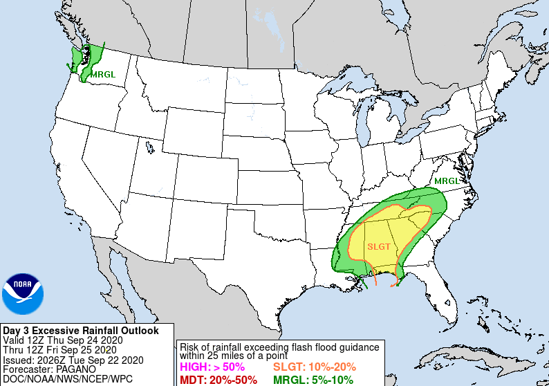
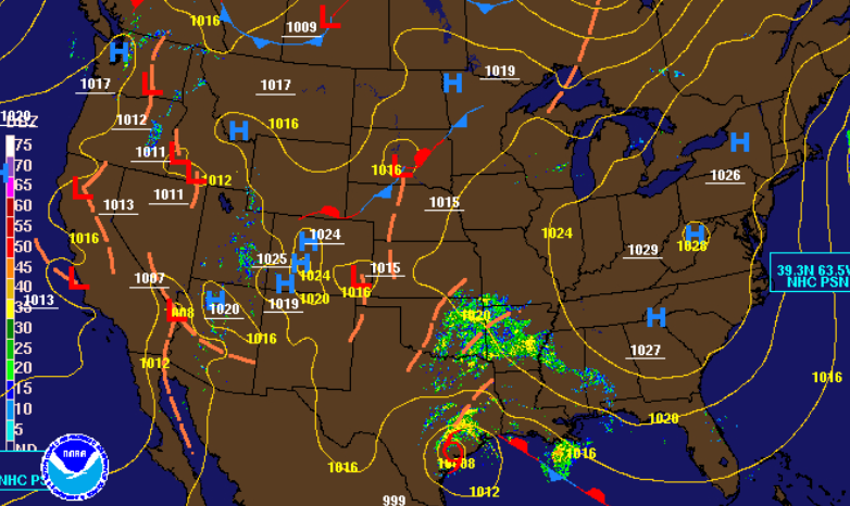
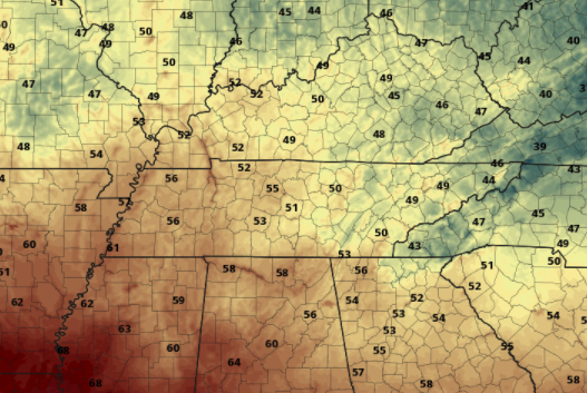
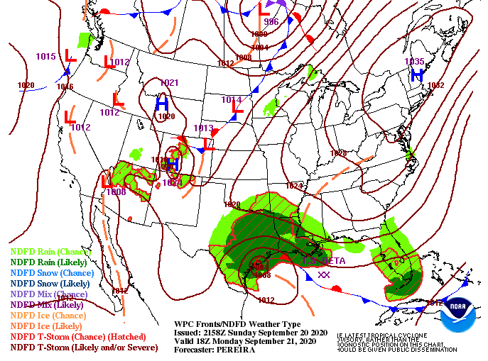
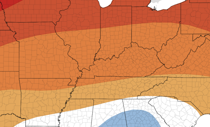
We are on tap for a cooler and drier period in the days ahead. As you can see from the Stansfield's webcam below, lots of clearing took place overnight. Temperatures right now in the valley are near 47 and will warm to high's in the low to mid 70's. Overall, there is not a ton to discuss. Things will stay dry for the next several days as another blast of cold air shoots in from the north and west. As you can see in the graphic below, a cold front extending from the Great Lakes will push through late Thursday. Through today and tomorrow we'll see high's in the 70's. With this secondary shot of reinforcing air, high's will be knocked back down to the 60's on Friday. We do have an opportunity the second half of Sunday for isolated shower chances, but data is hinting this will stay mainly to the north. Updates will be provided in the days ahead, but for now, enjoy the drier, calmer, and cooler streak. Things should be rather comfortable today and tomorrow with high's in the mid 70's. Then Friday, we'll cool back down to the 60's and ride that through much of the weekend. Do remember the jackets ahead though, as morning temperatures will vary from the the low to upper 40's (depending on the day and where you are located). A look into our coldest expected morning ahead as well as a full look into the forecast (Below) Good morning! For those who are leaving the house, you may want to throw on a light jacket. Temperatures right now are in the 50's and won't be warming up too much through the day. As you can see below, we are nearly 20 degrees cooler than we were this time yesterday. Cloud cover will stick around for the majority of the day making things feel on the cooler side (in addition to the obvious post-cold front air). Looking longer term, things will begin to quiet down. A few isolated showers will pop up through the first half of the day before drier air fills in tonight. If you look into the Dakotas area, a cold front out of Canada is diving southward. This will be our second blast of cool air by late work week and into the weekend. The good news is this second front looks dry, leaving sunny skies and cool to comfortable temps Friday and this weekend. For the time being, expect cloud cover to linger today with a few showers late morning to early afternoon. By tonight, things will begin clearing, allowing for sunshine back into Wednesday. Overall, things look gorgeous for Friday and the weekend. If you haven't made some outdoors plans yet, you should! Temperatures will slowly increase back into the 70's for Wednesday and Thursday before the 60's return late work week and the weekend. A strong cold front is on its way today with heavy showers and a few storms possible this evening & overnight. A secondary front will arrive late work week providing another cool down Friday and the weekend. High's will be nearly 20 degrees cooler tomorrow when compared to today's expected high's. The SPC has placed a majority of east Tennessee under a Marginal risk for severe weather. The brunt of heavy showers and storms will stay contained to the Plateau, but some could roll through the valley this evening & early overnight. In addition to the Marginal severe risk, a Marginal risk for flash flooding (5-10%) is also in place (more details in the forecast video below). The main threat will be localized heavy winds and downpours. We will see gusty winds throughout the day (up to 20 mph) as southern flow dominates ahead of the front. Most rainfall will take place between 8 pm and midnight with a few lingering showers into Tuesday morning. By Tuesday afternoon, dry air from the north and west will funnel in providing overnight low's into the 40's. Temperatures will begin increasing back mid-week to the lower 70's before another cold air mass knocks temps back down to the lower 60's for Friday. With an active start to the work week, tune in for updates. Localized heavy showers and storms will be followed by cool temperatures into Tuesday. Be sure to break out those jackets if you haven't already because temperatures will be trending below average all week long. Rainfall is beginning to peter out this morning as remnants of Beta continue to work eastward. The latest 24-hour precipitation accumulation map shows totals near the 4 inch mark for parts of McMinn to the south of Knoxville. The remainder of the area is lying in the 2 to 2.5 inch mark from Chattanooga to Jefferson City. All in all, movement of the system did work a bit further east with the later models we saw yesterday. Flooding conditions stayed limited as of this morning but if you have a report, you may send it to [email protected] or by tagging us on social media. Looking at the latest surface map, the low associated with Beta is working east, leaving a bit of drier air in behind. Unfortunately, this won't stick around too long as another system to the north and west will swoop through. This will allow for scattered showers the second half of the weekend and into early next week. Following the system, a steep cold front will leave high's Wednesday and onward in the lower 70's to mid/upper 60's. Doing a little teleconnection analysis, the Arctic Oscillation is phasing towards a negative signature....so what does that mean? As a brief background, teleconnections are large scale "signals" based on pressure and circulation differences. In this case, a -AO indicates the likelihood for cooler air across the southeast and and weaker trade winds off the coast of Africa. This relationship can be seen as we work into the next 3-8 days. Activity in the Tropics (as of this morning) have all but ceased and cooler temperatures are expected to migrate in the second half of next week. As shown from the graph below, AO will shift back positive, but it will be nice to feel a Fall front and have little activity in the Atlantic. I would also like to mention teleconnections are not see all be all, they are only guidance to help in a longer term forecast. As showers work out this morning, drier air will move in tonight. For the most part, expect showers to be out of the Valley by 2pm this afternoon. Most of us will stay dry tonight and through Saturday before scattered showers return Sunday and Monday with the next system. Once the cold front moves through, Wednesday, sunny skies will remain as cool dry air dominates behind the front. With lots on the plate today, check out all the details through the video forecast below. If Secret City Weather can help you, be sure to shoot us an email or visit our "Services" tab above. Have a wonderful weekend and check in on Twitter/Facebook for updates throughout the next couple of days. Shower activity continues this morning as the low from Beta works across the region. As of 7:30am, our office has recorded 0.22" of rainfall. Guidance is suggesting totals between the 1.5 and 3 inch mark depending on your area. Flash flooding remains a major concern as a 10%-20% (Slight risk) is still in place for today. As of last night at the 0Z run, models still were a bit optimistic on the path of this system. The NAM left the bulk of moisture a bit further west, while the GFS more eastward. As of this morning things are starting to come together. The GFS is still pushing for higher totals across the area, which makes a bit more sense given the orientation, movement, and duration we are expecting. Short-term high resolution data is somewhat in agreeance as well but keeps the heavier rainfall totals limited to the southern half of Tennessee. As we have described, totals won't be uniformed across east Tennessee. In total, based on the latest data, I believe totals between the 1.5 and 3" mark are right on cue. Higher totals are likely for the southern (Chattanooga & west) and central regions of Tennessee (Plateau & middle TN). Continue to check in for updates throughout the day as flooding could likely become a concern. The general consensus remains as seen below. As this low moves through, the heaviest rainfall will be in southern and middle Tennessee. If we see a push further east (as some data is suggesting this morning) then expect totals to follow suit. A large concern we are seeing is the rainfall through the day followed by heavy showers tonight. The ground likely won't handle heavy rainfall to an already saturated surface well, leaving rising waters. Continue to check in for updates throughout the day and provide reports when you can. Flooding is a concern, especially as we work into this evening and overnight. For more information, check out the daily video forecast below. Good afternoon! Cloud cover continues to pour in from the south and west as remnants of Beta draw closer. For the most part, showers will stay contained to the west, but a few light sprinkles are possible in the Plateau this afternoon. As we work ahead, expect showers to slowly work in tonight and throughout Thursday. The Day 3 release from the WPC shows a Slight risk of flash flooding across the southern half of the viewing area. A 10% to 20% chance of flash flooding is possible. Those who are in low-lying areas and flood-prone areas, take the proper precautions now. Showers are expected to work in Thursday morning and continue on and off through Friday morning. A look at model guidance shows showers from Beta working in from the south and west. Given the orientation of the rainfall and movement, east Tennessee will likely get hit the hardest will rainfall totals as high as 3+". If you recall from Monday morning, models indicated heavier rainfall totals would stay further west but as we are getting close to time, they've worked a bit further east. Flash flooding definitely is something of a concern Thursday through Friday morning, so check in here, the NWS, and local emergency officials for updates. By Friday night we should have a brief reprieve from rain before isolated to scattered showers arrive for the weekend (associated with a second system). Better news is in the long term as another large cold front is planned for late September and early October. The latest data is suggesting high's as cool as the mid 60's by early October so stay tuned for changes/updates. For now, keep the umbrellas handy and look out for flooding across the region. We welcome your reports and they can be sent via email at [email protected] or by tagging us on social media. We will pass those along to the NWS in Morristown. Gorgeous views over Newfound Gap this morning with light fog still hanging there in the background. As we have been fortunate enough to see the past few days, sunny skies and fall-like temperatures will be around again today. Cloud cover will begin funneling in this evening and overnight as moisture pushes into the area. A look at the latest surface map shows a high pressure system that has nosed in from New England. As remnants of Beta work eastward, this high will break down and work out. Beta will keep moisture locked in the later half of the work week before a second system brings additional shower chances this weekend and early next week. Model guidance paints the story the next couple of days. As remnants of Beta work in, shower chances increase from south west to northeast. Thursday and part of Friday will be our wettest days will rain totals in Middle TN up to 3+ inches and east Tennessee nearing 1 inch. Flash flooding potential is something on our radar for the Plateau so stay tuned and take the proper precautions. Enjoy what's left of the sunshine today as cloud cover and rain chances increase in the days ahead. We will also see temperatures increasing back into the 80's before another swift cold front knocks things back into the 70's (and even 60's) by the end of September and start of October. Good morning to you! If you haven't left the house yet, be sure to throw on a coat. As you can see below, current temperatures are in the upper 40's and lower 50's across the valley. Fortunately, we will warm up to another beautiful day in the mid 70's with plenty of sunshine. Looking at the latest surface map, a high pressure system is positioned in New England keeping things sunny and comfortable again today and tomorrow. Longer term, another tropical system will bring precipitation chances across the region. As indicated by the name, the National Hurricane Center has run out of hurricane names for the 2020 season. This is only the SECOND time in history this has ever happened. As Beta works north and east, moisture will accompany and begin arriving by Thursday. A low in behind will also provide rain chances through the weekend. As you would expect, things will be peaceful the first half of the work week. As we work into Wednesday, winds shift to out of the south, pushing in moisture and warmer temperatures. By Thursday, shower chances are back in the forecast. Given the latest model data, scattered showers are possible Thursday through the weekend under broken to cloudy skies. High's will gradually increase as well, back to the 80's on Friday and Saturday. Overall, enjoy the first half of this work week before a more dreary pattern presents itself later in the week. High's will also increase but stay at to slightly above average for this time of the year. If you enjoyed some outdoor time: hiking, the lake, camping, etc. don't forget to share with us! Send you pictures to [email protected] or by tagging us on social media (Twitter &/or Facebook). Cloudy skies continue to stick around for most this afternoon, but clearing is already on the way! Just to the west, sunny skies have migrated in which should continue overnight tonight. As we close out the remainder of the day, temperatures should remain in the mid 70's with spouts of sunshine peaking in. Working longer term, a slight warming trend is in the forecast. The latest data suggests at to slight above average temperatures for the end of September and into the start of October. Keep in mind averages for this time of the year are in the low 80's, so given the late summer extreme heat we dealt with a few weeks ago, this shouldn't be too bad. Overall, clearing will continue tonight providing a gorgeous weekend and early next week. For more information on drought, longer term impacts, and a full forecast, check out the latest video below. |
Your trusted source for everything weather in East Tennessee.
Social Media
|

