|
Good afternoon! The scene is a little different a few hundred miles south as I am in Florida for the week. This was captured this morning on South Hutchinson Island. Getting back to the forecast for today, another chance for showers/storms will present itself this afternoon. High's will remain near average in the low 80's with muggy conditions sticking around. If we look into Friday, better shower chances arrive throughout the day. A low pressure system to the west will move east giving way to scattered showers. On the tail-end, a cold front will slide through the region bringing cooler and drier air for the weekend. Rain totals tomorrow will be scattered but no more than a quarter of an inch is a safe bet. As the front draws closer, scattered showers will arrive late morning to early afternoon on Friday. By Friday night, the cold front will be overhead and clearing skies will take place into Saturday. A beautiful weekend is ahead with sunny skies and high's in the 70's (and yes it won't feel as sticky!). Expect similar conditions for early next week as well. If you can make it through dreary conditions today and tomorrow, a beautiful weekend is ahead. If Secret City Weather can help you, email us or visit our "Services" tab at the top of the page.
0 Comments
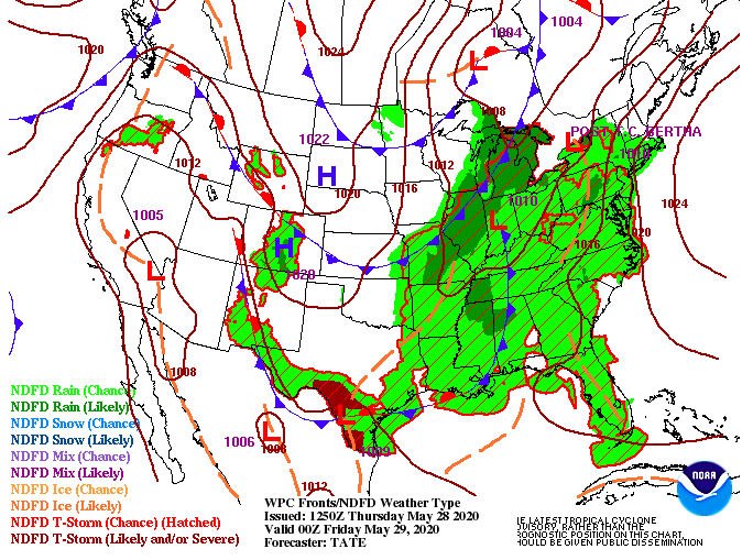
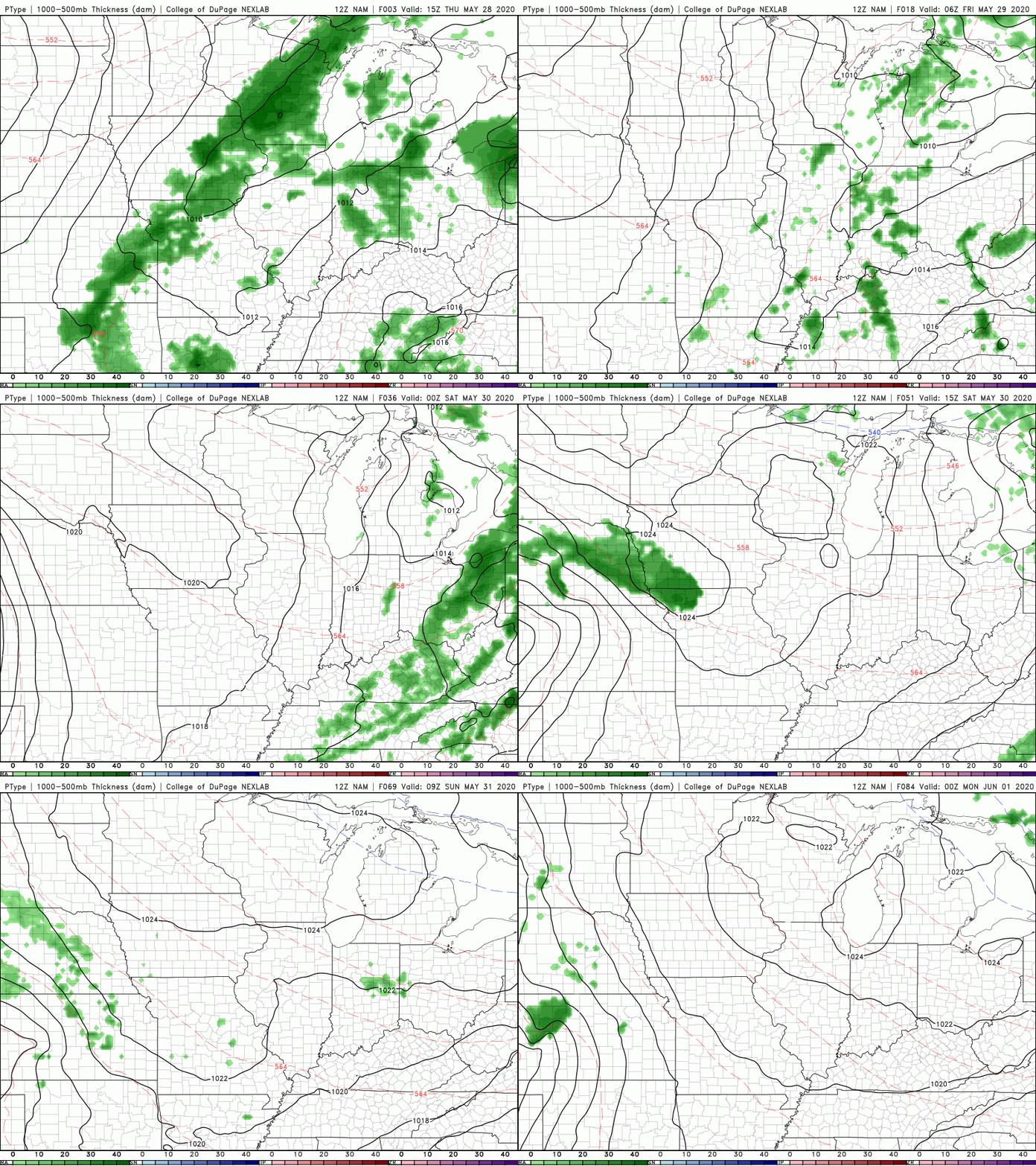
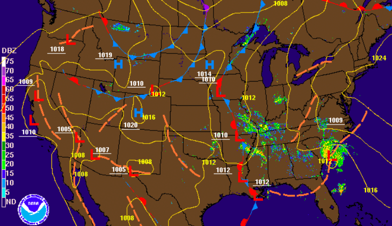
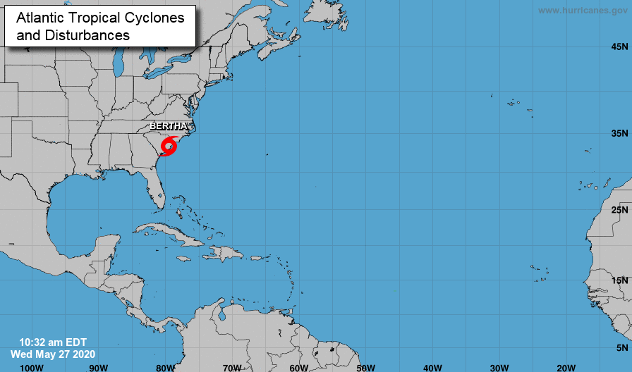
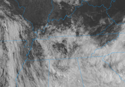
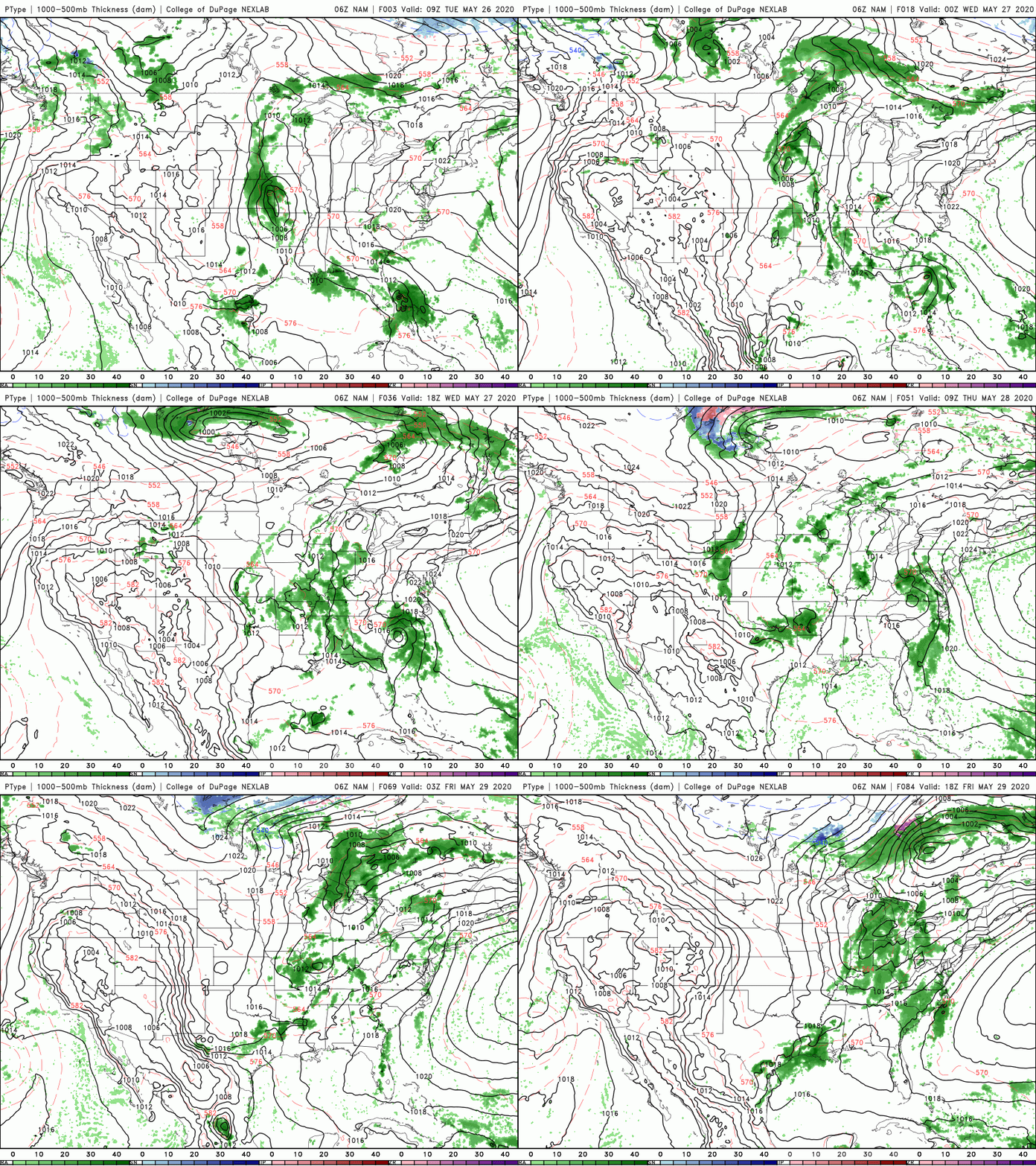
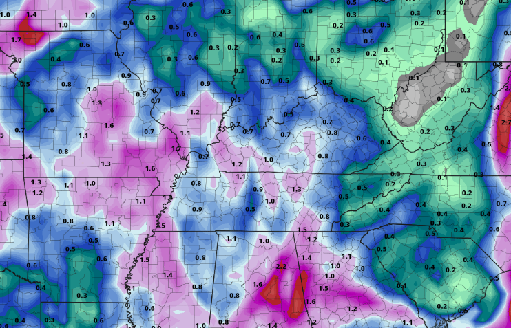
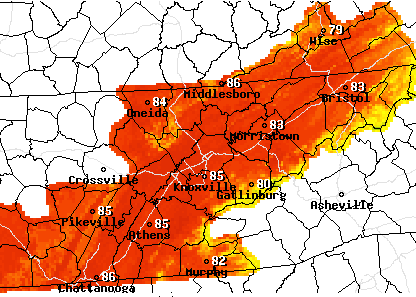
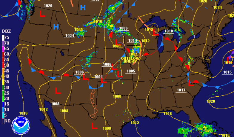
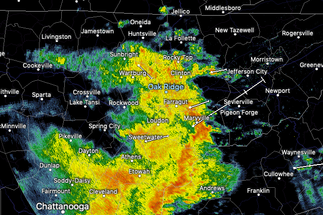
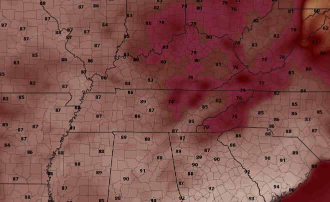
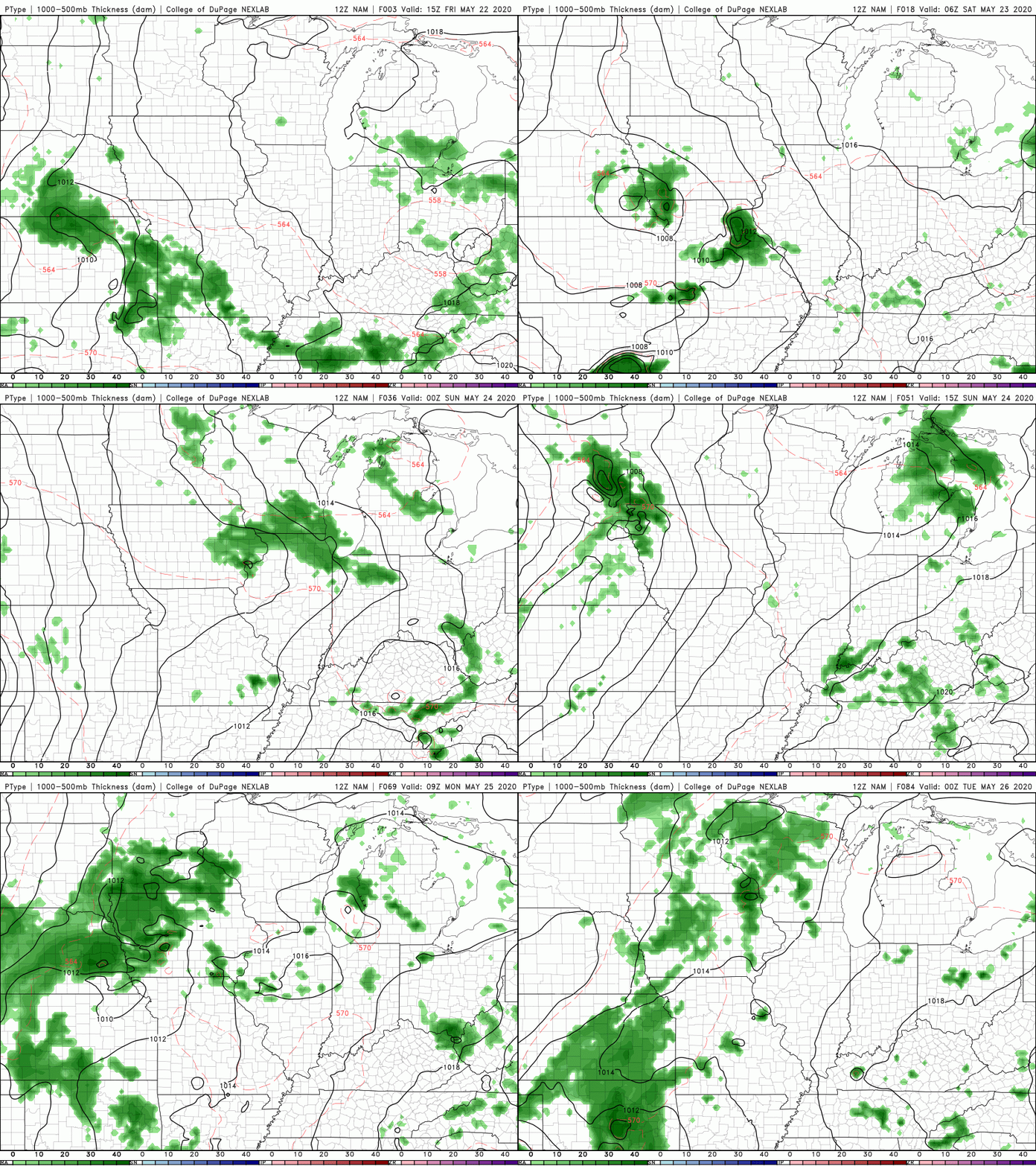
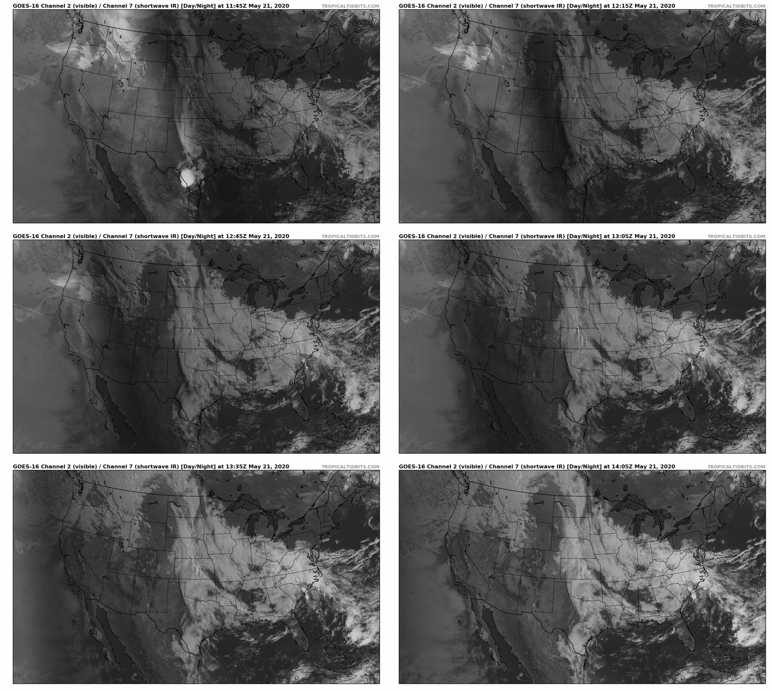
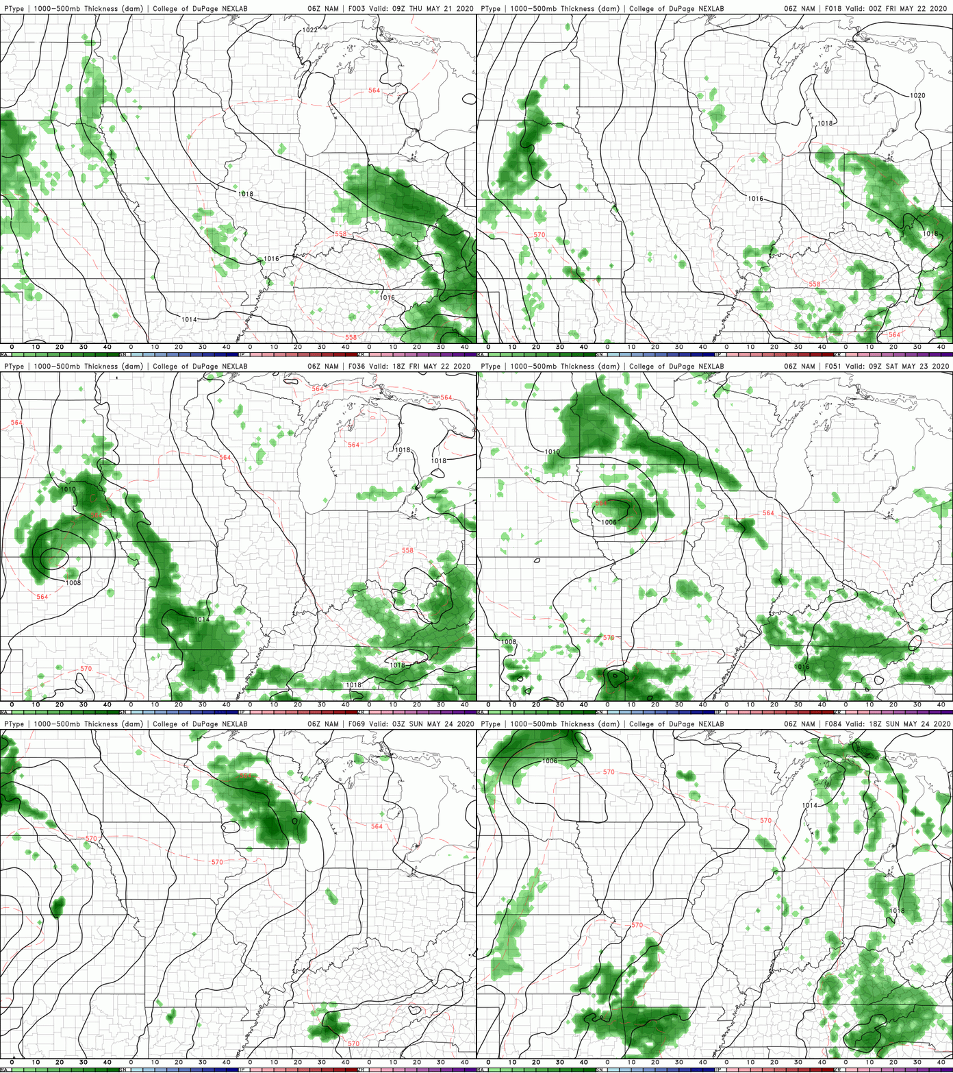
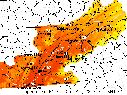
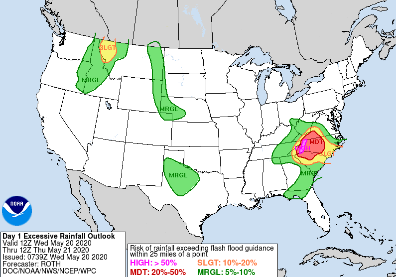
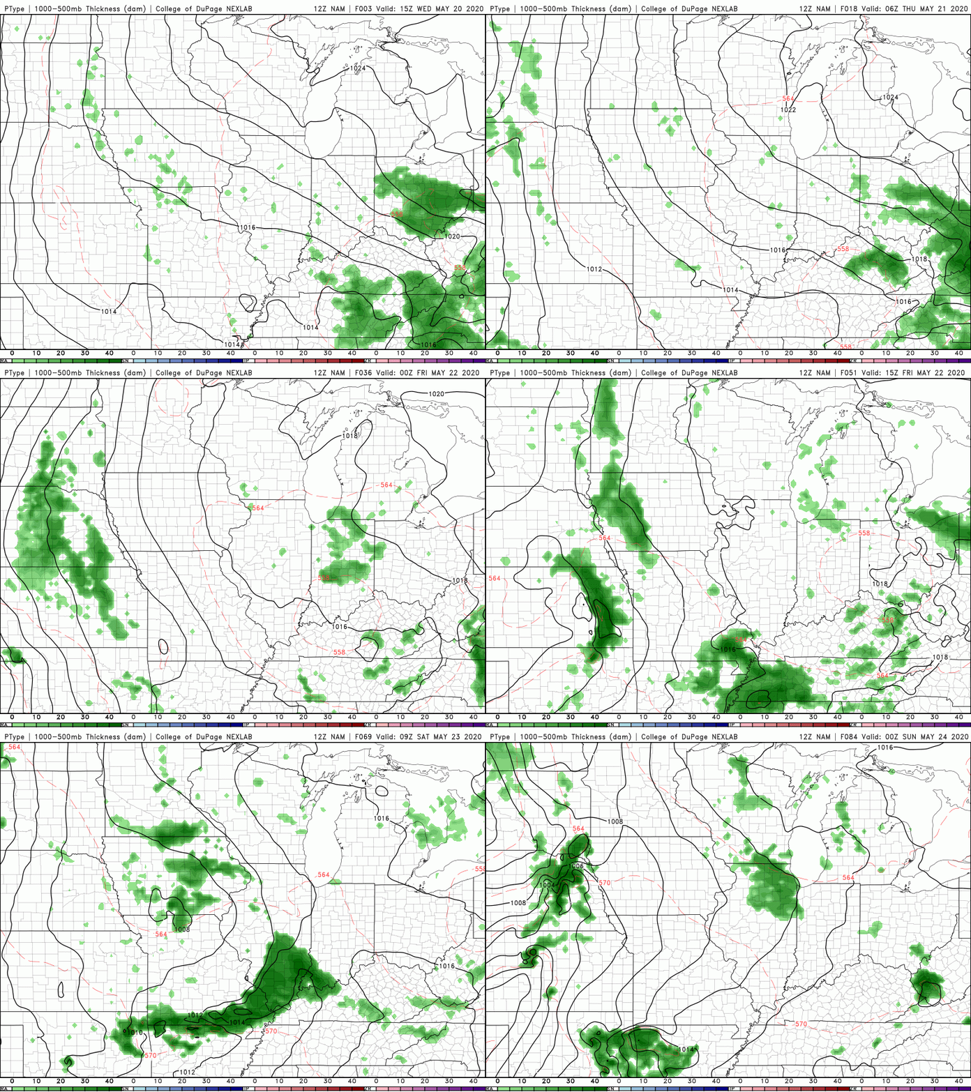
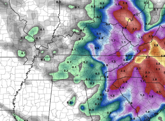
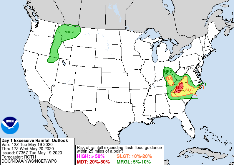
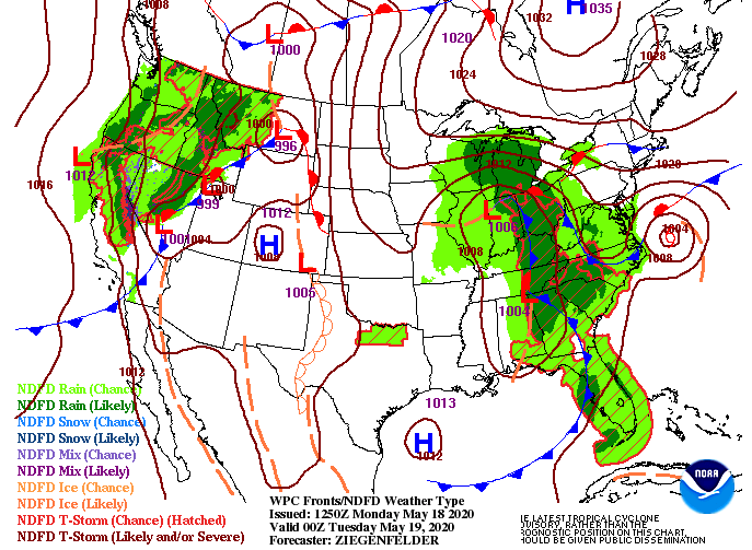
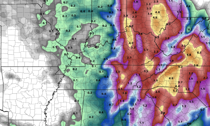
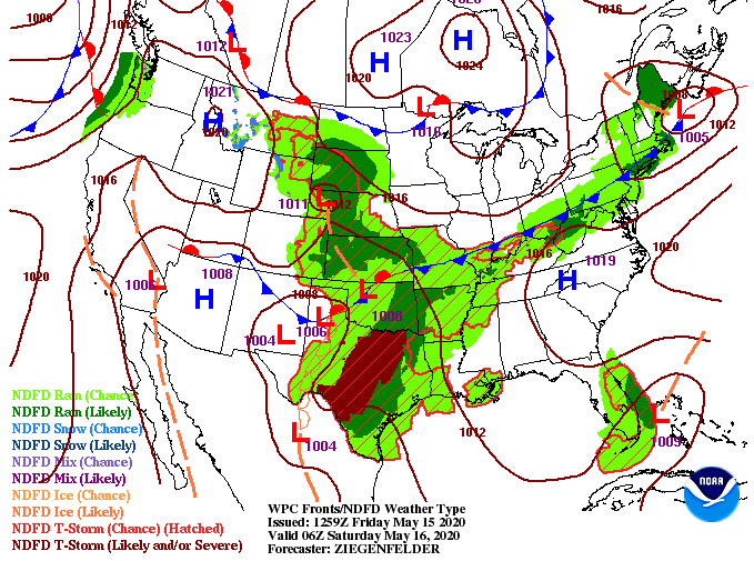
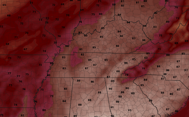
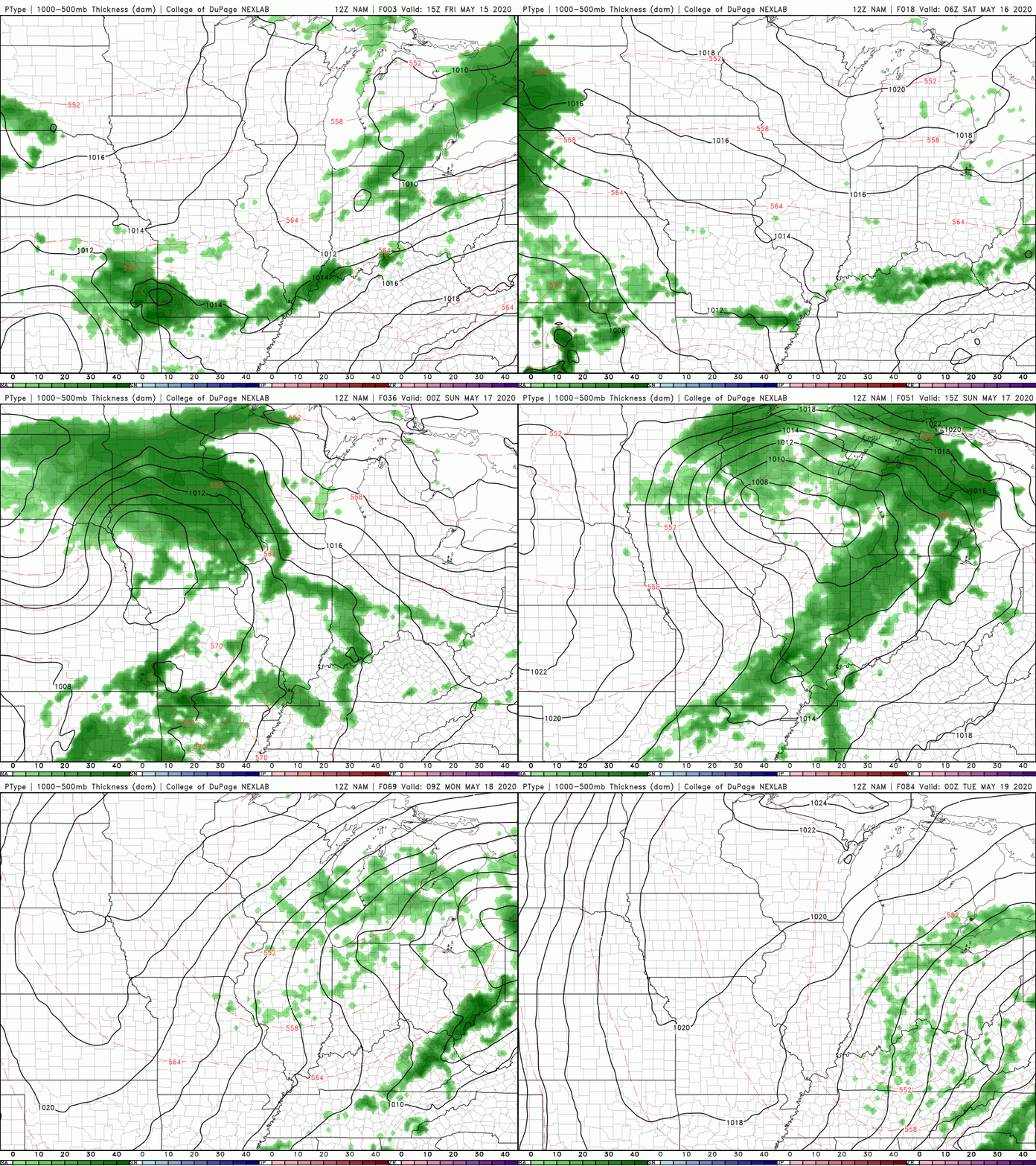
Good afternoon! Shower activity remains limited again this afternoon with pop up showers/storms possible. Looking at the current surface map, two features stand out. A low pressure system to the west will settle as a tropical system on the coast of South Carolina moves north. We will see shower activity from both systems tomorrow and Friday before clearing takes place this weekend. As the official start of hurricane season draws near, we are already seeing a very activity Atlantic. The second tropical storm of the year has been named (Bertha). This tropical system, off the coast of South Carolina, will meander north the next few days. Impacts here at home will be limited to scattered showers Thursday and Friday. As Bertha moves north, moisture will begin working in for Thursday. These showers will be scattered on and off with increased chances Friday. Jumping into the weekend, a cold front will swing through early Saturday bringing sunshine the second half of the day and into Sunday. Cooler and less humid conditions arrive for Sunday with highs in the mid to upper 70's. Overall, this weekend, especially the second half, should be a beautiful one! That will conclude today's forecast but if you can make it through the next few days, this weekend looks great! Cloud cover will increase across the area this afternoon providing a bit of a reprieve from the very warm temperatures. Muggy conditions continue to stick around though with afternoon pop up showers/ thunderstorms still possible. Southern flow remains dominant across the region so we will continue having afternoon pop up showers and muggy conditions today and tomorrow. Looking into the second half of the work week, a low pressure system sitting on the eastern side of the Rockies will phase in and provide better rain chances later Thursday, Friday and parts of the weekend. A cold front will also accompany this moisture late Friday, providing cooler afternoon temps for the start of the weekend. Overall rainfall amounts this week remain limited. With afternoon pop up showers/storms the dominant driver today and tomorrow, most rainfall will be in the higher elevations with storms flowing into the valley (what we saw on Memorial Day). Towards the end of the work week, showers will be more widespread giving a better rain coverage for the area. Nonetheless, rainfall totals will be near normal through Friday with between 0.5" and 1" likely for east TN. Cloud cover increases today but shower chances remain the same. Have a good Tuesday and continue staying hydrated; muggy conditions stick around the remainder of the week. Happy Memorial Day to all! Another muggy one sticks around today with afternoon high's expected to be in the mid to upper 80's. Accounting for dew point temps, high's could feel more like the low to mid 90's this afternoon (second image below). Stay hydrated and stay cool if you plan to be outdoors. The first half of the work week will be relatively the same. A mix of sunshine and cloud cover with afternoon pop up showers/thunderstorms possible. The second half of the week looks a bit more interesting though with another cut-off low expected to settle just to the west of the Rockies. That will likely provide more widespread shower activity late Thursday and into the day Friday. Temperatures will be closer to average tomorrow as we'll have a bit more cloud cover overhead. The chance for afternoon pop up showers and storms still remains in the forecast Tuesday and Wednesday before increases chances Thursday and Friday. Don't forget the sunscreen! It will be another hot and sticky day with high's pushing 90 degrees for some locations. Be safe and have a good day as we remember those who lost their lives serving our great country. Showers and a few embedded thunderstorms are working through east Tennessee now and will continue on and off through the afternoon. This is all associated with a low pressure system and warm front that will lift north this afternoon providing warm and muggy conditions in the days ahead. Drier air will arrive overnight setting up a partly cloudy start to Saturday. Getting a glimpse at the high's expected this weekend, most of the region will be in the mid to upper 80's with 90 degrees possible around Chattanooga (especially possible Sunday & Monday). In addition to the warm temperatures, muggy conditions could make things feel in the low to mid 90's at times, so stay hydrated and cool if you plan to be outdoors. With warm moist air out of the south over the next several days, afternoon pop up showers/thunderstorms will be likely at times (isolated to scattered). This is a very summer-like pattern that will be hanging around the region for at least the next week. Showers and storms will likely develop off the higher elevations and roll into the valley before dissipating into the evening and overnight hours. For more information and a look into your full Memorial Day forecast, watch the latest daily forecast below. Have a wonderful Memorial Day weekend and stay cool/hydrated! The "lingering low" as we'll call it remains overhead continuing to provide lots of rainfall for parts of North Carolina today. Throughout the day today and tomorrow the low will shift and push north and east as a trough from the west begins sliding in. Shower chances remain limited today (similar to yesterday) with the bulk of rainfall for northeastern TN. We will touch on the all important Memorial Day forecast, but first, Friday will likely be a wet one for most of the region. Widespread shower activity is likely the first half of the day before some clearing takes place overnight. To start Memorial Day weekend, partly cloudy with afternoon shower activity a bit more likely Saturday than on Sunday and Monday. Nonetheless, we are going to see a very summer-like pattern with warm and MUGGY conditions, which will likely lead to afternoon convection -> afternoon pop up showers & thunderstorms. Keep in mind chances look to be a bit more organized for Saturday than Sunday but any shower activity should only be during the daytime hours. Getting a glimpse at the weekend, warm temperatures are expected to return. With winds and the general flow coming from the south, warm and humid temperatures will be around through early next week. Sunday high's could feel closer to the lower 90's when we account for the humidity. Another round of scattered showers will arrive the first half of the day tomorrow before a better shot at sunshine sticks around for the weekend. More details can be found below: As a low pressure system continues to settle overhead, lots of rainfall will funnel into western North Carolina today and tomorrow. The Weather Prediction Center (WPC) has labeled this area of NC under a HIGH risk (4/4) of flash flooding through today. A slight risk is highlighted for parts of Kingsport, Bristol, and Johnson City today as well. Though flooding potential will begin winding down the next few days, a marginal risk is still in place for those in flood prone areas, especially near water features. For the days to come, cloudy skies and scattered showers will continue. The bulk of this, as seen from the excessive rainfall outlook, will be to the east now through Friday. For the central valley, we will continue to see a few scattered showers/ rumbles of thunder the next few days with lesser chances as you move west. The good news is this system will begin working NE tomorrow and Friday allowing for some sunshine to return for Memorial Day weekend. Isolated to scattered showers remain in the forecast but activity will be limited through the weekend. Saturday and Sunday will mainly contain your typical afternoon showers/ t'storms we are accustom to during the summer. These will likely form off of the Plateau & Smokies and roll into parts of the valley during the afternoon hours. The latest run for rainfall now through Friday really illustrates where the bulk of rainfall will be. An additional 1-3" will fall for NE TN with lesser totals as you push west. I expect us to round out the work week with 2-3" total for the central valley. We have already picked up, as of this morning, just over an inch and a half. A few more gloomy days are ahead before better chances at sunshine present itself into the weekend. If you'd like more information into weather conditions for personal use or for your business, send us an email at [email protected] or visit our services tab at the top of the page. I frequently talk about the "counter-clockwise flow" of low pressure systems so I thought I'd share a perfect example of that here at home. To the far east (right side of the image) you can make out Arthur swirling in the Atlantic as well. Getting back to east Tennessee, a mix of sunshine is possible early this afternoon but more rainfall will arrive late today and into the overnight hours. As we pointed out yesterday, flash flooding will remain the largest concern in the days to come. This is especially true for western North Carolina. As of this morning, our office station picked up 1.25" of rainfall with an additional 1" to 2" expected in the coming days. Model guidance also shows the counter-clockwise flow of the low overhead as scattered showers are expected to continue through Wednesday and parts of Thursday. To end the work week on Friday, showers are likely early with sunshine beginning to work in for the afternoon. Saturday will be partly cloudy with isolated shower chances throughout the day. We won't have all day rain events, but look to have shower chances stick around each day through early next week. Temperatures will remain on the cool side the next couple of days but as this system breaks down and moves out, we will slowly warm back up to the 80's by Saturday. As always, we will updates you with the latest! Be safe and let us know what you are seeing around east TN. A cut off low pressure system has made its way into the Mid-Atlantic and will stick around for much of this week. Severe weather remains low but gusty winds, heavy downpours (at times), and small hail are possible the next several days. I am not expecting all day rain events, but instead on and off showers throughout much of the work week. Looking at model guidance, the low will track right over east TN, likely bringing gusty winds and lightning. With Arthur off the coast of North Carolina, there is no where for this low to go, contributing to its slow movement across our area. This system will then begin settling over the Carolinas, dumping lots or rainfall this week. By Friday, it will begin to track north and east allowing for some sunshine to return for the weekend. Depending on how much moisture remains, limited pop up showers/storms remain in place for Saturday and Sunday. As hinted by the title, flooding is the largest concern this week. For east TN, I am expecting between 2-4 inches with locally higher amounts likely. Working further east, parts of North Carolina could see up to half a foot before we close out the work week on Friday. If you are in flood prone areas take the proper precautions and plan ahead. We'll continue to keep you posted but for our knowledge and the knowledge of others, we welcome updates on conditions around east Tennessee. If you are seeing waters rise, flooding, storm damage, hail, etc. let us know via email or social media! Good afternoon! We will see similar conditions to yesterday with partly cloudy skies and high's in the 80's. It will be breezy at times today with winds out of the south/southwest around 10 mph. As we work ahead into the weekend, changes are on the way. The system to our west (seen below), will work in a north and east direction. This means the majority of us will stay dry through the first half of the weekend but isolated pop up showers/ t'storms can't be ruled out. Along with the limited shower potential, we will continue warming. Looking at Sunday afternoon's temperatures, expect high's in the upper 80's here at home. Working further south, I wouldn't be surprised at all to see high's in Chattanooga at 90 degrees. If you have outdoor plans, stay hydrated. Not only will it be hot but also muggy. These are typical August high's so keep fluids close by. The majority of shower activity this weekend will be in the higher elevations but lingering showers/storms off the plateau could impact the valley, so look out. The bulk of rainfall will come late Sunday and into the day Monday as a cold front sweeps through. Look to have high's back in the low to mid 70's early next week. Clearing will begin taking place Tuesday afternoon with limited shower activity expected mid-week. That wraps it up for today but stay cool and stay dry (at times) through the weekend. Cooler temperatures will move back in next week! |
Your trusted source for everything weather in East Tennessee.
Social Media
|


