|
Skies will gradually clear out through the day, landing us partly cloudy overall. Fortunately, moving forward plenty of sunshine and mild temperatures are forecast. Highs will range from the upper 70s to mid 80s through early next week, with overnight lows in the mid 50s to around 60 degrees. The unfortunate side will be the lack of rainfall. With drought conditions beginning to spawn up, we will be in search of a good rain roughly a week out from now. View the latest forecast video below for more: Pre-recorded for 5pm weather broadcast
0 Comments
Pre-recorded for 5pm weather broadcast
Scattered showers and storms today through tomorrow, followed by drier air Friday into the weekend. Temperatures to remain near to just above average through this time. Good morning East Tennessee! A pleasant early Fall morning, with 9:45 am temperatures in the low to mid 60s. This is a bit cooler than yesterday, as depicted below on the 24-hour temperature change map. We'll warm up nicely today though, in fact above average, in the low to mid 80s. Mostly sunny to partly cloudy skies should dominate the day. 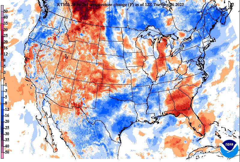 Looking at satellite, the last of morning fog is all but nearly gone. This is leaving mainly high clouds across the southeast, while plenty of sunshine elsewhere. We'll see some afternoon cumulus develop, but outside of this, generally dry and quiet through this afternoon. An approaching upper level disturbance will bring better cloud cover overnight into Wednesday, along with shower and storm chances for some. 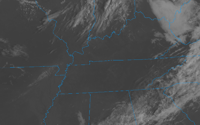 Looking at model guidance, the better potential for rain will be in locations north. The northern plateau and valley will fair the best shot, but even then, the highest rainfall chances will be across Kentucky. Nonetheless, any rain we get will be beneficial after our extended period of mostly quiet weather. We have a little bit of drought popping up in the recent data, so any rainfall is welcome before these conditions grow even further. Rain chances will be best tomorrow afternoon, with lingering chances Thursday to early Friday. Dry weather then returns for the weekend into early next week.  Rain amounts overall will be minimal for most. Those south of I-40 can expect upwards of a tenth, while those north up to a quarter of an inch. Any thunderstorms could bring locally higher amounts, along with a some gusty winds and hail. Again, the best potential for thunderstorms (strong or not) will be for areas the furthest north. Pre-recorded for 5pm weather broadcast
Good morning! A gorgeous day ahead with partly cloudy skies and highs in the upper 70s to low 80s. Generally dry weather will hold on through Tuesday (20% chance tomorrow), followed by unsettled weather Wednesday through Friday. A few storms could bring locally heavy rainfall Wednesday and Thursday (even though we need some rain) along with gusty winds and some hail. Clearer skies build back in late Friday, setting up a gorgeous weekend ahead. View our video forecast below for additional details. Pre-recorded for 5pm weather broadcast
Outside of a passing East Coast tropical system which provides increased cloud cover over the weekend, the vast majority of the area will stay dry and mild. Our next shot of rainfall doesn't arrive until next week, with the highest chances Tuesday and Wednesday. Check out our video forecast below for more. Happy first day of Fall this weekend! Pre-recorded for 5pm weather broadcast
Passing cloud cover at times with disturbances to our west, otherwise sunshine and mild temperatures. Our next best shot of rain doesn't arrive until early next week. Enjoy! Other than passing clouds from disturbances off to our west, East Tennessee will remain dry through the end of the work week. We will also see a weak trend in rising highs, topping out near average (low 80s) by Friday. Check out our video forecast below for more: A beautiful early afternoon across East Tennessee with mostly clear skies above and noon temperatures varying from the upper 60s to low 70s. Into mid afternoon, temperatures should notch up a few more degrees, topping out in the mid to upper 70s for many. Similar trends can be expected in the days to come, with slightly warmer air each day through the end of the work week. By Friday, we'll see highs return to the low and a few mid 80s. 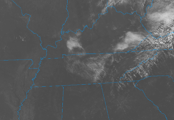 The tropics are beginning to quiet down, at least this week, with hurricane Nigel working through the Central Atlantic. The good news is this system will veer north and east, with no impacts expected to the States. 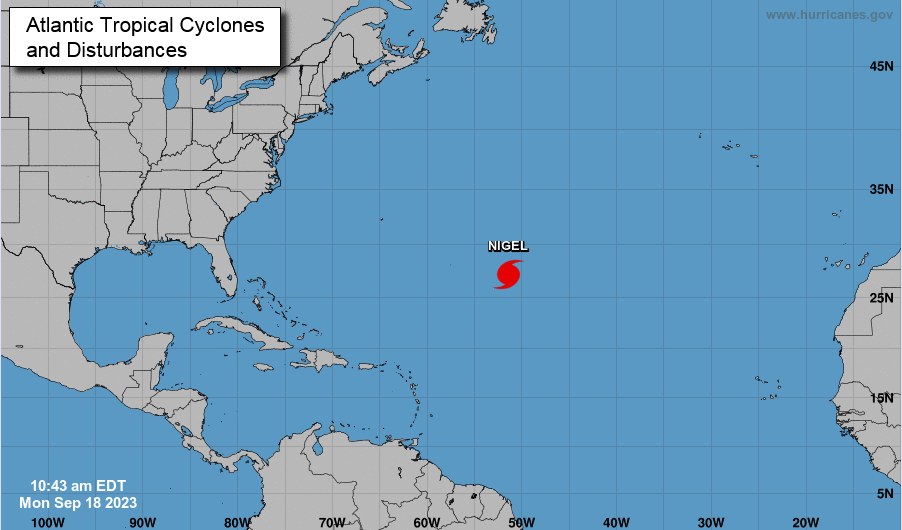 High pressure has settled just north of the state and will stick around for some time. Looking at the 7-day QPF (quantitative precipitation forecast), no rainfall is expected now through the weekend. We could see very low end chances late Sunday into early next week, but up until that point, dry weather prevails. 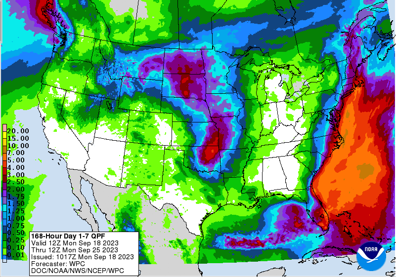 A very quiet week is ahead, with cool crisp starts, mild afternoon highs with plenty of sunshine, and patchy fog at times in the late overnight. Outside of this, temps will trend up a degree or two each day, finding the low to mid 80 by Friday afternoon (near to above average). Enjoy and have a good one! Pre-recorded for 5pm weather broadcast
|