|
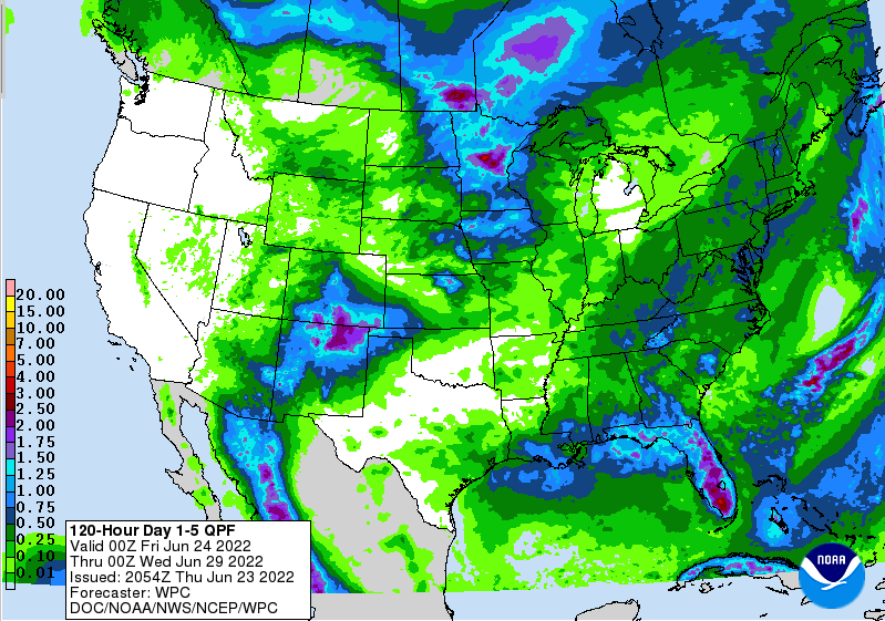
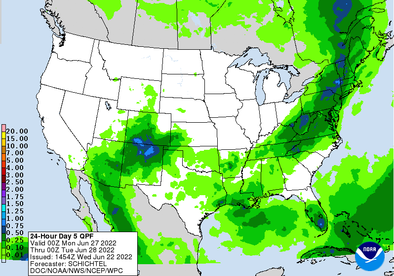
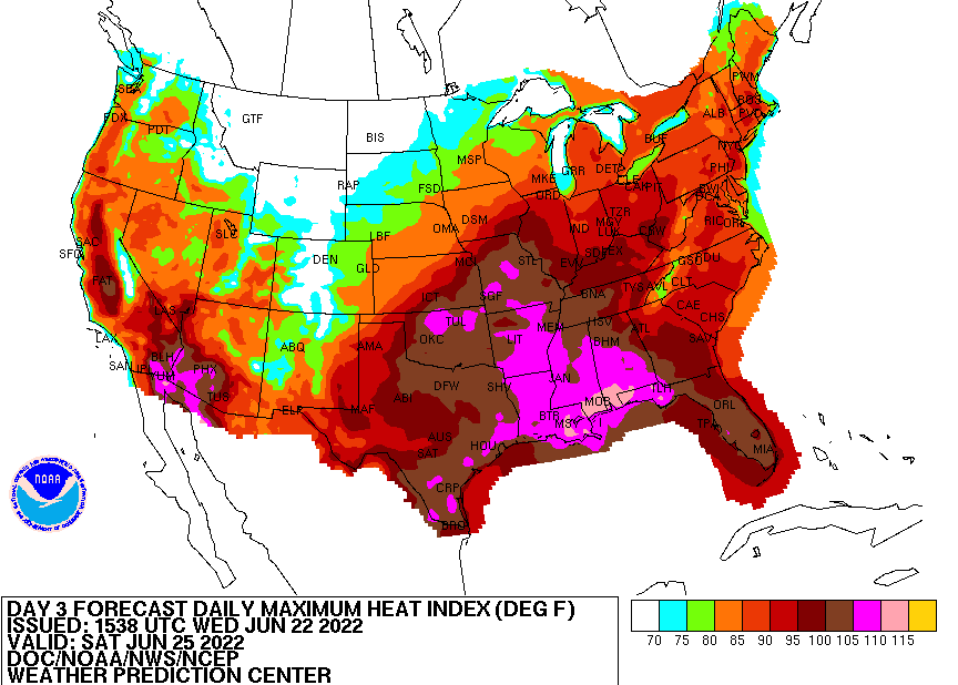
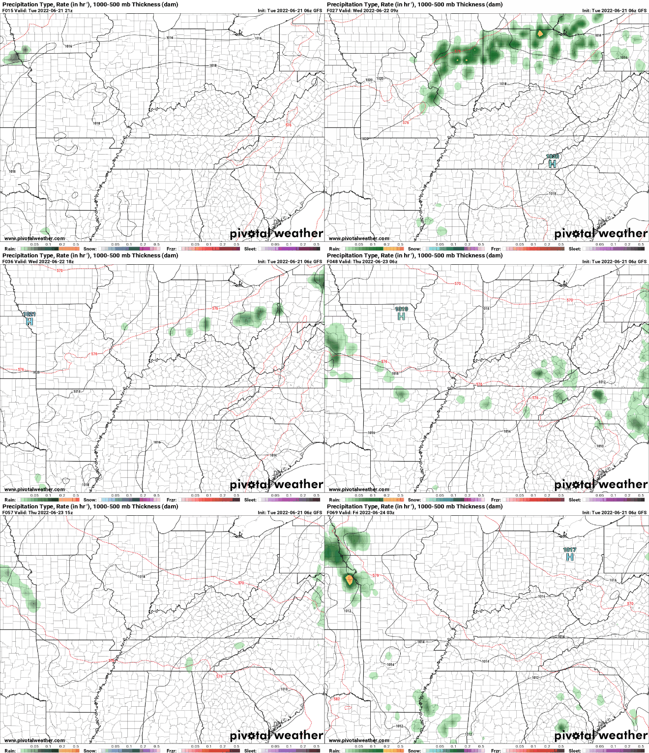
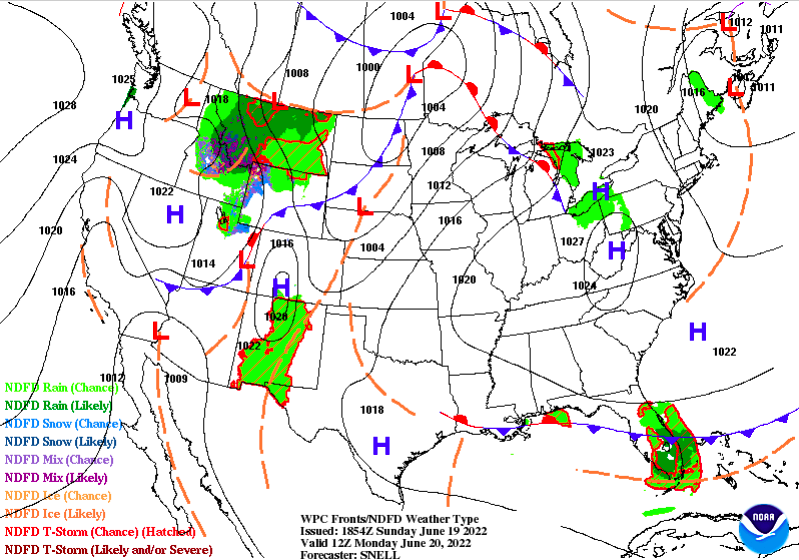
Morning all! This will be our only post of the week (BOOO, I know). I will be out of town on a mini vacation so be sure to follow along on social media (Twitter & Facebook). Our handle is @SecretCityWx and we will make sure you have the latest! Fortunately, this week should be fairly quiet, with near average temperatures and only a few chances of rain during the work week. Better chances arrive Friday and into the weekend. Take a look below for more:
0 Comments
Good Friday morning! As expected, drought conditions are beginning to creep in around the state. Looking at the latest release, mainly abnormally dry conditions are present but a small moderate drought is across Southwestern TN. Rainfall the next week could be enough to keep things idle, but I would guess abnormally dry conditions continue to be more widespread. We will keep you posted ahead! Moving forward, mostly dry conditions hang around today, though a very isolated shower/storm can't be ruled out along the high terrain in the east this afternoon. The same for Saturday, as isolated storms will be possible in the afternoon to early evening. Better chances will then arrive Sunday, as a cold front sweeps in from the west. This will give us fairly widespread rainfall Sunday evening and overnight and into the day Monday. A few storms will also be likely as this passes through, but severe chances look very low. Rainfall potential with this passing front look to range from 0.25-0.75", with locally higher amounts possible in thunderstorms. With that said, we still are well under our monthly normal. Rainfall doesn't look likely again until late in the work week, so this pretty dry pattern we have been dealing with looks to continue. That will do it for this week! Be sure to follow us on Twitter & Facebook for more information throughout the day and through the weekend. We will welcome the rain Sunday and Monday, with cooler temperatures (mid 80s) expected Monday and through mid week. Unfortunately, I will be fairly off the grid next week as well, so social media will be your best source to stay up to date. Be sure to follow along and I am sorry in advance @SecretCityWx Pre-recorded for 5pm show
I will keep it simple, warm and dry conditions look to continue today and again tomorrow, before a better opportunity for showers finds us into the weekend and early next week. As far as temperatures, we will be a bit cooler today with the passage of a cold front. This brought very isolated showers/storms to northern East Tennessee last evening and into the night, but we have since cleared begun clearing back out. Highs this afternoon will range from the upper 80s to low 90s, with similar conditions in store to close out the work week tomorrow. In terms of rainfall potential, we could see an isolated pop up afternoon shower/storm Saturday, but better chances arrive the later half of Sunday and into the day Monday. Looking at rainfall amounts we could see with the approach of another cold front, Monday amounts will range from a tenth to a quarter of an inch. This isn't much, but more than what we have seen. This remains something we will continue to monitor, as some drought conditions look increasingly likely in the near future. For now, let's hope showers and storms Sunday and Monday turn out to be a bit more widespread and consistent than the current guidance holds. As far as the heat, it has been fairly dry. Meaning, humidity has been reasonable much of this week. This looks to change into the weekend, as dew points increase across the area. Feel like temperatures Saturday afternoon will once again approach the triple digit mark, so keep that heat safety in mind. I know I sound like a broken record saying it, but there has already been several reports around the nation of preventable deaths relating to heat. That will do it for today, mostly sunny skies and warm temperatures prevail this afternoon, tomorrow, and a good portion of Saturday before shower and storms chances return best Sunday and into Monday. Pre-recorded for 5pm show
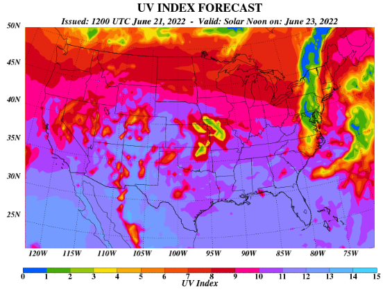
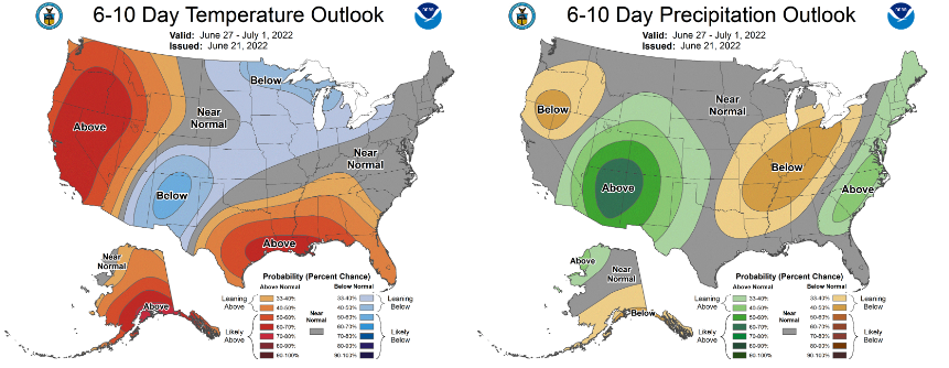
Mostly sunny skies kicked off the day and will continue through this afternoon. We will see some increased cloud cover toward this evening and overnight, as a weak cold front slides through our area. A very isolated shower or storm can't be ruled out overnight, but most stay dry. Highs will top out today in the mid 90s, with lower 90s coming tomorrow. With sunny skies a majority of this week, UV indices will be very high. Looking below we will average in the 10-11 category. Keep the sunscreen close by and drink plenty of fluids through the remainder of the week. Humidity will increase this weekend, making for the return of conditions similar to last week. Looking longer term, there's not much improvement to be had. If anything, the concern for increased drought is becoming more worrisome. Looking at the CPC outlook through the end of June and into July, near normal to slightly above normal temperatures are forecast, in addition to a higher confidence in below average rainfall. We have been running below average in terms of rain for the month, so this is not a good sign for the agriculture world, fire potential, and even those with a grass yard. We will release the latest drought map Friday, but I anticipate for increase D0 (abnormally dry) conditions. This trend will likely continue ahead, with a change not looking likely through at least early July. Temperatures also stay warm, especially this week, so practice heat safety! Check out our video forecast below for more: Pre-recorded for 5pm show
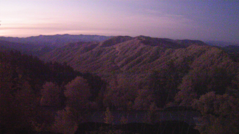
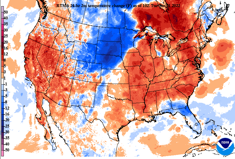
Good morning! Check out the view over the Smokies at sunrise a few hours ago. This image comes courtesy of the GSMNP at Newfound Gap. It has been a pleasant start to the morning with most (as of 8 am) ranging in the low to mid 60s. Other than some light fog dissipating out, most started and will continue to be mostly sunny today. Temperatures compared to this time yesterday are already warmer, and unfortunately, that will be reflected into this afternoon as well. Looking at the temperature change map below, temperatures for almost the entire eastern third of the US are running 10 to 15 degrees warmer than this time yesterday. In terms of highs this afternoon, most will top out in the low and mid 90s, with several more days of similar conditions still to come. Looking forward, there's little to discuss rain-wise through the end of the work week. Can't entirely rule out a stray shower or sprinkle overnight Wednesday, otherwise dry conditions persist. With that said, we do look to have a chance by the end of the weekend and into next week, as a cold front sweeps through. As it does so, scattered showers will be possible Sunday and Monday, with cooler temperatures (mid and upper 80s) returning early next week. We will keep an eye on this, but rainfall amounts will more than likely be very limited, and on average, few and far between. That will do it for today. This biggest take away for the week will be the heat. Keep your heat safety in mind by drinking plenty of fluids, limiting outdoor time, enjoy that shade and A/C, and knowing the symptoms of heat related illnesses.
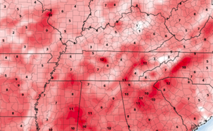
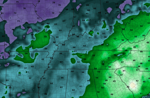
High pressure will once again be in control this week, as highs soar back into the 90s. The one positive is the lower dew points. This will make things feel much less humid and more true to what the actual temperature is. As you can see (right) below dew points will run in the 50s to low 60s through at least Wednesday, making things feel dry but warm. This is side by side to the temperature anomaly map (left). This is depicting what afternoon temperatures are expected to be compared to the average for this time of the year. As you can see, we will average 10-15 degrees above normal, landing highs in the mid (and for some) upper 90s. In terms of drought, we are doing alright (for now). I anticipate with our streak of very warm and very dry conditions for things to change fairly quick. Rainfall amounts over the next week look to be very limited, so we'll have to keep a close eye on how this impacts the state. My guess? most of the area will climb the ranks to a D0 and D1, with increased impacts possible next week. Overall, the main messaging this week will be heat safety (yet again). Highs will top out in the low and mid 90s tomorrow and through at least Friday. We could see a very isolated shot at rain overnight Wednesday and again this weekend, but chances will be few and far between. Stay safe, stay cool, and drink plenty of water! Pre-recorded for 5 pm show
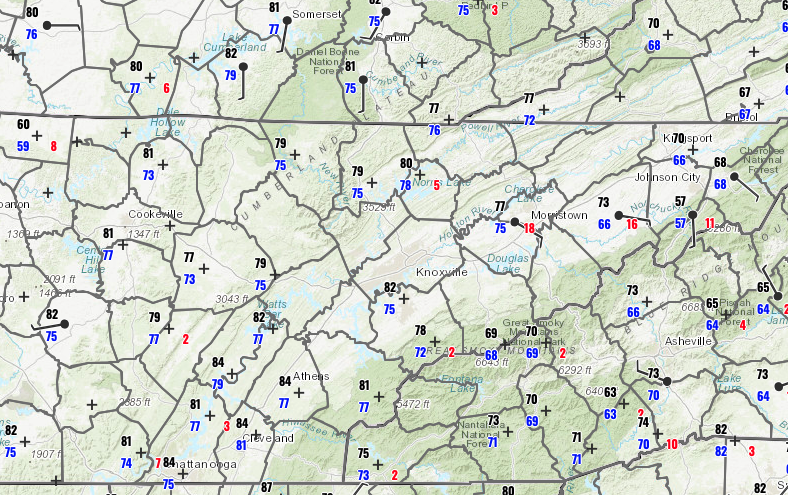
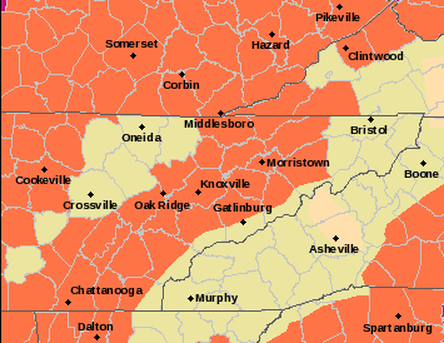
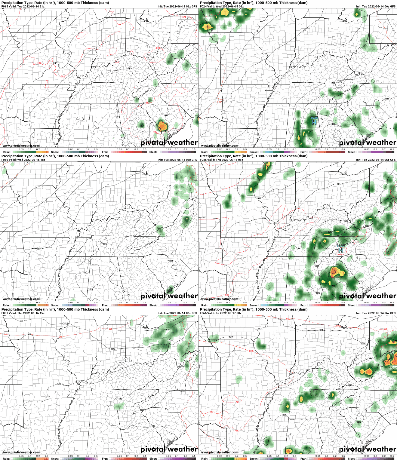
Strong to severe storms possible this afternoon, but coverage will be scattered. By tonight, a sweeping cold front will bring much cooler and drier air just in time for the weekend. Highs will top out near average, before much warmer air returns for next week. Take a look below for more and stay updated on our social media through this afternoon. Temperatures stay warm today and tomorrow, but a sweeping cold front will bring scattered showers and storms to end the work week. Some of these could be strong to severe but very isolated to scattered in nature. Much cooler, and importantly, drier air will find us Saturday and Sunday. Highs for the weekend will top out in the low and mid 80s. Unfortunately, very warm temperatures return next week. Take a look at our video forecast below for more. If you like walking on your grass and hearing a crunch, we have good news for you. If you don't, bad news is ahead. Check out when you can expect SOME relief, before temperatures soar back up next week. Check it all out below: WOW, its 9:30 am and temperatures are already in the mid 70s to low 80s. This is only a precursor to the highs we are anticipating this afternoon. Most will top out in the mid 90s, with a few nearing the triple digits. If that wasn't bad enough, dew points will be in the 70s. Whats that mean? HIGH humidity, with feel like temperatures easily in the 100s. Given the sweltering heat expected today, a heat advisory (orange) has been issued for the locations below. I would not at all be surprised if another was released for Wednesday, as conditions will be pretty much the same. Limit your outdoor time if possible, drink lots of water, and stay close to that air conditioning! With high pressure in control today and tomorrow, shower & storm potential will be limited. With that said, the chances aren't zero and if a storm does make it in, it could be strong given this environment. Into Thursday, a cold front will edge into the area, bringing scattered showers and storms. This will be followed by much cooler temperatures into the weekend, but keep in mind this is all relative. With average highs in the low to mid 80s and highs this week in the mid 90s, mid to upper 80s may seem (or even feel) much cooler. Nonetheless, Saturday and Sunday will feature afternoon temps in the mid 80s, so take advantage of the brief reprieve we have. Showers and storms will overall be scattered, with minimal rainfall amounts as an area-wide average. This will be something to watch for, as I believe drought conditions could become an issue over the next couple of weeks. Relief is in sight BUT only temporarily. Forewarning, another blast of very hot temperatures are in store for this time next week as well. Take a look at our video forecast below for more and stay tuned for updates in the days to come. Temperatures may be even warmer than they are today and tomorrow, just with humidity a bit lower. Pre-recorded for 5pm show
|
Your trusted source for everything weather in East Tennessee.
Social Media
|


