|
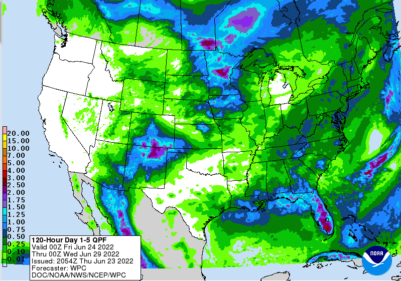
Good Friday morning! As expected, drought conditions are beginning to creep in around the state. Looking at the latest release, mainly abnormally dry conditions are present but a small moderate drought is across Southwestern TN. Rainfall the next week could be enough to keep things idle, but I would guess abnormally dry conditions continue to be more widespread. We will keep you posted ahead! Moving forward, mostly dry conditions hang around today, though a very isolated shower/storm can't be ruled out along the high terrain in the east this afternoon. The same for Saturday, as isolated storms will be possible in the afternoon to early evening. Better chances will then arrive Sunday, as a cold front sweeps in from the west. This will give us fairly widespread rainfall Sunday evening and overnight and into the day Monday. A few storms will also be likely as this passes through, but severe chances look very low. Rainfall potential with this passing front look to range from 0.25-0.75", with locally higher amounts possible in thunderstorms. With that said, we still are well under our monthly normal. Rainfall doesn't look likely again until late in the work week, so this pretty dry pattern we have been dealing with looks to continue. That will do it for this week! Be sure to follow us on Twitter & Facebook for more information throughout the day and through the weekend. We will welcome the rain Sunday and Monday, with cooler temperatures (mid 80s) expected Monday and through mid week. Unfortunately, I will be fairly off the grid next week as well, so social media will be your best source to stay up to date. Be sure to follow along and I am sorry in advance @SecretCityWx Pre-recorded for 5pm show
0 Comments
Leave a Reply. |
Your trusted source for everything weather in East Tennessee.
Social Media
|


